As São Paulo faces a climate-induced water crisis, campaigners are fighting to reverse the impact of pollution and illegal deforestation on its largest reservoir
By Sam Cowie and Avener Prado in São Paulo
Thu 4 Jun 2026 14.15 BSTShare
In a small motorboat laden with water-monitoring equipment, biologist Marta Marcondes and community activist Wesley Silvestre Rosa cross Billings reservoir on the far southern edge of São Paulo. Bright white herons glide over the water, which is flanked by thick dark green clusters of Brazil’s Atlantic forest, as the boat heads towards one of the more polluted parts of the reservoir.
“We see where sewage is entering, we see what has been deforested and how that has affected the water quality of the reservoir,” Marcondes says.
Marcondes and Rosa are dedicated to the upkeep of Billings, which at 127 sq km (49 sq miles) is Brazil’s largest urban reservoir by surface area and volume and a vital water source for the almost 22 million people who live in São Paulo’s metropolitan area. It also generates energy via a hydroelectric dam and plays a crucial role in flood control and irrigation; it provides a cooling effect during periods of extreme heat and people use its cleaner parts for recreation and fishing.
Biologist Marta Marcondes collects water samples from the reservoir to monitor contamination levels. Photograph: Avener Prado/The Guardian
Despite its importance, large areas of Billings are polluted: contaminated with household and industrial waste, pharmaceutical residues, microplastics and fecal matter. Urban planners blame neglect by local authorities, flawed water management policies and uncontrolled urban expansion.
This problem has been dragging on for decades. If we don’t do something now, we risk having a collapsed system
Marta Marcondes
As the boat reaches a heavily polluted part of Billings called Grota Funda, Marcondes observes bubbles rising from the water, which she identifies as fermenting bacteria. Donning rubber gloves, she lowers a metallic collection device into the water, empties its dark contents into a bucket before taking a sample in a plastic tube.
“Good lord, what a smell,” she says. “You could die if you drank this.”
Marcondes, who analyses water samples at the lab she runs at the nearby Municipal University of São Caetano do Sul, is also the project coordinator for the local NGO Water Pollutant Index. She notes that water quality and the reservoir’s storage capacity have deteriorated over the past 10 years.
A green algal bloom – typically associated with excess nutrients from sewage and urban runoff – spreads across the surface of the reservoir. Photograph: Avener Prado/The Guardian
“This problem has been dragging on for decades, and if we don’t do something about it now, we risk having a collapsed system,” she says.
In January, residents blamed São Paulo’s water utility, Sabesp, for dumping waste into the reservoir and the company was later fined by environmental authorities. Sabesp says: “The recorded incident was caused by the irregular entry of rainwater into the sewage network and the carrying of garbage, a situation intensified by the rains, which caused a hydraulic overload of the system.”
As the boat heads toward the Pedreira pumping station, which connects Billings to the Pinheiros River, the water thickens and turns green. Billings, which marked its 100th anniversary last year, was built to power the growing industrial base of São Paulo, South America’s richest city, via the Henry Borden hydroelectric plant that captures energy from water cascading over the Serra do Mar mountain range. Nabil Bonduki,a city council member with the Workers’ party and veteran urban planner, says the redirection of polluted water from the Pinheiros and Tietê rivers to supply the plant has turned Billings into an environmental sacrifice zone.
Environmental activist Wesley Silvestre Rosa documents construction debris left inside Parque dos Búfalos, near the Billings reservoir. Photograph: Avener Prado/The Guardian
Roughly 1.5 million people live around Billings, many in favelas or other irregular housing, up from 110,000 in 1970, after which rural migrants increasingly flocked to Brazil’s capitals in search of industrial jobs. But the pollution contributes to health problems.
“According to the São Paulo city climate plan, our region is one of the most susceptible places to climate change in the city,” says Rosa, who lives in Jardim Apurá, a densely populated, lower-income neighbourhood on the edge of the reservoir.
In 2018, authorities completed construction of Residencial Espanha, a development of nearly 4,000 public housing units for lower-income families in Jardim Apurá, but access to housing remains a critical issue in the region.
Wanderley da Silva, 46, lives in the Favela da Fumaça on the edge of Billings. His makeshift wooden home, which has a corrugated plastic roof, floods up to his knees during heavy rains. “All of a sudden it’s really hot, and then it pours down,” he says. “Everyone knows why, after humankind destroys nature, then comes the payback.”
Wanderley da Silva with his son in their home in Favela da Fumaça. During heavy rains the house on the edge of the Billings reservoir floods. Photograph: Avener Prado/The Guardian
Bonduki says Billings serves as a stark warning of what São Paulo’s other reservoirs could become, especially Guarapiranga, in the southern zone.
“Billings is deeply compromised, but it is not a lost battle,” he says.
Bonduki blames insufficient inspections from local authorities for the reservoir’s continued degradation. “It’s a political issue. It’s about having a public authority that wants to do something. These days, we have satellites that can detect deforestation in real time.”
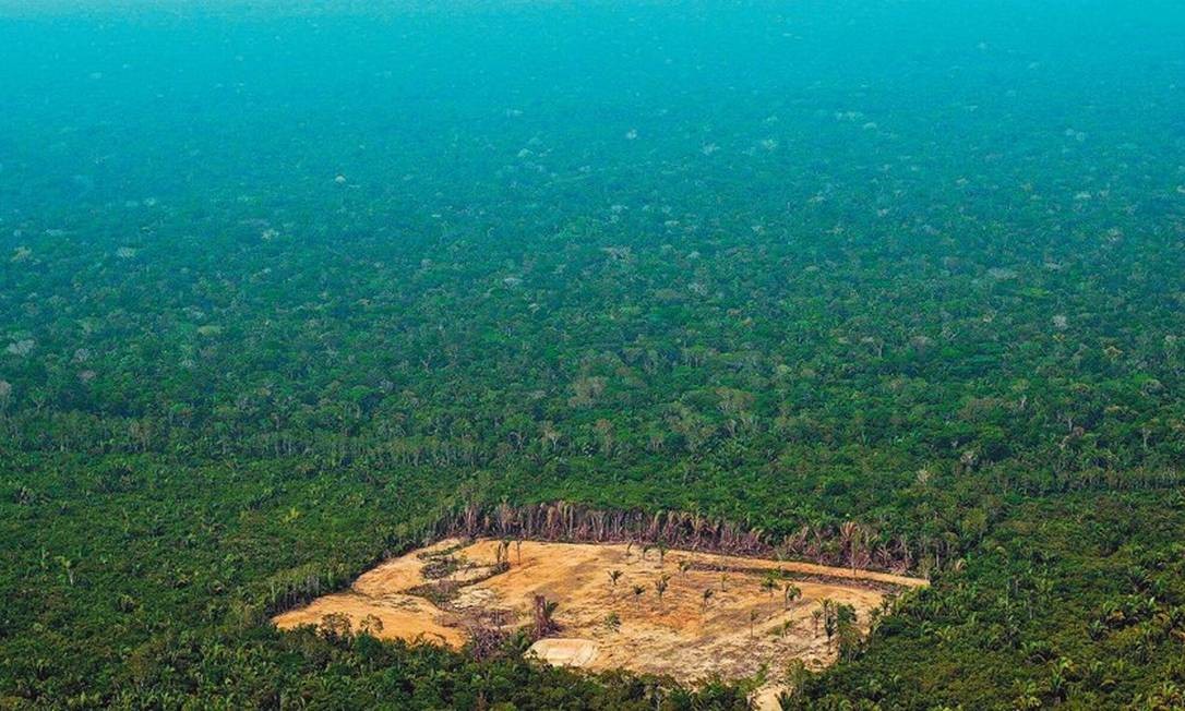
Illegal deforestation along the reservoir’s banks, mostly to clear land for clandestine construction, increases sediment levels in the reservoir and reduces its water storage and flood-control capacity, Marcondes says.
Livestock farming persists in parts of the environmentally protected watershed, raising concerns about erosion, runoff and water contamination. Photograph: Avener Prado/The Guardian
Almost all of Billings’ 700km (435 miles) of shoreline is technically protected under local environmental laws. Yet with a booming demand for real estate in São Paulo, powerful local actors seek to circumvent these rules for profit. Advertisements offering plots of land and properties for sale proliferate in the region and across online social media groups.
In a statement, São Paulo’s public prosecutor’s office for housing and urban planning blamed “the emergence and growth of illegal land subdivisions in the water catchment area of the southern region of the municipality of São Paulo”, and mentioned a civil inquiry “aimed at investigating the structure, planning, and possible deficiencies of state and municipal bodies”.
A stream runs through Favela da Fumaça before flowing into the Billings reservoir. The community lies within the protected watershed area. Photograph: Avener Prado/The Guardian
State legislation specifically prohibits heavy construction and dense urbanisation around the Billings reservoir. Yet using a drone from one of its polluted shorelines, it is possible to observe pockets of construction in cleared patches of Atlantic forest.
The structures are solid and professionally built, unlike the precarious dwellings of the Favela da Fumaça. Bonduki refers to them as “clandestine allotments”, speculative constructions often illegally built for future profits.
The Guardian spoke to sources, who asked not to be named, who cited collusion between local land barons, dominant political networks in the region and organised crime groups, enabled by corrupt lawyers and inspectors.
An abandoned car near Favela da Fumaça. The neighbourhood experiences flooding and has limited access to infrastructure. Photograph: Avener Prado/The Guardian
In a statement, São Paulo city hall acknowledged environmental crimes had happened around the reservoir, such as “deforestation of native vegetation”, “the disposal of solid waste, mainly construction waste and human waste” and “the clandestine sale of land plots, non-compliance with embargos and the illegal subdivision of land”.
It says that “in partnership with the state government, [it] operates an integrated water defence operation (OIDA) focused on protecting water sources such as Billings and Guarapiranga”. These operations “focus on inspection, fines, and seizures of materials and machinery, as well as the dismantling of unfinished or uninhabited constructions, based on court orders”. In 2026, the note concludes, about 20 operations have already been carried out.
A sign advertises land for sale on Estrada do Alvarenga, Pedreira, near Billings reservoir. Photograph: Avener Prado/The Guardian
The challenges facing Billings reservoir are becoming more urgent as São Paulo experiences mounting water shortages due to the climate crisis. In 2015, the Billings reservoir became part of São Paulo’s drought response, as authorities used it to help supply the city during the worst water crisis in its history. As a new crisis approaches, with climate-induced drought already depleting the city’s reservoirs ahead of the dry season, the NGO Institute of Water and Sanitation has warned that without planning, resilience is impossible.
Now, Billings is set to play a larger role during times of scarcity, with a new infrastructure project by Sabesp. In periods of crisis, clean water will be drawn from it to help supply the city.
To protect remaining green space around the reservoir, local people campaigned to create Buffalo Park, a home to 101 species of wildlife where local people can plant seeds. Matthew Richmond, a lecturer in political geographyat Newcastle University and Alameda Institute affiliate says: “Environmental activists on São Paulo’s peripheries are fighting to salvage the green spaces that survived, in the face of continued state neglect and unmet housing demand, which drives new land occupations.”
Rosa says local people have been blamed unfairly. “We suffer from environmental racism,” he says. “They blame us for the pollution, but we, the poor, black and peripheral people, keep our green spaces clean and alive.”
People walk through Parque dos Búfalos in Jardim Apurá, which lies within a protected watershed zone of the reservoir. Photograph: Avener Prado/The Guardian
“A redenção” 2022, acrílica sobre tela 1mx1m, exposição Nhe’ē Porã, Museu da Língua Portuguesa. Pintura: Daiara Tukano
A vida é selvagem. Esse é um elemento essencial para um pensamento que tem me provocado: como a ideia de que a vida é selvagem poderia incidir sobre a produção do pensamento urbanístico hoje? É uma convocatória a uma rebelião do ponto de vista epistemológico, de colaborar com a produção de vida. Quando falo que a vida é selvagem, quero chamar a atenção para uma potência de existir que tem uma poética esquecida, abandonada pelas escolas, formadoras de profissionais que perpetuam a lógica de que a civilização é urbana, de que tudo fora das cidades é bárbaro, primitivo – e que a gente pode tacar fogo.
Como atravessar o muro das cidades? Quais possíveis implicações poderiam existir entre comunidades humanas que vivem na floresta e as que estão enclausuradas nas metrópoles? Pois se a gente conseguir fazer com que continue existindo florestas no mundo, existirão comunidades dentro delas. Eu vi um número que a World Wide Fund for Nature (WWF) publicou em um relatório, dizendo que 1,4 bilhão de pessoas no mundo dependem da floresta, no sentido de ter uma economia ligada a ela. Não é a turma das madeireiras, não: é uma economia que supõe que os humanos que vivem ali precisam de floresta para viver.
A antropóloga Lux Vidal escreveu um trabalho muito importante sobre habitações indígenas, no qual relaciona materiais e conceitos que organizam a ideia de habitat equilibrado com o entorno, com a terra, o Sol, a Lua e as estrelas. Um habitat que está integrado ao cosmos, diferente desse implante que as cidades viraram no mundo. Aí eu me pergunto: como fazer a floresta existir em nós, em nossas casas, em nossos quintais? Podemos provocar o surgimento de uma experiência de florestania começando por contestar essa ordem urbana sanitária ao dizer: eu vou deixar o meu quintal cheio de mato, quero estudar a gramática dele. Como eu acho no meio do mato um ipê, uma peroba rosa, um jacarandá? E se eu tivesse um buritizeiro no quintal?
Temos que parar com essa fúria de meter asfalto e cimento em cima de tudo. Nossos córregos estão sem respirar, porque uma mentalidade de catacumba, agravada com a política do marco sanitário, acha que tem que meter uma placa de concreto em cima de qualquer riacho, como se fosse uma vergonha ter água correndo ali. A sinuosidade do corpo dos rios é insuportável para a mente reta, concreta e ereta de quem planeja o urbano. Hoje, na maior parte do tempo, o planejamento urbano é feito contra a paisagem. Como reconverter o tecido urbano industrial em tecido urbano natural, trazendo a natureza para o centro e transformando as cidades por dentro?
Ailton Krenak é líder indígena, ambientalista, filósofo, poeta, escritor, e doutor honoris causa pela Universidade Federal de Juiz de Fora (UFJF). Protagonizou uma das cenas mais marcantes da Assembleia Constituinte, em 1987, quando pintou o rosto com jenipapo para protestar contra os ataques aos direitos indígenas. Participou da União dos Povos Indígenas, que se transformou na Aliança dos Povos da Floresta, junto com David Kopenawa Yanomami e Chico Mendes. Fundou a ONG Núcleo de Cultura Indígena. Com seu povo na região do Rio Doce, enfrentou os efeitos do rompimento da barragem do Fundão, em Mariana (MG). Como escritor, lançou “Ideias para adiar o fim do mundo”, “O amanhã não está à venda” e “A vida não é útil”.
Daiara Tukano (ilustração), ou Duhigô, é artista visual, muralista, comunicadora, professora e mestre em Direito Humanos pela Universidade de Brasília (UNB). Ativista pelos direitos indígenas, coordenou a Rádio Yandê, primeira web rádio indígena do Brasil. Em 2020, tornou-se a artista indígena a ter o maior mural de arte urbana do mundo, com a pintura de mais de 1.000 m² no histórico Edifício Levy, no Centro de Belo Horizonte (MG).
[This is a reposting of a CaliforniaWaterBlog.com post from February 2016, near the end of the previous drought. For human uses, conditions seem somewhat similar to this point in the previous drought, so this perspective might be useful. A couple of more recent readings are added to this post.]
“You can’t always get what you want But if you try sometimes you just might find You get what you need,” Rolling Stones (1969, Let It Bleed album)
The ongoing California drought has many lessons for water managers and policy-makers. Perhaps the greatest lesson is how unimportant a drought can be if we manage water well.
For the last two years, California lost about 33% of its normal water supply due to drought, but from a statewide perspective saw statistically undetectable losses of jobs and economic production, despite often severe local effects. Agricultural production, about 2% of California’s economy, was harder hit, fallowing about 6% of irrigated land, and reducing net revenues by 3% and employment by 10,000 jobs from what it would have been without drought. Yet, high commodity prices and continued shifts to higher valued crops (such as almonds, with more jobs per acre) raised statewide agricultural employment slightly and raised overall revenues for agriculture to record levels in 2014 (the latest year with state statistics).
Cities, responsible for the vast majority of California’s economy, were required to reduce water use by an average of 25% in 2015. These conservation targets were generally well achieved on quite short notice. Most remarkably, there has been little discernible statewide economic impact from this 25% reduction in urban water use, although many local water districts are suffering financially.
More groundwater pumping greatly reduced drought impacts. Picture courtesy of DWR.
How could such a severe drought cause so little economic damage? Much of the lost water supply from drought was made up for by withdrawals of water from storage, particularly groundwater. But the substantial amount of water shortage that remained was largely well-allocated. Farmers of low-valued crops commonly sold water to farmers of higher-valued crops and to cities, greatly reducing economic losses. Within each sector, moreover, utilities, farmers, and individual water users allocated available water for higher-valued uses and shorted generally lower-valued uses and crops.
If shortages are well-allocated, California has tremendous potential to absorb drought-related shortages with relatively little economic impact. This economic robustness to drought arises from several characteristics of California’s economic structure and its uses of water.
First, the most water-intensive part of California’s economy, agriculture, accounts for about 80% of all human water use, but is about 2% of California’s economy. So long as water deliveries are preserved for the bulk of the economy, in cities, California’s economy can withstand considerable drought (Harou et al. 2010). And the large strong parts of the economy can aid those more affected by drought.
Gross annual revenue for California crops ($ millions). (using California Department of Water Resources irrigated crop acres and water use data)
Second, within agriculture, roughly 80-90% of employment and revenues are from higher-valued crops (such as vegetable and tree crops) which occupy about 50% of California’s irrigated land and are about 50% of California’s agricultural water use. If available water is allocated to these crops, a very large water shortage can be accommodated with a much smaller (but still substantial and unprecedented) economic loss. Water markets have made these allocations flexibly, with some room for improvement.
Global food markets have fundamentally changed the nature of drought for humans. Throughout history, disruptions of regional food production due to drought would lead to famine and pestilence. This is no longer the case for California and other globally-connected economies, where food is readily available at more stable global prices. California continued to export high-valued fruits and nuts, even as corn and wheat production decreased, with almost no effects on local or global prices. Food insecurity due to drought is largely eliminated in globalized economies (poverty is another matter). Subsistence agriculture remains more vulnerable from drought.
Third, cities also concentrate much of their water use in lower-valued activities. Roughly half of California’s urban water use is for landscape irrigation. By concentrating water use reductions on such less-productive uses, utilities and individual water users greatly lowered the costs of drought. If cities had shut down 25% of businesses to implement 25% cuts in water use, the drought and California’s drought management would have been truly catastrophic.
Fourth, although California’s climate is very susceptible to drought, California’s geology provides abundant drought water storage in the form of groundwater, if managed well. The availability of groundwater allowed expanded pumping which made up for over 70% of agriculture’s loss of surface water during the drought and provided a buffer for many cities as well. If we replenish groundwater in wetter years, as envisioned in the 2014 groundwater legislation, California’s geologic advantage for withstanding drought should continue.
All of this leads to what we might call a Mick Jagger theory of drought management. Yes, droughts can be terrible in preventing us from getting all that we want, and will cause severe local impacts. But if we manage droughts and water well and responsibly, then we can usually get the water that the economy and society really needs. This overall economic strength also allows for aid to those more severely affected by drought. This is an optimistic and pragmatic lesson for dry drought-prone places with strong globalized economies, such as California.
California’s ecosystems should have similar robustness of ecosystem health with water use, and naturally persisted through substantial droughts long ago. But today, California’s ecosystems entered this drought in an already severely depleted and disrupted state. (The Mick Jagger characterization of California’s ecosystems might be “Gimme Shelter,” from the same album.) If we can sufficiently improve our management of California’s ecosystems before and during droughts, perhaps they will be more robust to drought. Reconciling native ecosystems with land and water development is an important challenge.
“If I don’t get some shelter Oh yeah, I’m gonna fade away”Rolling Stones (1969, Let It Bleed album)
The drought reminds us that California is a dry place where water will always cause controversy and some dissatisfaction. However, despite the many apocalyptic statements on California’s drought, the state has done quite well economically, so far, overall. But, the drought has identified areas needing improvement, so that we can continue to get most of what we really need from water in California, even in future droughts. We should neither panic, nor be complacent, but focus on the real challenges identified by the drought.
Jay Lund is Co-Director of the Center for Watershed Sciences and Professor of Civil and Environmental Engineering at the University of California – Davis.
Hanak, E., J. Mount, C. Chappelle, J. Lund, J. Medellín-Azuara, P. Moyle, and N. Seavy, What If California’s Drought Continues?, 20 pp., PPIC Water Policy Center, San Francisco, CA, August 2015.
A different ‘Big One’ is approaching. Climate change is hastening its arrival.
Aug. 12, 2022
California, where earthquakes, droughts and wildfires have shaped life for generations, also faces the growing threat of another kind of calamity, one whose fury would be felt across the entire state.
This one will come from the sky.
According to new research, it will very likely take shape one winter in the Pacific, near Hawaii. No one knows exactly when, but from the vast expanse of tropical air around the Equator, atmospheric currents will pluck out a long tendril of water vapor and funnel it toward the West Coast.
This vapor plume will be enormous, hundreds of miles wide and more than 1,200 miles long, and seething with ferocious winds. It will be carrying so much water that if you converted it all to liquid, its flow would be about 26 times what the Mississippi River discharges into the Gulf of Mexico at any given moment.
When this torpedo of moisture reaches California, it will crash into the mountains and be forced upward. This will cool its payload of vapor and kick off weeks and waves of rain and snow.
The coming superstorm — really, a rapid procession of what scientists call atmospheric rivers — will be the ultimate test of the dams, levees and bypasses California has built to impound nature’s might.
But in a state where scarcity of water has long been the central fact of existence, global warming is not only worsening droughts and wildfires. Because warmer air can hold more moisture, atmospheric rivers can carry bigger cargoes of precipitation. The infrastructure design standards, hazard maps and disaster response plans that protected California from flooding in the past might soon be out of date.
As humans burn fossil fuels and heat up the planet, we have already increased the chances each year that California will experience a monthlong, statewide megastorm of this severity to roughly 1 in 50, according to a new study published Friday. (The hypothetical storm visualized here is based on computer modeling from this study.)
In the coming decades, if global average temperatures climb by another 1.8 degrees Fahrenheit, or 1 degree Celsius — and current trends suggest they might — then the likelihood of such storms will go up further, to nearly 1 in 30.
At the same time, the risk of megastorms that are rarer but even stronger, with much fiercer downpours, will rise as well.
These are alarming possibilities. But geological evidence suggests the West has been struck by cataclysmic floods several times over the past millennium, and the new study provides the most advanced look yet at how this threat is evolving in the age of human-caused global warming.
The researchers specifically considered hypothetical storms that are extreme but realistic, and which would probably strain California’s flood preparations. According to their findings, powerful storms that once would not have been expected to occur in an average human lifetime are fast becoming ones with significant risks of happening during the span of a home mortgage.
“We got kind of lucky to avoid it in the 20th century,” said Daniel L. Swain, a climate scientist at the University of California, Los Angeles, who prepared the new study with Xingying Huang of the National Center for Atmospheric Research in Boulder, Colo. “I would be very surprised to avoid it occurring in the 21st.”
Unlike a giant earthquake, the other “Big One” threatening California, an atmospheric river superstorm will not sneak up on the state. Forecasters can now spot incoming atmospheric rivers five days to a week in advance, though they don’t always know exactly where they’ll hit or how intense they’ll be.
Using Dr. Huang and Dr. Swain’s findings, California hopes to be ready even earlier. Aided by supercomputers, state officials plan to map out how all that precipitation will work its way through rivers and over land. They will hunt for gaps in evacuation plans and emergency services.
The last time government agencies studied a hypothetical California megaflood, more than a decade ago, they estimated it could cause $725 billion in property damage and economic disruption. That was three times the projected fallout from a severe San Andreas Fault earthquake, and five times the economic damage from Hurricane Katrina, which left much of New Orleans underwater for weeks in 2005.
Dr. Swain and Dr. Huang have handed California a new script for what could be one of its most challenging months in history. Now begin the dress rehearsals.
“Mother Nature has no obligation to wait for us,” said Michael Anderson, California’s state climatologist.
In fact, nature has not been wasting any time testing California’s defenses. And when it comes to risks to the water system, carbon dioxide in the atmosphere is hardly the state’s only foe.
THE ULTIMATE CURVEBALL
On Feb. 12, 2017, almost 190,000 people living north of Sacramento received an urgent order: Get out. Now. Part of the tallest dam in America was verging on collapse.
That day, Ronald Stork was in another part of the state, where he was worrying about precisely this kind of disaster — at a different dam.
Standing with binoculars near California’s New Exchequer Dam, he dreaded what might happen if large amounts of water were ever sent through the dam’s spillways. Mr. Stork, a policy expert with the conservation group Friends of the River, had seen on a previous visit to Exchequer that the nearby earth was fractured and could be easily eroded. If enough water rushed through, it might cause major erosion and destabilize the spillways.
He only learned later that his fears were playing out in real time, 150 miles north. At the Oroville Dam, a 770-foot-tall facility built in the 1960s, water from atmospheric rivers was washing away the soil and rock beneath the dam’s emergency spillway, which is essentially a hillside next to the main chute that acts like an overflow drain in a bathtub. The top of the emergency spillway looked like it might buckle, which would send a wall of water cascading toward the cities below.
Mr. Stork had no idea this was happening until he got home to Sacramento and found his neighbor in a panic. The neighbor’s mother lived downriver from Oroville. She didn’t drive anymore. How was he going to get her out?
Mr. Stork had filed motions and written letters to officials, starting in 2001, about vulnerabilities at Oroville. People were now in danger because nobody had listened. “It was nearly soul crushing,” he said.
“With flood hazard, it’s never the fastball that hits you,” said Nicholas Pinter, an earth scientist at the University of California, Davis. “It’s the curveball that comes from a direction you don’t anticipate. And Oroville was one of those.”
Ronald Stork in his office at Friends of the River in Sacramento.
The spillway of the New Exchequer Dam.
Such perils had lurked at Oroville for so long because California’s Department of Water Resources had been “overconfident and complacent” about its infrastructure, tending to react to problems rather than pre-empt them, independent investigators later wrote in a report. It is not clear this culture is changing, even as the 21st-century climate threatens to test the state’s aging dams in new ways. One recent study estimated that climate change had boosted precipitation from the 2017 storms at Oroville by up to 15 percent.
A year and a half after the crisis, crews were busy rebuilding Oroville’s emergency spillway when the federal hydropower regulator wrote to the state with some unsettling news: The reconstructed emergency spillway will not be big enough to safely handle the “probable maximum flood,” or the largest amount of water that might ever fall there.
Sources: Global Historical Climatology Network, Huang and Swain (2022) Measurements taken from the Oroville weather station and the nearest modeled data point
This is the standard most major hydroelectric projects in the United States have to meet. The idea is that spillways should basically never fail because of excessive rain.
Today, scientists say they believe climate change might be increasing “probable maximum” precipitation levels at many dams. When the Oroville evacuation was ordered in 2017, nowhere near that much water had been flowing through the dam’s emergency spillway.
Yet California officials have downplayed these concerns about the capacity of Oroville’s emergency spillway, which were raised by the Federal Energy Regulatory Commission. Such extreme flows are a “remote” possibility, they argued in a letter last year. Therefore, further upgrades at Oroville aren’t urgently needed.
In a curt reply last month, the commission said this position was “not acceptable.” It gave the state until mid-September to submit a plan for addressing the issue.
The Department of Water Resources told The Times it would continue studying the matter. The Federal Energy Regulatory Commission declined to comment.
“People could die,” Mr. Stork said. “And it bothers the hell out of me.”
WETTER WET YEARS
Donald G. Sullivan was lying in bed one night, early in his career as a scientist, when he realized his data might hold a startling secret.
For his master’s research at the University of California, Berkeley, he had sampled the sediment beneath a remote lake in the Sacramento Valley and was hoping to study the history of vegetation in the area. But a lot of the pollen in his sediment cores didn’t seem to be from nearby. How had it gotten there?
When he X-rayed the cores, he found layers where the sediment was denser. Maybe, he surmised, these layers were filled with sand and silt that had washed in during floods.
It was only late that night that he tried to estimate the ages of the layers. They lined up neatly with other records of West Coast megafloods.
“That’s when it clicked,” said Dr. Sullivan, who is now at the University of Denver.
His findings, from 1982, showed that major floods hadn’t been exceptionally rare occurrences over the past eight centuries. They took place every 100 to 200 years. And in the decades since, advancements in modeling have helped scientists evaluate how quickly the risks are rising because of climate change.
For their new study, which was published in the journal Science Advances, Dr. Huang and Dr. Swain replayed portions of the 20th and 21st centuries using 40 simulations of the global climate. Extreme weather events, by definition, don’t occur very often. So by using computer models to create realistic alternate histories of the past, present and future climate, scientists can study a longer record of events than the real world offers.
Dr. Swain and Dr. Huang looked at all the monthlong California storms that took place during two time segments in the simulations, one in the recent past and the other in a future with high global warming, and chose one of the most intense events from each period. They then used a weather model to produce detailed play-by-plays of where and when the storms dump their water.
Those details matter. There are “so many different factors” that make an atmospheric river deadly or benign, Dr. Huang said.
Xingying Huang of the National Center for Atmospheric Research in Boulder, Colo. Rachel Woolf for The New York Times
The New Don Pedro Dam spillway.
Wes Monier, a hydrologist, with a 1997 photo of water rushing through the New Don Pedro Reservoir spillway.
In the high Sierras, for example, atmospheric rivers today largely bring snow. But higher temperatures are shifting the balance toward rain. Some of this rain can fall on snowpack that accumulated earlier, melting it and sending even more water toward towns and cities below.
Climate change might be affecting atmospheric rivers in other ways, too, said F. Martin Ralph of the Scripps Institution of Oceanography at the University of California, San Diego. How strong their winds are, for instance. Or how long they last: Some storms stall, barraging an area for days on end, while others blow through quickly.
Scientists are also working to improve atmospheric river forecasts, which is no easy task as the West experiences increasingly sharp shifts from very dry conditions to very wet and back again. In October, strong storms broke records in Sacramento and other places. Yet this January through March was the driest in the Sierra Nevada in more than a century.
“My scientific gut says there’s change happening,” Dr. Ralph said. “And we just haven’t quite pinned down how to detect it adequately.”
Better forecasting is already helping California run some of its reservoirs more efficiently, a crucial step toward coping with wetter wet years and drier dry ones.
On the last day of 2016, Wes Monier was looking at forecasts on his iPad and getting a sinking feeling.
Mr. Monier is chief hydrologist for the Turlock Irrigation District, which operates the New Don Pedro Reservoir near Modesto. The Tuolumne River, where the Don Pedro sits, was coming out of its driest four years in a millennium. Now, some terrifying rainfall projections were rolling in.
First, 23.2 inches over the next 16 days. A day later: 28.8 inches. Then 37.1 inches, roughly what the area normally received in a full year.
If Mr. Monier started releasing Don Pedro’s water too quickly, homes and farms downstream would flood. Release too much and he would be accused of squandering water that would be precious come summer.
But the forecasts helped him time his flood releases precisely enough that, after weeks of rain, the water in the dam ended up just shy of capacity. Barely a drop was wasted, although some orchards were flooded, and growers took a financial hit.
The next storm might be even bigger, though. And even the best data and forecasts might not allow Mr. Monier to stop it from causing destruction. “There’s a point there where I can’t do anything,” he said.
KATRINA 2.0
How do you protect a place as vast as California from a storm as colossal as that? Two ways, said David Peterson, a veteran engineer. Change where the water goes, or change where the people are. Ideally, both. But neither is easy.
Firebaugh is a quiet, mostly Hispanic city of 8,100 people, one of many small communities that power the Central Valley’s prodigious agricultural economy. Many residents work at nearby facilities that process almonds, pistachios, garlic and tomatoes.
Firebaugh also sits right on the San Joaquin River.
For a sleepless stretch of early 2017, Ben Gallegos, Firebaugh’s city manager, did little but watch the river rise and debate whether to evacuate half the town. Water from winter storms had already turned the town’s cherished rodeo grounds into a swamp. Now it was threatening homes, schools, churches and the wastewater treatment plant. If that flooded, people would be unable to flush their toilets. Raw sewage would flow down the San Joaquin.
Luckily, the river stopped rising. Still, the experience led Mr. Gallegos to apply for tens of millions in funding for new and improved levees around Firebaugh.
Levees change where the water goes, giving rivers more room to swell before they inundate the land. Levee failures in New Orleans were what turned Katrina into an epochal catastrophe, and after that storm, California toughened levee standards in urbanized areas of the Sacramento and San Joaquin Valleys, two major river basins of the Central Valley.
The idea is to keep people out of places where the levees don’t protect against 200-year storms, or those with a 0.5 percent chance of occurring in any year. To account for rising seas and the shifting climate, California requires that levees be recertified as providing this level of defense at least every 20 years.
Firebaugh, Calif., on the San Joaquin River, is home to 8,100 people and helps power the Central Valley’s agricultural economy.
Ben Gallegos, the Firebaugh city manager.
A 6-year-old’s birthday celebration in Firebaugh.
The problem is that once levees are strengthened, the areas behind them often become particularly attractive for development: fancier homes, bigger buildings, more people. The likelihood of a disaster is reduced, but the consequences, should one strike, are increased.
Federal agencies try to stop this by not funding infrastructure projects that induce growth in flood zones. But “it’s almost impossible to generate the local funds to raise that levee if you don’t facilitate some sort of growth behind the levee,” Mr. Peterson said. “You need that economic activity to pay for the project,” he said. “It puts you in a Catch-22.”
A project to provide 200-year protection to the Mossdale Tract, a large area south of Stockton, one of the San Joaquin Valley’s major cities, has been on pause for years because the Army Corps of Engineers fears it would spur growth, said Chris Elias, executive director of the San Joaquin Area Flood Control Agency, which is leading the project. City planners have agreed to freeze development across thousands of acres, but the Corps still hasn’t given its final blessing.
The Corps and state and local agencies will begin studying how best to protect the area this fall, said Tyler M. Stalker, a spokesman for the Corps’s Sacramento District.
The plodding pace of work in the San Joaquin Valley has set people on edge. At a recent public hearing in Stockton on flood risk, Mr. Elias stood up and highlighted some troubling math.
The Department of Water Resources says up to $30 billion in investment is needed over the next 30 years to keep the Central Valley safe. Yet over the past 15 years, the state managed to spend only $3.5 billion.
“We have to find ways to get ahead of the curve,” Mr. Elias said. “We don’t want to have a Katrina 2.0 play out right here in the heart of Stockton.”
As Mr. Elias waits for projects to be approved and budgets to come through, heat and moisture will continue to churn over the Pacific. Government agencies, battling the forces of inertia, indifference and delay, will make plans and update policies. And Stockton and the Central Valley, which runs through the heart of California, will count down the days and years until the inevitable storm.
The Sacramento-San Joaquin Delta near Stockton, Calif.
Sources
The megastorm simulation is based on the “ARkHist” storm modeled by Huang and Swain, Science Advances (2022), a hypothetical statewide, 30-day atmospheric river storm sequence over California with an approximately 2 percent likelihood of occurring each year in the present climate. Data was generated using the Weather Research and Forecasting model and global climate simulations from the Community Earth System Model Large Ensemble.
The chart of precipitation at Oroville compares cumulative rainfall at the Oroville weather station before the 2017 crisis with cumulative rainfall at the closest data point in ARkHist.
The rainfall visualization compares observed hourly rainfall in December 2016 from the Los Angeles Downtown weather station with rainfall at the closest data point in a hypothetical future megastorm, the ARkFuture scenario in Huang and Swain (2022). This storm would be a rare but plausible event in the second half of the 21st century if nations continue on a path of high greenhouse-gas emissions.
Additional credits
The 3D rainfall visualization and augmented reality effect by Nia Adurogbola, Jeffrey Gray, Evan Grothjan, Lydia Jessup, Max Lauter, Daniel Mangosing, Noah Pisner, James Surdam and Raymond Zhong.
Photo editing by Matt McCann.
Produced by Sarah Graham, Claire O’Neill, Jesse Pesta and Nadja Popovich.
Crise climática impacta chuvas, e dois terços do país enfrentam problemas no fornecimento de água
Maria Abi-Habib e Bryan Avelar
7 de agosto de 2022
O homem vestindo um boné de beisebol azul enche baldes com água de um caminhão do governo. Fonte: New York Times
O México —ou grande parte do país— está ficando sem água. Uma seca extrema tem deixado as torneiras secas, e quase dois terços dos municípios enfrentam escassez que vem obrigando as pessoas a encarar horas em filas para entregas de água feitas pelo governo em alguns locais.
A falta d’água está tão grave que moradores já fizeram barreiras em rodovias e sequestraram funcionários para exigir mais carregamentos. Os números são mesmo assustadores: em julho, 8 dos 32 estados enfrentaram estiagem de extrema a moderada, levando 1.546 dos 2.463 municípios a enfrentar cortes no fornecimento, segundo a Comissão Nacional de Água.
Em meados de julho, a seca atingia 48% do território do México —no ano passado, a situação afetou 28% do país.
Vincular uma seca isolada à crise climática requer análise, mas cientistas não têm dúvida de que o aquecimento global pode alterar os padrões de chuva no mundo e está elevando a probabilidade de ocorrência de secas.
A crise está especialmente aguda em Monterrey, um dos centros econômicos mais importantes do México, com uma região metropolitana de 5 milhões de habitantes. Alguns bairros estão sem água há 75 dias, levando escolas a fechar as portas antes das férias de verão. Um jornalista percorreu várias lojas à procura de água potável, incluindo um supermercado Walmart, em vão.
Baldes estão em falta no comércio ou são vendidos a preços astronômicos, enquanto os habitantes juntam recipientes para coletar a água distribuída por caminhões enviados aos bairros mais afetados. Alguns usam latas de lixo limpas, e crianças lutam para ajudar a carregar a água.
A crise afeta inclusive as regiões de alta renda. “Aqui a gente tem que sair à caça de água”, diz Claudia Muñiz, 38, cuja família frequentemente tem passado uma semana sem água corrente. “Num momento de desespero, as pessoas explodem.”
Monterrey fica no norte do México e viu sua população crescer nos últimos anos, acompanhando o boom econômico. O clima tipicamente árido da região não ajuda a suprir as necessidades da população, e a crise climática reduz as chuvas já escassas.
Hoje os moradores podem caminhar sobre o leito da represa da barragem de Cerro Prieto, que no passado era uma das maiores fontes de água da cidade e uma importante atração turística, com animados restaurantes à beira da água, pesca, passeios de barco e esqui aquático.
A chuva que caiu em julho em partes do estado de Nuevo León, que faz divisa com o Texas e cuja capital é Monterrey, representou apenas 10% da média mensal registrada desde 1960, segundo Juan Ignacio Barragán Villareal, diretor-geral da agência local de recursos hídricos. “Nem uma gota caiu no estado inteiro em março”, diz. Foi o primeiro março sem chuvas desde que se começou a registrar esses dados, em 1960.
Hoje o governo distribui 9 milhões de litros de água por dia para 400 bairros. O motorista de caminhão-pipa Alejandro Casas conta que, quando começou na função há cinco anos, ajudava os bombeiros e era chamado uma ou duas vezes por mês para levar água a um local incendiado. Ele passava muitos dias de trabalho apenas olhando para o telefone.
Mas desde janeiro ele trabalha sem parar, fazendo até dez viagens por dia, para suprir cerca de 200 famílias a cada vez. Quando ele chega a um local, uma longa fila já serpenteia pelas ruas. Pessoas levam recipientes que comportam até 200 litros e passam a tarde sob o sol para receber água só à meia-noite —e ela pode ser a única entregue por até uma semana.
Ninguém policia as filas, por isso é comum ocorrerem brigas, com moradores de outras comunidades tentando se infiltrar. Em maio o caminhão de Casas foi assaltado por jovens que subiram no assento do passageiro e o ameaçaram, exigindo que ele levasse o veículo ao bairro deles. “Se a gente não fosse para onde eles queriam, iam nos sequestrar.”
Casas seguiu a ordem, encheu os baldes dos moradores e foi libertado.
Maria de los Angeles, 45, nasceu e cresceu em Ciénega de Flores, cidade próxima a Monterrey. Ela diz que a crise está afetando sua família e seu negócio. “Nunca antes vi isso. Só temos água nas torneiras a cada quatro ou cinco dias”, diz.
O viveiro de plantas de jardim é a única fonte de renda de sua família e requer mais água do que a que chega apenas ocasionalmente às torneiras. “Toda semana sou obrigada a comprar um tanque que me custa 1.200 pesos [R$ 300] de um fornecedor particular”, diz. É metade de sua receita semanal. “Não aguento mais.”
Pequenos e microempresários como ela estão frustrados por serem abandonados à própria sorte, enquanto as grandes indústrias podem operar quase normalmente: as fábricas conseguem receber 50 milhões de metros cúbicos de água por ano, devido a concessões federais que lhes garantem acesso especial aos aquíferos da cidade.
O governo está tendo dificuldade em responder à crise. Para tentar mitigar estiagens futuras, o estado está investindo US$ 97 milhões na construção de uma estação de tratamento de águas servidas e pretende comprar água de uma estação de dessalinização em construção num estado vizinho. Também gastou US$ 82 milhões para alugar mais caminhões, pagar motoristas adicionais e cavar mais poços.
O governador de Nuevo León, Samuel García, recentemente exortou o mundo a agir em conjunto para combater a crise climática. “Ela nos alcançou”, escreveu no Twitter. “Hoje precisamos cuidar do ambiente, é uma questão de vida ou morte.”
Crise de energia pode derrubar o PIB e aumentar a inflação no ano que vem, aponta relatório da RPS Capital
Douglas Gavras – 19 de agosto de 2021
O Brasil pode entrar em um quadro de estagflação (combinação de fraqueza econômica e preços em alta), caso não volte a chover no quarto trimestre do ano, segundo avaliação dos analistas da RPS Capital.
“Se o período úmido for ruim, a gente pode ter complicações e o risco não é pequeno. O cenário de estiagem precisa passar até outubro, quando ocorre a transição desse período mais chuvoso”, diz Gabriel Barros, da RPS.
Para o analista, o governo tem adotado algumas medidas, que vão na direção correta, mas não são suficientes para evitar um cenário preocupante nos reservatórios das usinas.
“O que o governo tem anunciado é mais focado em grandes consumidores, ao deslocar o pico de carga da indústria para suavizar a curva”, diz. Como a situação é dramática, no entanto, deveria ser adotado um plano mais amplo de economia de energia.
Ele lembra que a inflação de alimentos ainda deve pesar no bolso, combinada com o aumento de preços da energia.
A inflação medida pelo IPCA (Índice Nacional de Preços ao Consumidor Amplo) subiu 0,96% em julho, o maior resultado para o mês desde 2002, quando a alta foi de 1,19%.
No ano, o indicador acumula alta de 4,76% e, em 12 meses, 8,99%. Segundo o IBGE (Instituto Brasileiro de Geografia e Estatística), oito dos nove grupos pesquisados apresentaram alta no mês. A maior pressão veio do aumento de 3,10% na habitação, pela alta de 7,88% na energia elétrica.
Além disso, a economia se beneficiou de um avanço na vacinação, o que deve movimentar o setor de serviços no segundo semestre. “Esses negócios estão em um momento de recompor preços e a inflação de serviços mostrou que está viva”, diz o analista.
Conforme o setor for reabrindo, a inflação como um todo também deve ficar mais alta. “São vários choques sequenciais e acontecendo ao mesmo tempo, criando uma tempestade perfeita para o BC”, diz o economista.
Diante desse quadro, caso o período de seca seja prolongado e não tenha chuva no fim do ano, cresce a possibilidade de que a economia não aguente mais um choque, explica Barros. “Uma seca mais aguda poderia gerar um cenário de estagflação.”
A geração hidrelétrica continua representando a maior parcela do parque gerador do país, que já representou 90% durante o apagão de 2001 e está em torno de 70%. Com a seca histórica, os reservatórios atingiram nível crítico e o governo precisou acionar térmicas (mais caras) para manter a geração.
“A reabertura da economia ajuda, mas tem de ter energia. Sem energia, isso vai derrubar o PIB (Produto Interno Bruto) e aumentar a inflação no ano que vem.”
MANAUS, Brazil (AP) — Rivers around the biggest city in Brazil’s Amazon rainforest have swelled to levels unseen in over a century of record-keeping, according to data published Tuesday by Manaus’ port authorities, straining a society that has grown weary of increasingly frequent flooding.
The Rio Negro was at its highest level since records began in 1902, with a depth of 29.98 meters (98 feet) at the port’s measuring station. The nearby Solimoes and Amazon rivers were also nearing all-time highs, flooding streets and houses in dozens of municipalities and affecting some 450,000 people in the region.
Higher-than-usual precipitation is associated with the La Nina phenomenon, when currents in the central and eastern Pacific Ocean affect global climate patterns. Environmental experts and organizations including the U.S. Environmental Protection Agency and the National Oceanic and Atmospheric Administration say there is strong evidence that human activity and global warming are altering the frequency and intensity of extreme weather events, including La Nina.
Seven of the 10 biggest floods in the Amazon basin have occurred in the past 13 years, data from Brazil’s state-owned Geological Survey shows.
“If we continue to destroy the Amazon the way we do, the climatic anomalies will become more and more accentuated,” said Virgílio Viana, director of the Sustainable Amazon Foundation, a nonprofit. ” Greater floods on the one hand, greater droughts on the other.”
Large swaths of Brazil are currently drying up in a severe drought, with a possible shortfall in power generation from the nation’s hydroelectric plants and increased electricity prices, government authorities have warned.
But in Manaus, 66-year-old Julia Simas has water ankle-deep in her home. Simas has lived in the working-class neighborhood of Sao Jorge since 1974 and is used to seeing the river rise and fall with the seasons. Simas likes her neighborhood because it is safe and clean. But the quickening pace of the floods in the last decade has her worried.
“From 1974 until recently, many years passed and we wouldn’t see any water. It was a normal place,” she said.
Aerial view of streets flooded by the Negro River in downtown Manaus. (AP Photos/Nelson Antoine) A man pushes a shopping cart loaded with bananas on a street flooded by the Negro River, in downtown Manaus. (AP Photo/Edmar Barros)
When the river does overflow its banks and flood her street, she and other residents use boards and beams to build rudimentary scaffolding within their homes to raise their floors above the water.
“I think human beings have contributed a lot (to this situation,” she said. “Nature doesn’t forgive. She comes and doesn’t want to know whether you’re ready to face her or not.”
Flooding also has a significant impact on local industries such as farming and cattle ranching. Many family-run operations have seen their production vanish under water. Others have been unable to reach their shops, offices and market stalls or clients.
“With these floods, we’re out of work,” said Elias Gomes, a 38-year-old electrician in Cacau Pirera, on the other side of the Rio Negro, though noted he’s been able to earn a bit by transporting neighbors in his small wooden boat.
Gomes is now looking to move to a more densely populated area where floods won’t threaten his livelihood.
A man rides his motorcycle through a street in downtown Manaus. (AP Photo/Edmar Barros)
Limited access to banking in remote parts of the Amazon can make things worse for residents, who are often unable to get loans or financial compensation for lost production, said Viana, of the Sustainable Amazon Foundation. “This is a clear case of climate injustice: Those who least contributed to global warming and climate change are the most affected.”
Meteorologists say Amazon water levels could continue to rise slightly until late June or July, when floods usually peak.
People walk on a wooden footbridge set up over a street in downtown Manaus. (AP Photo/Edmar Barros)
A 3D portrait of methane concentrations and a slightly wobblier Earth.
Of all the things attributable to climate change, the rotational poles moving differently is definitely one of the weirder ones. But a new study shows that’s exactly what’s happening. It builds on previous findings to show that disappearing ice is playing a major role, and shows that groundwater depletion is responsible for contributing to wobbles as well.
The findings, published last month in Geophysical Research Letters, uses satellites that track gravity to track what researchers call “polar drift.” While we think of gravity as a constant, it’s actually a moving target based on the shape of the planet. While earthquakes and other geophysical activities can certainly play a role by pushing land around, it’s water that is responsible for the biggest shifts. The satellites used for the study, known as GRACE and GRACE-FO, were calibrated to measure Earth’s shifting mass.
Polar drift is something that happens naturally. The Earth’s axis is slowly shifting, but there’s been a marked acceleration in recent decades. The poles are now moving at nearly 17 times the rate they were in 1981, a fairly remarkable speed-up. What’s even more remarkable, though, is that poles actually began moving in a new direction quite suddenly in 2000, at a rapid clip.
Previous research used the same satellite data to observe the speed-up and change of gear and attributed it to ice loss in Greenland and West Antarctica as well as groundwater pumping. The new study extends the record back to the 1990s and explores some of the year-to-year wobbles in more detail. The findings point to changes in groundwater use in specific regions as the source of some of those differences.
“Using the GRACE data (for the period 2002-2015) we showed that such interannual signals (as these authors pointed out: kinks at 2005 and 2012) can be explained by the terrestrial water storage,” Surendra Adhikari, a scientist at NASA Jet Propulsion Laboratory who led the 2016 research, said in an email. “The new paper reinforces the statement by also showing that another kink in the polar motion data (at 1995) is also explained by total water storage variability, especially by the on-set of accelerated Greenland ice mass loss and depletion of water storage in the Middle East and the Indian subcontinent.
“In general, the paper (along with our previous works) reveals the strong connection between the climate variability and how the Earth wobbles,” he added, noting the new study was a “nicely done paper.”
In the scheme of things, climate change triggering polar movement isn’t too worrisome, given the other clear and present dangers like intense heat waves, ocean acidification, and the sixth mass extinction. Ditto for the role of groundwater depletion, which has the potential to impact billions of lives. But it’s a powerful reminder of just how much humans have reshaped the planet and why we should probably cut it out sooner than later if we don’t want our world to turn upside down.
Correction, 4/23/21, 6:30 p.m.: This post has been updated to reflect that the rotational poles are the ones in question moving and being studied.
Indigenous communities are leading worldwide push to recognise legal ‘personhood’ rights of rivers, lakes and mountains.
The Magpie River, a 300km waterway in the Cote Nord region of the Canadian province of Quebec, was recognised as a ‘legal person’ in February [Courtesy Uapukun Metokosho/International Observatory on the Rights of Nature]
Jillian Kestler-D’Amours, 3 Apr 2021
Montreal, Canada – Jean-Charles Pietacho says the belief that nature is a living thing that must be respected, has been at the heart of the Innu people’s way of life for generations.
But now, that idea has been applied in a new way as the Innu Council of Ekuanitshit in February recognised the Magpie River, a 300km (186 miles) waterway in the Cote Nord region of the Canadian province of Quebec, as a “legal person”.
The designation – a first in Canada – aims to give the Indigenous community an added tool to defend the river, known as Muteshekau Shipu in the Innu language, from potential environmental harms.
“The Creator put us on this piece of territory called Nitassinan, which encompasses all these rivers, all these mountains, all these trees,” Pietacho, chief of the Innu Council of Ekuanitshit, told Al Jazeera in a phone interview. “The Innu people always believed that you had to protect the earth. It’s water – it’s life.”
The Magpie River, which sits on the north shore of the St Lawrence River and is known for its strong rapids, currently has one hydroelectric dam on it, but the provincial energy authority has said it has no plans for further development on the waterway.
“Despite that, we didn’t feel secure, we didn’t have total confidence,” Pietacho said.
“It’s very, very important for us to have arrived at this protection. It might be tested, but at least we have a majority – if not the entire region – that supports us.”
Indigenous stewardship
The Magpie is the first river in Canada to be granted legal personhood rights – through twin resolutions adopted by the Innu Council of Ekuanitshit and a local body, the Minganie Regional County Municipality – but it is unclear what would happen if the designation is tested in a Canadian court.
Among other things, the resolution affirms the river’s “right to live, exist and flow”, to evolve naturally, to be protected from pollution, to maintain its integrity, and to take legal action. It says “river guardians” will soon be appointed to ensure that those rights are respected.
The decision comes as a movement called “rights of nature” gains global attention.
Proponents of the idea, put forward in a 1972 paper by Christopher D Stone called Should Trees Have Standing? Toward Legal Rights for Natural Objects, say current legal systems often fall short on protecting the environment.
The Magpie River is known for its strong rapids [Courtesy Uapukun Metokosho/International Observatory on the Rights of Nature]
Instead of treating nature as property under the law, they want it to hold legal standing on its own – in other words, legally enforceable rights akin to those of humans or corporations. Depending on how a specific case is framed, the obligation then falls to specific actors to ensure the legal rights of nature are not infringed upon.
Courts, various levels of government, and other decision-making bodies in countries around the world have recognised the personhood rights of ecosystems in different ways over the past few years: In 2017, a court in India ruled that the Ganges and Yamuna rivers should be granted the same legal rights as people. Colombia’s Constitutional Court declared in 2016 that the Atrato River in the country’s northwest was a “subject of rights”.
Over a decade earlier, Ecuador in its 2008 constitution recognised the right of nature to exist, maintain and regenerate. “All persons, communities, peoples and nations can call upon public authorities to enforce the rights of nature,” the constitution reads.
Experts say Indigenous communities around the world – where the idea that nature has inherent rights is longstanding – have emerged at the forefront of many of the campaigns to grant personhood status to bodies of water and other ecosystems.
“The rights of nature, in the Ecuadorian context, is very much tied to the worldviews of various Indigenous groups … of emphasing the interconnectedness of ecosystems and the social world,” said Maria Akchurin, assistant professor of sociology at Loyola University in Chicago, who has studied the Ecuador case.
Akchurin told Al Jazeera that while Ecuador is one of the region’s major oil exporters and has a growing mining sector, it is also extremely biodiverse – and the constitutional recognition came amidst underlying tensions between economic development, environmental protection and Indigenous rights in the country.
Indigenous people in Ecuador hold a banner which reads, ‘Vote Yes’, during a rally in support of a referendum to approve the country’s 2008 constitution [File: Guillermo Granja/Reuters]
Legal personhood for nature has been largely symbolic so far, she added, though it can give social groups and communities a new way to frame their opposition to extractive projects, especially as the rights of nature have begun to be applied by the courts. “But in terms of actually stopping projects it’s difficult to say if it’s been really effective,” Akchurin said.
“I think it’s a great conversation to have, I think it’s extremely valuable and I think it can work in particular settings; but we should also be mindful that just having rights on paper doesn’t necessarily translate into concrete change on the ground immediately.”
New Zealand
Perhaps the most prominent cases have been in New Zealand, where the Whanganui River – the country’s third-longest river, located on the North Island – was recognised as a “legal entity” in 2017 as part of a negotiated settlement between the government and the Maori people. The legal entity, called Te Awa Tupua, “has all the rights, powers, duties and liabilities of a legal person”, the agreement reads.
Three years earlier, also in negotiations with Maori leaders, New Zealand similarly recognised Te Urewera, a former national park, as a “legal entity”. It also reached an agreement in 2017 with Maori tribes to recognise the Taranaki Mountain on the North Island as a person. Negotiations for the implementation of the latter deal are ongoing.
The Whanganui River is New Zealand’s third longest river [Courtesy: Creative Commons]
Jacinta Ruru, professor of law at University of Otago and co-director of Nga Pae o te Maramatanga, New Zealand’s Maori Centre of Research Excellence, said she does not consider these examples part of the environmentally driven “rights of nature” movement, however.
“In the New Zealand context, the legal personality arose from a hopeful reconciliation with the Indigenous peoples, Maori, not from a rights to nature [perspective],” Ruru told Al Jazeera.
Both the Te Awa Tupua and Te Urewera agreements clearly outline the legal rights, obligations and decision-making bodies tasked with monitoring the legal personhood status of the ecosystems. In the case of the river, the government of New Zealand and the Maori tribal federation each chose one person to speak on its behalf.
“From a Maori perspective, that comes very naturally,” Ruru said, explaining that Maori people have always spoken about rivers or mountains “as being their ancestors and that we must be respecting them, that their health and wellbeing is totally interrelated to the health and wellbeing of us as people and our community”.
Ruru added that the New Zealand agreements demonstrate that countries can better enable Indigenous participation in the management of lands and waters. “This is not Indigenous peoples necessarily saying anything new, it’s just that other peoples are now listening.”
A general view of a mountain range near Wanganui on New Zealand’s North Island [File: David Brookes/AFP]
Pushback
In other countries, some have raised concerns about how legal personhood for nature is being applied. In Bangladesh, where the country’s top court in 2019 granted all rivers the same legal rights as people, some say without a clear framework for implementation, the decision could make it easier to evict poor communities living off the waterways.
“The New Zealand ruling recognised communities as stakeholders, and that is key,” Himanshu Thakkar, coordinator of South Asia Network on Dams, Rivers and People, told the Reuters news agency at the time.
Meanwhile, in the United States, legal personhood cases have been met with staunch opposition. A court in the US state of Ohio last year ruled as unconstitutional the Lake Erie Bill of Rights, passed by the city of Toledo in 2019, which recognised the lake’s “right to exist, flourish, and naturally evolve”. A farmer had sued, saying the move was an “unconstitutional and unlawful assault” on family farms.
A view of a power plant and frozen Lake Erie in Avon Lake, Ohio [Aaron Josefczyk/Reuters]
Another lawsuit seeking to have a court recognise the Colorado River ecosystem as “capable of possessing rights similar to a ‘person’” as well as “rights to exist, flourish, regenerate, and naturally evolve” was withdrawn in 2017 after pressure from state authorities.
“At the time, the Attorney General was run by a Republican, so they threatened me with sanctions and disbarment,” Jason Flores-Williams, the lawyer who brought the case, told Al Jazeera. He said officials had argued “that it was ridiculous to make an argument on behalf of the rights of nature and personhood of nature”.
Nevertheless, the push to grant legal personhood to nature is gaining attention.
Back in Montreal, Yenny Vega Cardenas, president of the International Observatory on the Rights of Nature, said the Magpie River recognition drew interest from people across Canada and abroad, who have since called to ask if their local rivers could also get personhood rights.
She said a shift in thinking is under way – and with each successful case, more communities are considering the idea. “We’ve become aware of the weaknesses of our system,” she told Al Jazeera. “And if we don’t change now, when? We cannot wait any longer.”
Christopher Flavelle, Brad Plumer, Hiroko Tabuchi – Feb 20, 2021
Traffic at a standstill on Interstate 35 in Kileen, Texas, on Thursday. Credit: Joe Raedle/Getty Images
Continent-spanning storms triggered blackouts in Oklahoma and Mississippi, halted one-third of U.S. oil production and disrupted vaccinations in 20 states.
Even as Texas struggled to restore electricity and water over the past week, signs of the risks posed by increasingly extreme weather to America’s aging infrastructure were cropping up across the country.
The week’s continent-spanning winter storms triggered blackouts in Texas, Oklahoma, Mississippi and several other states. One-third of oil production in the nation was halted. Drinking-water systems in Ohio were knocked offline. Road networks nationwide were paralyzed and vaccination efforts in 20 states were disrupted.
The crisis carries a profound warning. As climate change brings more frequent and intense storms, floods, heat waves, wildfires and other extreme events, it is placing growing stress on the foundations of the country’s economy: Its network of roads and railways, drinking-water systems, power plants, electrical grids, industrial waste sites and even homes. Failures in just one sector can set off a domino effect of breakdowns in hard-to-predict ways.
Much of this infrastructure was built decades ago, under the expectation that the environment around it would remain stable, or at least fluctuate within predictable bounds. Now climate change is upending that assumption.
“We are colliding with a future of extremes,” said Alice Hill, who oversaw planning for climate risks on the National Security Council during the Obama administration. “We base all our choices about risk management on what’s occurred in the past, and that is no longer a safe guide.”
Sewer systems are overflowing more often as powerful rainstorms exceed their design capacity. Coastal homes and highways are collapsing as intensified runoff erodes cliffs. Coal ash, the toxic residue produced by coal-burning plants, is spilling into rivers as floods overwhelm barriers meant to hold it back. Homes once beyond the reach of wildfires are burning in blazes they were never designed to withstand.
Credit: Matt Williamson/The Enterprise-Journal, via Associated Press
Problems like these often reflect an inclination of governments to spend as little money as possible, said Shalini Vajjhala, a former Obama administration official who now advises cities on meeting climate threats. She said it’s hard to persuade taxpayers to spend extra money to guard against disasters that seem unlikely.
But climate change flips that logic, making inaction far costlier. “The argument I would make is, we can’t afford not to, because we’re absorbing the costs” later, Ms. Vajjhala said, after disasters strike. “We’re spending poorly.”
The Biden administration has talked extensively about climate change, particularly the need to reduce greenhouse gas emissions and create jobs in renewable energy. But it has spent less time discussing how to manage the growing effects of climate change, facing criticism from experts for not appointing more people who focus on climate resilience.
“I am extremely concerned by the lack of emergency-management expertise reflected in Biden’s climate team,” said Samantha Montano, an assistant professor at the Massachusetts Maritime Academy who focuses on disaster policy. “There’s an urgency here that still is not being reflected.”
A White House spokesman, Vedant Patel, said in a statement, “Building resilient and sustainable infrastructure that can withstand extreme weather and a changing climate will play an integral role in creating millions of good paying, union jobs” while cutting greenhouse gas emissions.
And while President Biden has called for a major push to refurbish and upgrade the nation’s infrastructure, getting a closely divided Congress to spend hundreds of billions, if not trillions of dollars, will be a major challenge.
Heightening the cost to society, disruptions can disproportionately affect lower-income households and other vulnerable groups, including older people or those with limited English.
“All these issues are converging,” said Robert D. Bullard, a professor at Texas Southern University who studies wealth and racial disparities related to the environment. “And there’s simply no place in this country that’s not going to have to deal with climate change.”
Many forms of water crisis
Credit: Matthew Hatcher/Getty Images
In September, when a sudden storm dumped a record of more than two inches of water on Washington in less than 75 minutes, the result wasn’t just widespread flooding, but also raw sewage rushing into hundreds of homes.
Washington, like many other cities in the Northeast and Midwest, relies on what’s called a combined sewer overflow system: If a downpour overwhelms storm drains along the street, they are built to overflow into the pipes that carry raw sewage. But if there’s too much pressure, sewage can be pushed backward, into people’s homes — where the forces can send it erupting from toilets and shower drains.
This is what happened in Washington. The city’s system was built in the late 1800s. Now, climate change is straining an already outdated design.
DC Water, the local utility, is spending billions of dollars so that the system can hold more sewage. “We’re sort of in uncharted territory,” said Vincent Morris, a utility spokesman.
The challenge of managing and taming the nation’s water supplies — whether in streets and homes, or in vast rivers and watersheds — is growing increasingly complex as storms intensify. Last May, rain-swollen flooding breached two dams in Central Michigan, forcing thousands of residents to flee their homes and threatening a chemical complex and toxic waste cleanup site. Experts warned it was unlikely to be the last such failure.
Many of the country’s 90,000 dams were built decades ago and were already in dire need of repairs. Now climate change poses an additional threat, bringing heavier downpours to parts of the country and raising the odds that some dams could be overwhelmed by more water than they were designed to handle. One recent study found that most of California’s biggest dams were at increased risk of failure as global warming advances.
In recent years, dam-safety officials have begun grappling with the dangers. Colorado, for instance, now requires dam builders to take into account the risk of increased atmospheric moisture driven by climate change as they plan for worst-case flooding scenarios.
But nationwide, there remains a backlog of thousands of older dams that still need to be rehabilitated or upgraded. The price tag could ultimately stretch to more than $70 billion.
“Whenever we study dam failures, we often find there was a lot of complacency beforehand,” said Bill McCormick, president of the Association of State Dam Safety Officials. But given that failures can have catastrophic consequences, “we really can’t afford to be complacent.”
Built for a different future
Credit: Tamir Kalifa for The New York Times
If the Texas blackouts exposed one state’s poor planning, they also provide a warning for the nation: Climate change threatens virtually every aspect of electricity grids that aren’t always designed to handle increasingly severe weather. The vulnerabilities show up in power lines, natural-gas plants, nuclear reactors and myriad other systems.
Higher storm surges can knock out coastal power infrastructure. Deeper droughts can reduce water supplies for hydroelectric dams. Severe heat waves can reduce the efficiency of fossil-fuel generators, transmission lines and even solar panels at precisely the moment that demand soars because everyone cranks up their air-conditioners.
Climate hazards can also combine in new and unforeseen ways.
In California recently, Pacific Gas & Electric has had to shut off electricity to thousands of people during exceptionally dangerous fire seasons. The reason: Downed power lines can spark huge wildfires in dry vegetation. Then, during a record-hot August last year, several of the state’s natural gas plants malfunctioned in the heat, just as demand was spiking, contributing to blackouts.
“We have to get better at understanding these compound impacts,” said Michael Craig, an expert in energy systems at the University of Michigan who recently led a study looking at how rising summer temperatures in Texas could strain the grid in unexpected ways. “It’s an incredibly complex problem to plan for.”
Some utilities are taking notice. After Superstorm Sandy in 2012 knocked out power for 8.7 million customers, utilities in New York and New Jersey invested billions in flood walls, submersible equipment and other technology to reduce the risk of failures. Last month, New York’s Con Edison said it would incorporate climate projections into its planning.
As freezing temperatures struck Texas, a glitch at one of two reactors at a South Texas nuclear plant, which serves 2 million homes, triggered a shutdown. The cause: Sensing lines connected to the plant’s water pumps had frozen, said Victor Dricks, a spokesman for the federal Nuclear Regulatory Agency.
It’s also common for extreme heat to disrupt nuclear power. The issue is that the water used to cool reactors can become too warm to use, forcing shutdowns.
Flooding is another risk.
After a tsunami led to several meltdowns at Japan’s Fukushima Daiichi power plant in 2011, the U.S. Nuclear Regulatory Commission told the 60 or so working nuclear plants in the United States, many decades old, to evaluate their flood risk to account for climate change. Ninety percent showed at least one type of flood risk that exceeded what the plant was designed to handle.
The greatest risk came from heavy rain and snowfall exceeding the design parameters at 53 plants.
Scott Burnell, an Nuclear Regulatory Commission spokesman, said in a statement, “The NRC continues to conclude, based on the staff’s review of detailed analyses, that all U.S. nuclear power plants can appropriately deal with potential flooding events, including the effects of climate change, and remain safe.”
Several climate-related risks appeared to have converged to heighten the danger. Rising seas and higher storm surges have intensified coastal erosion, while more extreme bouts of precipitation have increased the landslide risk.
Add to that the effects of devastating wildfires, which can damage the vegetation holding hillside soil in place, and “things that wouldn’t have slid without the wildfires, start sliding,” said Jennifer M. Jacobs, a professor of civil and environmental engineering at the University of New Hampshire. “I think we’re going to see more of that.”
The United States depends on highways, railroads and bridges as economic arteries for commerce, travel and simply getting to work. But many of the country’s most important links face mounting climate threats. More than 60,000 miles of roads and bridges in coastal floodplains are already vulnerable to extreme storms and hurricanes, government estimates show. And inland flooding could also threaten at least 2,500 bridges across the country by 2050, a federal climate report warned in 2018.
Sometimes even small changes can trigger catastrophic failures. Engineers modeling the collapse of bridges over Escambia Bay in Florida during Hurricane Ivan in 2004 found that the extra three inches of sea-level rise since the bridge was built in 1968 very likely contributed to the collapse, because of the added height of the storm surge and force of the waves.
“A lot of our infrastructure systems have a tipping point. And when you hit the tipping point, that’s when a failure occurs,” Dr. Jacobs said. “And the tipping point could be an inch.”
Crucial rail networks are at risk, too. In 2017, Amtrak consultants found that along parts of the Northeast corridor, which runs from Boston to Washington and carries 12 million people a year, flooding and storm surge could erode the track bed, disable the signals and eventually put the tracks underwater.
And there is no easy fix. Elevating the tracks would require also raising bridges, electrical wires and lots of other infrastructure, and moving them would mean buying new land in a densely packed part of the country. So the report recommended flood barriers, costing $24 million per mile, that must be moved into place whenever floods threaten.
The blasts at the plant came after flooding knocked out the site’s electrical supply, shutting down refrigeration systems that kept volatile chemicals stable. Almost two dozen people, many of them emergency workers, were treated for exposure to the toxic fumes, and some 200 nearby residents were evacuated from their homes.
More than 2,500 facilities that handle toxic chemicals lie in federal flood-prone areas across the country, about 1,400 of them in areas at the highest risk of flooding, a New York Times analysis showed in 2018.
Leaks from toxic cleanup sites, left behind by past industry, pose another threat.
Almost two-thirds of some 1,500 superfund cleanup sites across the country are in areas with an elevated risk of flooding, storm surge, wildfires or sea level rise, a government audit warned in 2019. Coal ash, a toxic substance produced by coal power plants that is often stored as sludge in special ponds, have been particularly exposed. After Hurricane Florence in 2018, for example, a dam breach at the site of a power plant in Wilmington, N.C., released the hazardous ash into a nearby river.
“We should be evaluating whether these facilities or sites actually have to be moved or re-secured,” said Lisa Evans, senior counsel at Earthjustice, an environmental law organization. Places that “may have been OK in 1990,” she said, “may be a disaster waiting to happen in 2021.”
Credit: Bronte Wittpenn/Austin American-Statesman, via Associated Press
Com a loucura fingindo que isso é normal, a água começou a ser negociada na última segunda-feira, 7, na Nasdaq, no mercado futuro de commodities, como o petróleo e o ouro.
O nome do índice é Nasdaq Veles California Water, que, segundo a Nasdaq, “oferece maior transparência e soluções inovadoras de gestão de risco para os indivíduos e entidades que dependem dos mercados de água para alinhar a oferta e a procura”.
O ticker é NQH2O e, na segunda, 1.233 metros cúbicos de água valiam no mercado futuro US$ 486,53, fechando o dia com valorização de 1,06%. Por mais que vinculado à precificação das reservas de água da Califórnia, a tendência é que o NQH2O seja usado como referência para o resto do mundo.
“Em períodos de condições hidrológicas secas e oferta limitada de água, o índice responde à pressão de alta sobre o preço. A mesma relação é verdadeira em períodos de condições hidrológicas úmidas e excesso de oferta de água”, informa ainda a Nasdaq.
O “conceito original para indexação do preço da água” é um oferecimento da Nasdaq em parceria com a Veles Water, “empresa de produtos financeiros especializada em precificação da água, produtos financeiros da água, além de metodologias econômicas e financeiras da água”.
“Os futuros” do Nasdaq Veles California Water Index são negociados por meio do CME Group, vulgo Bolsa de Chicago. Em seu site, o CME Group participa que o NQH2O é “uma solução clara para a gestão de risco do preço da água. Agora disponível”.
Insípida, inodora, incolor e produto financeiro “agora disponível” para os fundos globais de investimento.
Updated 0638 GMT (1438 HKT) January 21, 2020 The Budj Bim aquatic system, located in southeastern Australia, was built over 6,000 years ago – older than Egypt’s pyramids.
(CNN)Extensive water channels built by indigenous Australians thousands of years ago to trap and harvest eels for food have been revealed after wildfires burned away thick vegetation in the state of Victoria.
The Budj Bim Cultural Landscape, consisting of channels, weirs and dams built from volcanic rocks, is one of the world’s most extensive and oldest aquaculture systems, according to UNESCO. Constructed by the Gunditjmara people more than 6,600 years ago, it is older than Egypt’s pyramids.
While the aquatic system was known to archaeologists — it was added to UNESCO’s World Heritage List last July — additional sections were revealed by the fires that have ripped through the state in December.
Gunditjmara representative Denis Rose, project manager at non-profit group Gunditj Mirring Traditional Owners Aboriginal Corporation, told CNN that the system was significantly bigger than what was previously recorded.
“When we returned to the area, we found a channel hidden in the grass and other vegetation. It was about 25 meters (82 feet) in length, which was a fairly substantial size,” Rose said.
He said other new structures resembling channels and ponds were now visible in the burnt landscape. “It was a surprise continually finding new ones that the fires revealed,” he added.
According to the Aboriginal Corporation’s website, the aquaculture system — which is part of the Budj Bim National Park — it was built by the indigenous population using the abundant volcanic rocks from a now-dormant volcano in the area.
UNESCO said Gunditjmara people used the system to redirect and modify waterways to maximize aquaculture yield.”
The Budj Bim Cultural Landscape bears an exceptional testimony to the cultural traditions, knowledge, practices and ingenuity of the Gunditjmara,” it said.
The fire near the national park was caused by a lightning strike in late December, which eventually spread to some 790 hectares (3 square miles) in size, said Mark Mellington, district manager for Forest Fire Management Victoria.
In order to protect the world heritage, firefighters worked with local groups to identify culturally important sites, and used “low impact techniques” to replace heavy machinery when putting out the fires, he said.”
These actions prevented the fire spreading beyond containment lines even on an extreme fire day and protected the cultural sites from damage,” he added.
The Gunditjmara was one of several groups of indigenous people that used to reside in the southern parts of the present-day Victoria state before the European settlement, according to the Victorian government. Its population was believed to be in the thousands before the 1800s, but dwindled significantly after the Europeans arrived.
Rose said that he was relieved that the fires did not cause too much damage to the region compared to other parts of Australia, and hoped it would provide a good opportunity to further explore the ancient aquaculture system.”
Over the next few weeks, we are hoping to conduct a comprehensive cultural heritage survey to check areas that were not previously recorded,” he said. “It’s important because it provided a rich, sustainable life for the traditional people, and has continued to be an important part of our cultural life.”
Projeto de lei que revoga unidades de conservação pode provocar impactos
em setores como agricultura, geração de energia e turismo
Para especialistas, projeto de lei que revoga obrigatoriedade de
reservas legais em propriedades rurais coloca em risco equilíbrio e a
proteção da floresta Foto: CARL DE SOUZA/AFP/22-9-2017
RIO — Um dos ditados populares da Amazônia diz que “a floresta faz
chover”. E faz, não só na Região Norte, mas muito distante, no Sul do
Brasil e até em partes da Argentina e do Uruguai, com impacto sobre a
agricultura, a geração de energia e o turismo.
A discussão sobre as consequências do projeto de lei 2.362/2019, dos
senadores Flávio Bolsonaro (PSL-RJ) e Márcio Bittar (MDB-AC), que revoga
a obrigatoriedade de se manter a chamada reserva legal nas propriedades
rurais, acabou por destacar a relevância da Floresta Amazônica para o
clima do Brasil. É na Amazônia que nascem os rios voadores que
distribuem chuvas no país.
A expressão rios voadores foi criada há quase duas décadas pelo
meteorologista José Marengo, coordenador geral de Pesquisa e
Desenvolvimento do Centro Nacional de Monitoramento e Alertas de
Desastres Naturais (Cemaden). Ela se refere aos jatos de ar carregados
de umidade que se originam sobre a floresta e atravessam o Brasil, a
cerca de 3 mil metros de altitude.
Um de seus efeitos bem estabelecidos é permitir a existência das
florestas do oeste do Paraná, como as das cataratas do Parque Nacional
do Iguaçu e as que protegem a Usina de Itaipu.
O climatologista Carlos Nobre, um dos mais respeitados especialistas do
mundo em mudanças climáticas, explica que está comprovado que, quando
uma seca castiga a Amazônia, chove menos em toda a vasta região que vai
do oeste do Paraná, onde estão as florestas de Iguaçu, Santa Catarina,
Rio Grande do Sul, e chega até o centro-leste da Argentina, Uruguai e
Paraguai.
Impacto na agricultura
Só existe floresta no Paraná porque chove no inverno por lá, e chove porque os rios voadores levam a umidade da Amazônia.
— Se não fosse a umidade da Amazônia, toda essa região seria uma savana — afirma Nobre.
Chove menos em Foz do Iguaçu, por exemplo, do que em Brasília. Enquanto
nesta caem de 1.600 a 1700 milímetros de chuva por ano, em Foz a média é
de 1.300 mm. Porém, Brasília tem uma estiagem de meio ano e vegetação
de Cerrado. Já em Foz e em toda a área coberta pelos rios voadores, a
chuva é distribuída ao longo do ano, graças a eles.
Os rios voadores são canais de umidade que transportam vapor d’água e
fazem com que chova durante todo o ano, inclusive no inverno,
normalmente seco no Centro-sul. Sem chuva ao longo de todo o ano, não há
condições para existir uma floresta, observa Nobre.
As reservas legais protegem 80% das florestas de uma propriedade rural e
são essenciais para deter o desmatamento e, assim, preservar a Amazônia
e os rios voadores que ela gera. Mas, para Nobre, a maior importância
das reservas legais está na proteção da própria Amazônia.
As florestas prestam serviços, como redução da temperatura — são até 3
graus Celsius menos quentes que plantações e pastagens —, produção de
água, prevenção de erosão e polinização de culturas comerciais.
— O maior impacto do desmatamento das reservas legais será para a
agricultura da região, que já enfrenta um clima hostil e um solo pobre —
salienta.
Professor titular do Instituto de Física da USP e reconhecido como o
maior especialista do mundo em química da atmosfera da Amazônia, Paulo
Artaxo vê ameaça concreta de perdas para os investidores nos setores
agrícola e de energia, que dependem da disponibilidade de água e da
regularidade climática.
— O desmatamento afeta o fluxo de umidade na atmosfera e traz
desequilíbrio. A destruição de reservas legais trará incerteza para o
Brasil. Para quem investe, é um fator de risco.
Sanjeev Khagram. Dams and Development: Transnational Struggles for Water and Power. Ithaca Cornell University Press, 2004. 288 pp. $22.95 (paper), ISBN 978-0-8014-8907-5.
Reviewed by Tony Andersson (New York University)
Published on H-Water (May, 2011)
Commissioned by John Broich
Tony Andersson on Khagram, Dams and Development
The controversies over big dams, and the aggressive promotion of such development projects by multinational organizations like the World Bank, have produced an extensive literature written mostly by environmental and social justice activists reacting to the loss of wildlife, often violent human displacements, and the fiscal costs associated with big dams. A welcome addition to this field, Dams and Development is the first monograph published by Sanjeev Khagram, a political scientist at the University of Washington. Pulling back somewhat from the activist literature, Khagram assumes a more distant view in order to explain why, after the 1970s, big dams as a development model seemed to fall so precipitously out of favor among governments and development agencies. Khagram’s previous work on transnational social movements informs this study of anti-dam activism as he reconstructs the international networks of nongovernmental organizations (NGOs), local activists, and institutions that during the latter twentieth century acted to contest and reform development models that uncritically relied on big dams. Taking India as a case study, and in particular the series of damming schemes in the Narmada Valley, Khagram argues that transnational alliances of anti-dam activists have “dramatically altered the dynamics surrounding big dams from the local to the international levels,” affecting not only the scale but also the actual policies that guide large development projects (p. 3). Further, Khagram identifies two principle variables on which the success of anti-dam campaigns hinge: the extent to which local activists in developing countries are able to internationalize their campaigns, linking up with donors and lobbyists in the United States or Europe; and the degree of democratization in the country concerned. According to Khagram, successful anti-dam movements depended on both a robust network of international activists as well as democratic domestic political systems.
Khagram begins the book by elaborating his theoretical framework and general argument. He reviews the rise of the “big dam regime” and its unexplained fall by the 1990s. After noting the inadequacy of technical or financial constraints in explaining the precipitous decline of dam construction worldwide after a century of enthusiastic growth, Khagram details how transnational alliances and democratic institutions facilitated a global shift in norms in relation to the environment, human rights, and indigenous peoples.
Chapters 2 through 4 constitute the heart of the book, exploring India’s infatuation and subsequent disillusionment with dams after the Second World War. In chapter 2, Khagram briefly recounts the rise of big dams as a development model and applies his theoretical arguments to the case of the Silent Valley–the world’s first successful transnational campaign to stop a major dam project, according to the author. He then proceeds to question why, despite an apparent lack of financial or technical constraints, dam building across India declined rapidly after the 1970s. Visiting a series of sites in the subcontinent, Khagram points to the alliances between local activists and international NGOs that, he says, were the motive force behind the decline in dam construction. He also enumerates a group of countervailing trends that worked against anti-dam campaigns, notably a revamped lobbying campaign by dam boosters, the emergence of neoliberal ideology among third world leaders, and a right-wing Hindu nationalist movement that quashed the voices of many anti-dam activists.
Chapter 3 ventures into the history of India’s monumental plans to dam the Narmada Valley. Khagram is keen to note that local resistance met virtually every proposed dam, but that it was ineffective without the support of international organizations that could pressure Western legislators and World Bank managers. He asserts the emergence of a global set of norms pertaining to environmental conservation, human rights, and the protection of indigenous peoples as an essential factor in the success of the anti-dam movements in reforming policies at the bank. Chapter 4 chronicles the major events that eventually led the World Bank to withdraw funding from the Narmada projects in 1993, highlighting the consolidation of the anti-dam coalition in the late 1980s after a momentary split. Here Khagram emphasizes the role that India’s democratic institutions–notably the judiciary–played in upholding settlements that favored the anti-dam coalitions within India’s borders.
The focus shifts in chapter 5 from India to a comparative analysis of dam building and resistance. The author reviews examples from Brazil, Indonesia, South Africa, and China. He evaluates the success of anti-dam movements in each of the five countries, arguing that the outcome can be understood as a product of the two factors–international social mobilization and domestic democratization–that he identifies in the first chapter. According to Khagram, Brazil’s relatively democratic political system and the close ties between local activists and international NGOs successfully stopped the damming of the Xingu River. In South Africa and Indonesia, authoritarian regimes limited the strength of transnational anti-dam movements, even in spite of Indonesia’s relatively well-organized campaigns of resistance. China, lacking both democratic institutions and meaningful social mobilization, has yet to witness any effective resistance to dam building.
The final chapter again alters course, placing the rise of anti-dam movements in global perspective. Khagram locates the origins of the turn away from dams in the 1990s among environmental activism in the United States and Europe from the 1960s. While acknowledging that local resistance to dams has always been present, if ineffective, in the third world, Khagram emphasizes the role played by international NGOs in changing the discourse and policies surrounding dams. Of particular importance were the campaigns to reform dam policy at the World Bank, which were notable for their public visibility and effective coordination between local activists and operatives in a position to influence managers at the bank and their political backers in the United States and Europe. Khagram holds up a series of major declarations, internal reviews by the bank, and the reformist tone of the World Commission on Dams as evidence for the success of these anti-dam coalitions in bringing an end to the big dam regime. Khagram concludes with a review of alternative explanations of the global decline of dam construction and reaffirms his argument, allowing that the anti-dam movement probably contributed little toward the adoption of new sustainable development models that substantially reduced poverty.
The most valuable contribution of this book is its placement of the anti-dam movement within a framework of global changes in development praxis and international norms governing the rights of indigenous peoples. Critics of big dams often discuss the global reach of large organizations like the World Bank, but rarely are the bank’s antagonists given such geographical breadth. Too often, commentators present indigenous communities as passive, tragic victims of an inexorable modernizing state. Leveraged through international networks of NGOs, Khagram demonstrates the agency of marginalized peoples as well as the institutional and political obstacles that they face.
Given the valuable contribution just mentioned, a number of concerns ought to be raised with this book. The first is the author’s too easy dismissal of alternative explanations for the turn away from dams during the 1980s, especially the turn to austerity over stimulus at the World Bank and the International Monetary Fund. In Latin America, dams and their associated projects were a major contributor to the fiscal problems that boiled into the debt crises starting in the late 1970s. Governments and lenders (public and private) were reluctant to undertake big dams at a time of economic uncertainty and shrinking budgets, even if dams retained their appeal as monuments to progress.
One might also like to see more direct evidence connecting the anti-dam movement to specific and transformative changes in World Bank policy or international norms vis-à-vis indigenous peoples and human rights. The relative absence of such evidence in the face of a global resurgence of big dam construction in the first decade of the twenty-first century (again funded by the World Bank) somewhat undermines the argument that transnational anti-dam networks did, in fact, affect real change in attitudes toward modernization, development, or the rights of indigenous peoples. Likewise, the author’s treatment of Brazil–especially its democratic credentials–glosses over important contradictions in that nation’s political history and the limited access to power by poor Brazilians. Brazil’s newly minted president–formerly a leftist guerrilla and once a dedicated opponent of the Xingu River dam–is now its most prominent booster and has been accused of suppressing the legal petitions brought against the dam by the indigenous communities it will displace. This suggests that the allure of big ticket modernization projects like dams has overridden the democratic politics and international alliances that Khagram has proposed as its remedy. Reading this book in 2011, one is left with a sense that the author would have benefited from a more critical view of World Bank reports and the efficacy of UN declarations. On first glance, the argument is compelling and optimistic, but a skeptical look at the sources cited reveals some weak evidentiary foundations.
Citation: Tony Andersson. Review of Khagram, Sanjeev, _Dams and Development: Transnational Struggles for Water and Power_. H-Water, H-Net Reviews. May, 2011. URL: https://www.h-net.org/reviews/showrev.php?id=33220
This work is licensed under a Creative Commons Attribution-Noncommercial-No Derivative Works 3.0 United States License.
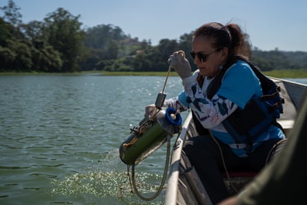

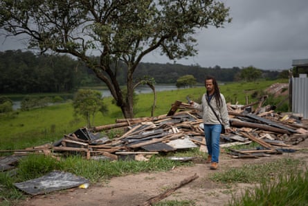
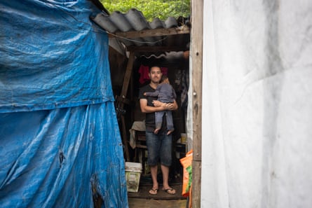
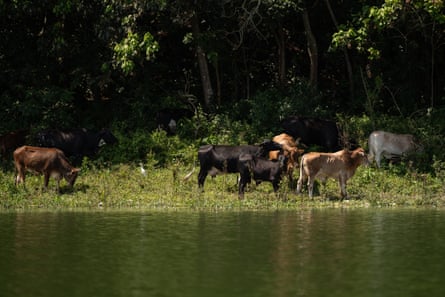
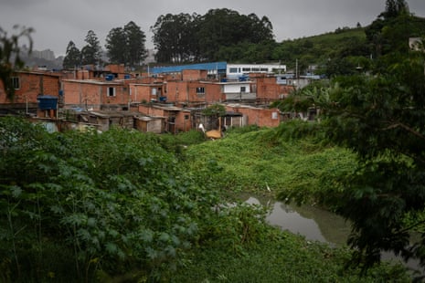
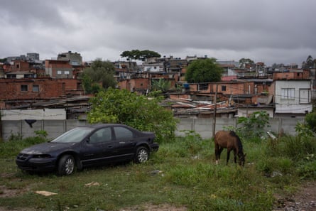
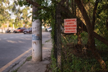
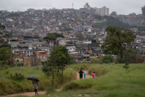


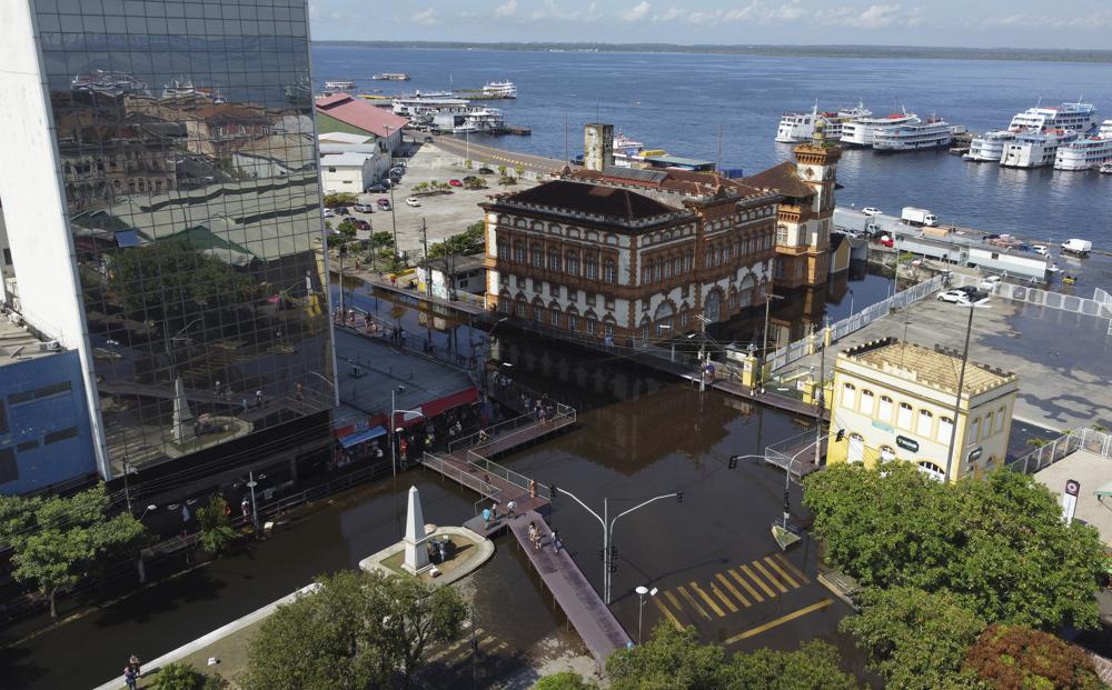
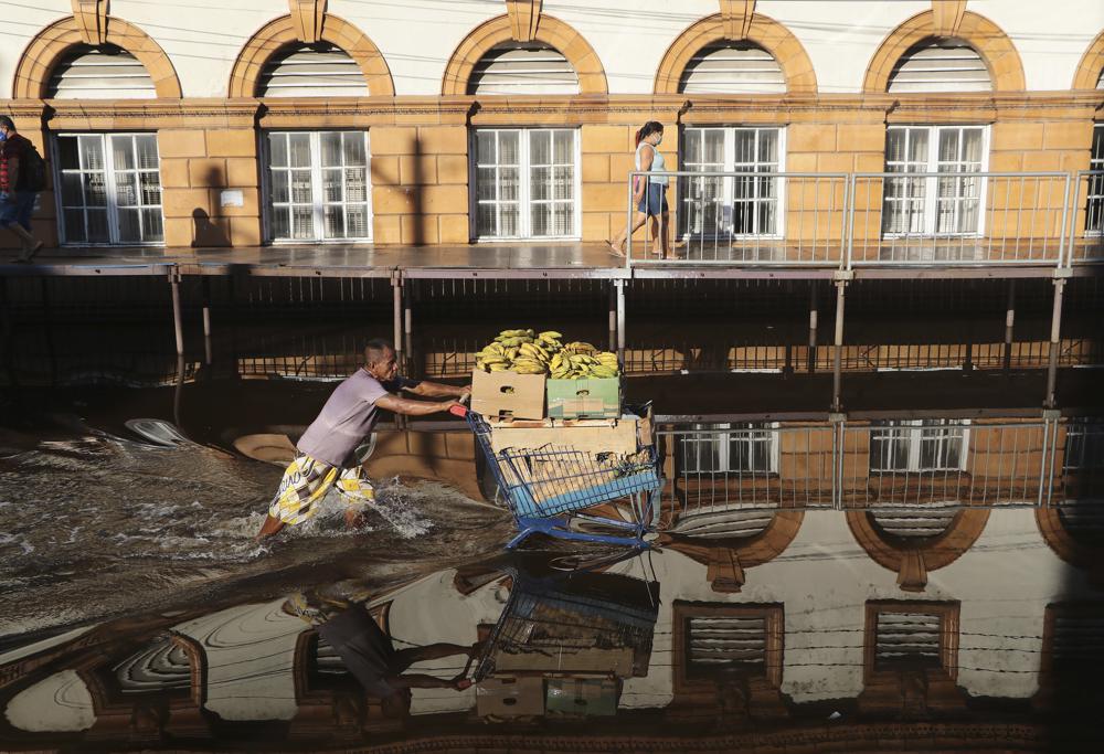
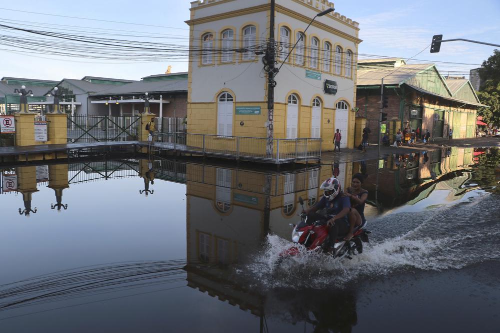


![The Magpie River, a 300km waterway in the Cote Nord region of the Canadian province of Quebec, was recognised as a 'legal person' in February [Courtesy Uapukun Metokosho/International Observatory on the Rights of Nature]](https://www.aljazeera.com/wp-content/uploads/2021/03/Uapukun-24.jpg?resize=770%2C513)
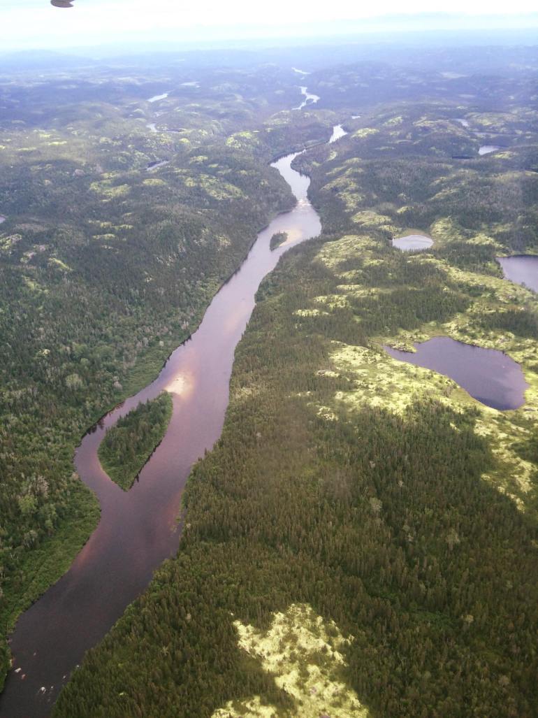
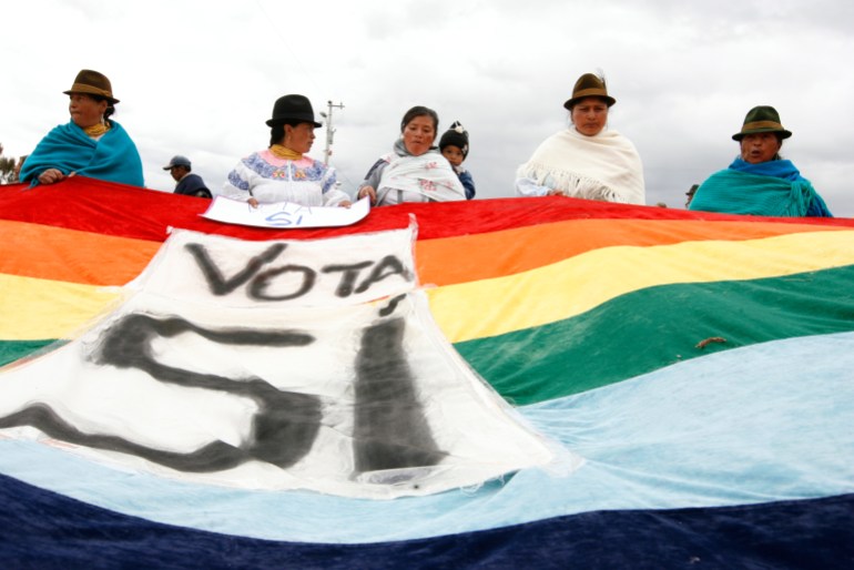
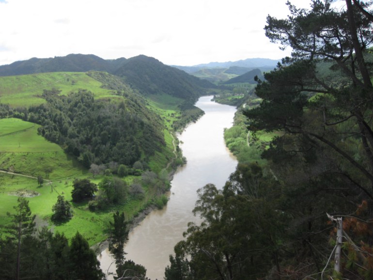
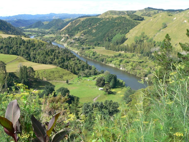
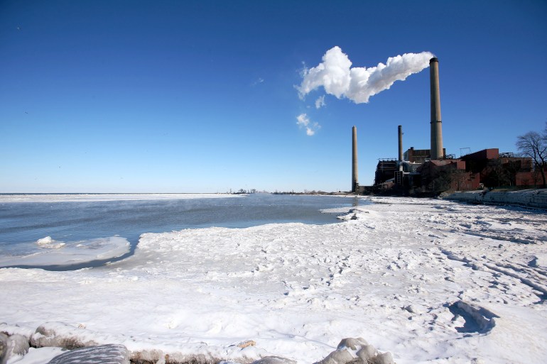


 The Budj Bim aquatic system, located in southeastern Australia, was built over 6,000 years ago – older than Egypt’s pyramids.