Arquivo da tag: Conflito

Racionalidade não é suficiente em situações de estresse, diz professor de negociação de Harvard (Folha de S.Paulo)

Em livro, Daniel Shapiro apresenta método para solucionar conflitos

15.ago.2021 às 16h00

Fernanda Brigatti São Paulo

As negociações e os conflitos que decorrem delas fazem parte da vida em sociedade e, ainda que a prática da negociação seja mais fortemente associada ao ambiente empresarial, ela está presente em delicadas questões geopolíticas, impasses orçamentários em empresas e mesmo em questões domésticas e relações familiares e corporativas.

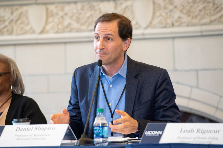
Para o psicólogo Daniel Shapiro, fundador do Programa Internacional de Negociação da Universidade de Harvard, nos Estados Unidos, o que essas situações têm em comum é a alta carga emocional, que despertam reações inconscientes que inviabilizam avanços.

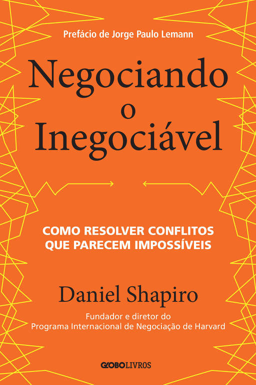
Polarizações, sejam políticas ou entre pessoas da mesma família, diz, são reações emocionais complicadas, mas nem por isso impossíveis. Em “Negociando o Inegociável”, lançado em julho no Brasil pela GloboLivros, Shapiro detalha o que pretende ser um manual para lidar com essas emoções e chegar a soluções.

A experiência na mediação de conflitos –Shapiro trabalhou em negociações entre a China continental e Taiwan, em diferentes partes da África, no conflito israelo-palestino e na Europa central na virada do comunismo para o capitalismo– levou ao aprimoramento dessa metodologia que batizou de “teoria da identidade relacional”.

Daniel Shapiro, fundador do Programa Internacional de Negociação da Universidade de Harvard – Divulgação

Para ele, a noção de identidade é central nos conflitos contemporâneos. Uma vez ameaçada, ela expõe os envolvidos a iscas mentais –ou tentações– que mantêm o estado de conflito e impedem uma resolução. https://s.dynad.net/stack/928W5r5IndTfocT3VdUV-AB8UVlc0JbnGWyFZsei5gU.html%5B x ]

Shapiro diz ter identificado as cinco principais tentações —vertigem, compulsão à repetição, tabus, ataque ao sagrado e política de identidade— a partir da observação de um exercício repetido por ele em diversos ambientes e com diferentes audiências.

Na simulação, o grupo é estimulado a se agrupar em tribos com valores comuns —uma identidade é forjada entre eles. Organizados esses grupos, um alienígena invade a sala e faz uma única exigência: “escolham um único líder para representá-lo ou destruirei o mundo.” Invariavelmente, diz Shapiro, o mundo explode.

A primeira dessas experiências foi no Estado da Macedônia, sob tensão e iminente conflito étnico, ainda nos anos 1990. Naquele que talvez seja o mais curioso, “o mundo explodiu em Davos” —45 líderes mundiais, entre políticos e grandes executivos, foram convidados a participar da dinâmica.

A racionalidade, ou pressupor que os lados estejam sendo racionais no diálogo, segundo ele, não é suficiente. “Supomos que cada lado realmente tenha uma preocupação racional e use processos racionais para satisfazer essas preocupações. Quando se trata desses conflitos de grande carga emocional, não é suficiente.”

Segundo Shapiro, é a identidade o elemento invisível que, em conflitos de grande carga emocional, acaba ativando o que ele chama de efeito das tribos, um estado mental de alerta e polarização.

Com a pandemia, diz o psicólogo, estamos todos sob intenso estresse, o que torna as chances de as negociações terminarem em um acordo ainda menores. “É como reunir grupos de identidades distintas para negociar em uma sala escura e apertada.”

Veja os principais trechos da entrevista concedida à Folha por videoconferência.

Novo livro
O trabalho que faço é em negociação e solução de conflitos. Estou nessa área há 30 e poucos anos —e minha calvície é a prova disso. Tenho observado como as pessoas negociam, o que funciona e o que não funciona nos mais significativos conflitos de nossas vidas, sejam profundamente políticos, ou desafios diários carregados de emoção.

O que descobri é que as pessoas tendem a negociar em um nível irracional. Supomos que cada lado realmente tenha uma preocupação racional e use processos racionais para satisfazer essas preocupações. Quando se trata desses conflitos de grande carga emocional, a racionalidade não é suficiente.

Como podemos entender e lidar com as dimensões mais profundas desses conflitos? Então, “Negociando o Inegociável” é uma forma de explorar essas dimensões do conflito que levam à polarização e como podemos entender mais profundamente esses conflitos –e que eu coloco na categoria da identidade.

Existem tantos bons livros por aí que oferecem soluções rápidas, que oferecem respostas fáceis para lidar com problemas difíceis. Mas para realmente chegar à raiz dos problemas que enfrentamos em nossas sociedades e em nossas vidas, precisamos compreender profundamente essas dimensões. O papel da emoção, o papel da identidade e como eles nos afetam e como os afetamos para uma mudança construtiva.

As cinco tentações
Por que as sociedades e as famílias estão polarizadas? Mesmo quando se trata de um enorme custo emocional para pais, filhos, avós, por que fazemos isso? Essa é a questão sobre a qual venho pensando há muitos anos.

Em “Negociando o Inegociável”, discuto os cinco principais instigadores da mentalidade da tribo, que chamo de tentações. Eles são os instigadores de conflitos. No momento em que nossa identidade parece ameaçada, essas tentações começam a nos tentar em direção à mente tribal.

Desenvolvendo o método
Assistindo àquele exercício da tribo, e o mundo explodindo de novo e de novo, me pergunto o que está acontecendo. Como essas pessoas, os líderes mais racionais do mundo, pessoas afetivas e amorosas estão explodindo o mundo de novo. Por quê? Cinco tentações, cinco iscas.

Capa do livro Negociando o Inegociável, de Daniel Shapiro
Capa do livro Negociando o Inegociável, de Daniel Shapiro – Divulgação/Globo Livros

Vertigem
Primeiro, entramos rapidamente no que chamo de vertigem. A ideia aqui é que, se entrarmos em um conflito com meu cônjuge, muito rapidamente podemos ser consumidos nesse conflito e uma discussão de dois minutos sobre quem deveria ter lavado a louça se transforma em duas horas de discussão horrível. Estamos em vertigem.

As polarizações dos Estados Unidos estão indiscutivelmente em um lugar de vertigem, consumidos no conflito, pensando estritamente sobre isso não podemos ver o quadro geral, estamos presos em nosso próprio pequeno lugar. Estamos presos na vertigem.

A palavra significa tontura, e essa é a experiência aqui. De repente, estou consumido pela vertigem, perco a noção de tempo e espaço e minha compreensão de tudo some. Parece sair daqui, um dos caminhos é perguntar “qual é o meu propósito nesse conflito?”.

Compulsão à repetição
Como seres humanos, tendemos a repetir os mesmos padrões de comportamento disfuncionais de novo e de novo e de novo. Seja no sistema familiar, todos podemos prever os conflitos que teremos no domingo à noite, com a esposa ou filhos. Sabemos o que cada pessoa vai dizer, sabemos o que elas vão fazer e como vamos nos sentir depois. É uma compulsão à repetição.

E também somos muito bons em prever, por meio de intuição e palpite, em um nível nacional ou local, “opa, lá vamos nós de novo”. E esse é um daqueles momentos em que um grupo vai dizer isso, o outro vai dizer aquilo, e começarão apontar o dedo um para o outro e vai levar à violência.

O problema como essa repetição é que esse padrão vira parte da nossa identidade e vira uma tatuagem. É muito difícil de se livrar disso, é mais que um simples hábito, é muito mais profundo. A saída para a compulsão à repetição é tomar ciência disso e realmente olhar para esse padrão em que eu costumo entrar com aquela pessoa. Por que e como eu posso me livrar disso.

Tabus
O que, na sociedade brasileira, é um tabu de se conversar? Se você falar de certo assunto, vai ter muitos problemas, será punido, rejeitado socialmente e corre o risco de ser agredido fisicamente.

Uma coisa que é um tabu nos Estados Unidos é um apoiador do Trump e um do Biden sentarem lado a lado para uma refeição. Como se um lado fosse contaminar o outro. O medo não é infundado.

Acho que, no momento em que uma pessoa de um lado olha alguém de sua tribo se associar com alguém da tribo oposta, bem, um tabu da associação acaba de ser quebrado. “Você está traindo nossa tribo? Está traindo nossa gente? Não fale com eles!” Bem, mas como você pode solucionar um conflito, como você reduz as polarizações se os lados não conversam.

Ataque ao sagrado
Toda tribo política, toda família tem crenças, valores que considera sagrados. Se você sente que eu a ofendi ou ameacei aquilo que para você tem grande importância, religioso ou secular, bum, voltamos à mentalidade tribal.

A imagem na minha cabeça é a de uma cobra que salta sobre você, quando você ofende algo muito sagrado. Também penso que no contexto moderno, politicamente as pessoas podem tornar alguns assuntos sagrados, e são eles que constroem as tribos internas e tornam mais difícil a reconciliação com outros grupos.

Política de identidade
Uso o termo de maneira um pouco diferente daquilo que foi popularizado. Acho que as pessoas normalmente veem políticas de identidade [no Brasil, o termo é traduzido mais frequentemente como políticas identitárias] como a reunião de grupos minoritários para tentar criar mudanças políticas em certos assuntos.

Para mim, política de identidade é o uso ou o mau uso da identidade para atingir certos objetivos políticos. Quando um líder diz “nós temos que nos unir para melhorar o nosso país.” Temos que nos unir, mas quem é esse “nós” a que ele se refere? Na maior parte das vezes, não vale para todo mundo, vale somente para alguns grupos, e cria, com frequência de maneira explícita, uma dinâmica de nós contra eles. Nós temos que nos unir para brigar como eles. Políticas de identidade podem ser usadas para dividir.

Meu conselho: em uma democracia funcional, use política de identidade para unir. Foque em um “nós” mais amplo. Todos nós juntos. Sim, temos tribos menores com interesses políticos. Ótimo. E todos somos parte de um projeto maior. Você pode fazer o que Mandela fez, você pode unir, usar essas políticas de identidade para unir.

O efeito da tribo
A pandemia colocou muito estresse em todos. Ansiedade, a dor de perder um parente, perder alguém próximo –e meu coração está com o Brasil, sei que sofreu muito. Acho que isso é um fardo, um peso emocional que está sobre os ombros de todos.

Enquanto isso, devemos fazer tudo o que fazíamos antes, agora no Zoom. Todos esses fardos emocionais nos fazem, em parte, querer buscar algum tipo de segurança emocional e ela pode vir na forma de nos aproximarmos de um grupo ao qual sinto que pertenço. Para uma tribo.

O problema é que as tensões também começam a aparecer entre os diferentes grupos, que estão muito mais comprimidos agora, estão mais apertados, por conta da pandemia.

Sob pressão
Acho que a pandemia está tendo um grande impacto na busca de segurança. A tribo é uma forma de segurança, mas pode facilmente se transformar em uma mentalidade tribal de “nós contra eles”.

A pandemia comprimiu todos nós. É muito mais difícil passar pelo desagradável. E estar emocionalmente desconfortável é como estar em um campo aberto com seus arquiinimigos. Estamos em um ambiente comprimido e todos esses instintos tribais são ativados com muito mais facilidade.

Quando há hierarquia
​O poder é muito maleável. Acho que existem dezenas de fontes de poder. Algumas pessoas têm mais poder hierárquico. Se eu tenho dinheiro, as pessoas podem atender o telefone com mais frequência.

Mas, em uma negociação, é útil tentar descobrir quais são minhas fontes de poder. Se não chegarmos a um acordo, o que posso fazer? Há poder, por exemplo, em entender os interesses do outro lado. Se estou negociando com você uma nova política para a empresa e precisamos que o presidente diga sim, que o vice-presidente aceite. Quanto mais eu entendo os interesses dos outros, mais poderoso sou.

Saúde mental no trabalho
Um dos conceitos mais fundamentais, em minha opinião, é o poder da apreciação. Apreciação, da forma como uso, não significa apenas dizer obrigado, não é gratidão. O que quero dizer é um entendimento profundo daquilo que a outra pessoa vive.

Enquanto passamos pela pandemia, acredito que, como seres humanos, precisamos de mais apreço do que nunca. Então, no local de trabalho, talvez a liderança executiva possa encontrar maneiras de ser um pouco mais gentil com a força de trabalho.

Não significa que as expectativas são menores, mas que o apoio é maior. É dizer ‘estamos aqui para você emocionalmente, nos preocupamos com você. Você não é apenas um objeto que está produzindo dinheiro para nós, é um ser humano que valorizamos’.

Vejo executivos agindo como ‘estou no comando, vou falar e mostrar o quanto sou inteligente’. A pandemia exige muito mais ouvir.

Ouvir mais, falar menos
É comum que igualemos negociações a conversas. Nós as chamamos de conversas de negociação [negotiation talks]. Uma terminologia muito melhor seria chamá-las de “ouvintes de negociação” [negotiation listens].

Porque você vai liderar muito mais a negociação se ouvir. Se você escuta 80% do tempo, e fala 20% do tempo e vice-versa.

Penso isso também sobre minha própria vida. Sabe, encontre tempo e espaço para dar um passeio, sentar-se em silêncio por dez minutos e absorver o que está acontecendo, reconhecer suas emoções.

E a razão para isso é que serei muito mais eficaz em minha vida pessoal e profissional se entendo o luto, os sentimentos, ressentimentos ou o desejo por mais amor e conexão. Quanto mais estou ciente de minha própria experiência interna, mais posso realmente interagir com os outros. Estar atento e ouvir é mesmo muito importante.

Negociando o Inegociável: Como resolver conflitos que parecem impossíveis

  • Preço A partir de R$ 44,92 na versão impressa | R$ 39,90 na versão e-book
  • Autor Daniel Shapiro
  • Editora Globo Livros

Floods as war weapons – Humans caused a third of floods in past 500 years in SW Netherlands (Hydrology.nl)

new study shows that, from 1500 until 2000, about a third of floods in southwestern Netherlands were deliberately caused by humans during wartimes. Some of these inundations resulted in significant changes to the landscape, being as damaging as floods caused by heavy rainfall or storm surges. The work, by Dutch researcher Adriaan de Kraker, is published in Hydrology and Earth System Sciences, a journal of the European Geosciences Union (EGU).

This photograph shows remnants of the former breach made here in February 1584, now a tidal channel. The marshland visible in the picture is former arable land.

During the Eighty Years’ War, as the Spanish army fought to recapture territory in what is now northern Belgium and southwestern Netherlands in the late sixteenth century, the Dutch rebels led by William of Orange decided to use the low-lying, flood-prone landscape to their advantage. In an attempt to liberate Bruges, Ghent and Antwerp from Spanish dominance and defend their territory, the rebels destroyed seawalls at strategic places from 1584 to 1586 to cause deliberate, large-scale floods.

»The plan got completely out of hand«, says De Kraker, an assistant professor at the VU University Amsterdam in the Netherlands. »It came at the expense of the countryside of northern Flanders, now Zeeland Flanders, some two thirds of which was flooded.«

Floods can result in loss of life and damage homes and businesses, and when the water remains inland for a long time, it can change the landscape through erosion and deposition, forming new tidal channels and creeks. The area flooded during the Eighty Years’ War became part of a strategic line of defence and remained inundated for more than 100 years in some places, with profound consequences for the landscape. After the waters receded, a thick layer of clay covered all remnants of buildings and roads in the area. As sea water was used, soil salinity increased, affecting agricultural yields.

»Strategic flooding is a highly risky tactic. It can only be successful if there’s a well-thought-out backup plan and a plan for fast repairs«, warns De Kraker. However, that was not the case here, he says: »I desperately looked for evidence of backup plans for the repair of the dykes and who was going to pay for the costs incurred. I could find hardly any records of such plans.«

Map showing the strategic flooding of the Philippine area, southwestern Netherlands, in 1747 at the time of a French military attack.

De Kraker has been studying historical floods – occurring from the year 1500 to 2000 – in southwestern Netherlands since the 1980s to find out their causes and outcomes. Mostly below sea level, and dominated by three river estuaries populated with islands and a system of dykes and dams that protect the fertile land from the sea, this region is particularly susceptible to floods.

In his research, De Kraker used documents relating to land ownership and land use, accounts of maintenance of sea defences, and correspondence between stakeholders, such as rebels, Spanish officials, and mayors of besieged towns. He also used aerial photographs of the area, historical maps and maps of soil and landscape changes.

As reported in the new Hydrology and Earth System Sciences article, he noticed the main floods in the area in the past 500 years could be grouped into those caused by storm surges (21 events) and those happening during wartimes (11 events). The former had natural causes and the latter were created by humans, but De Kraker says human action played a major role in both.

The most damaging flood occurred in the winter of 1953, when strong winds blew for two days causing a long-lasting storm surge, which resulted in extremely high water levels. Over 1800 people died, 100 000 were evacuated and damages reached the equivalent of 700 million euros. While the cause of this flood was natural, De Kraker says human factors contributed to the extent of the damage. He reports that officials were slow at responding to the event, failing to take mitigation measures such as raising the dykes fast enough. Weak building construction and inadequate rescue procedures contributed to the material damage and human toll.

The study also shows floods in the Netherlands were used as a weapon as recently as the 1940s. »Strategic flooding during the Second World War undertaken by the Germans remained purely defensive, while the Allied flooding of the former island of Walcheren in the southwest of the country sped up the Allied offensive«, says De Kraker.

Brasil é o terceiro país do mundo com mais conflitos ecológicos (O Globo)

JC e-mail 4929, de 08 de abril de 2014

Segundo levantamento global, busca por recursos naturais prejudica comunidades tradicionais. Posição do país no ranking seria explicada pela abundância de projetos de infraestrutura relacionados ao meio ambiente

A exploração mineral, o desmatamento e a disputa por terras e água estão entre os maiores motivos de conflitos ambientais do mundo, segundo um levantamento internacional divulgado recentemente pela ONG Ejolt (Environmental Justice Organizations, Liabilities and Trade) e coordenado pela Universidade Autônoma de Barcelona (UAB). Os pesquisadores identificaram 945 casos em 78 países. Empatado com a Nigéria, o Brasil foi o terceiro colocado no ranking, com 58 casos, atrás apenas da Índia (112) e da Colômbia (77).

Os conflitos do país, segundo o Atlas Global de Justiça Ambiental, estão ligados à abundância de projetos de infraestrutura relacionados ao meio ambiente. São obras, como a construção de hidrelétricas, que dividem ativistas e empreiteiras; e o setor agrícola, cujas plantações invadem unidades de conservação.

– O crescimento da população mundial provocará uma busca cada vez mais intensa por commodities, e o Brasil, que é rico em terra, água, petróleo e minérios, será um alvo – descreve Leah Temper, coordenadora do Atlas. – E este recursos estão em terras ocupadas por indígenas, quilombolas e pequenos agricultores. Estes grupos serão os mais afetados.

Entre os conflitos ecológicos brasileiros estão episódios de grilagem para especulação imobiliária e a disputa por regiões que poderiam receber projetos como barragens hidrelétricas. São instalações que ampliam a geração de energia por uma matriz energética considerada limpa, mas que provocam alto impacto ambiental no local de sua construção.

Falhas na legislação
Apesar do processo de industrialização nacional ter catapultado nas décadas passadas, as exportações do Brasil são altamente dependentes de produtos do setor primário. Em 2012, metade dos produtos comercializados para outras nações vinham do agronegócio – carne, soja, etanol, por exemplo – e outros semiacabados, entre eles alumínio e aço bruto. O potencial econômico do campo leva extrativistas a se aventurarem em reservas indígenas.

Professor de Direito Ambiental da Fundação Getúlio Vargas, Rômulo Sampaio lembra que a exploração de commodities sempre gera disputa de interesses.

– O petróleo, por exemplo, provoca interesses nacionais, conservacionais e do mercado privado – destaca. – No campo, o problema fundiário torna o conflito ainda mais agudo, devido à desigualdade na distribuição de propriedades.

Sampaio atribui os dilemas ambientais e suas consequências sociais a falhas graves na legislação.

– Não há uma discussão sobre como lidar com os conflitos – condena. – Falta uma orientação, uma política pública. O debate só aparece na hora de implementação de cada projeto. Por isso, aumenta o número de ações no Judiciário.

A Fiocruz realiza, desde o ano passado, um catálogo sobre injustiças ambientais no Brasil. O órgão foi uma das fontes do mapeamento da UAB e, em trabalhos independentes, destaca os danos à saúde coletiva provocados pelos conflitos ecológicos. Nas grandes cidades, moradores no entorno de lixões estão sujeitos a doenças respiratórias, dengue e leptospirose.

Já a atuação da indústria em áreas próximas a rios leva à alteração do ciclo reprodutivo da fauna, a doenças cardíacas e à insegurança alimentar.

– Analisamos denúncias de problemas de saúde causados por conflitos ecológicos, como a contaminação de rios por agrotóxicos – revela Marcelo Firpo Porto, professor do Centro de Estudos da Saúde do Trabalhador e Ecologia Humana, da Escola Nacional de Saúde Pública. – As doenças estão ligadas à degradação dos ecossistemas.

Em seu novo mapeamento, a Fiocruz já identificou 450 casos de conflito ecológico no Brasil.

– Levamos ao mapeamento da UAB os casos mais emblemáticos, relacionados ao comércio internacional – conta. – Mas conhecemos muitas outras ocorrências, de âmbito regional ou nacional.

No Rio, por exemplo, a Zona Oeste registra dois casos que seriam atentados à justiça ambiental. O polo industrial de Santa Cruz já provocou emissões de uma poeira de ferro e carbono, que causa danos ao aparelho respiratório.

Na Barra da Tijuca, moradores de comunidades vizinhas à Vila do Autódromo são ameaçadas de remoção devido à especulação imobiliária. A região receberá instalações para os Jogos Olímpicos. Segundo a Fiocruz, alterações já realizadas pelo assoreamento de recursos hídricos no local pioram a qualidade de vida da população.

Para Sampaio, as comunidades urbanas e rurais têm em comum a falta de mobilização, que permite a sobrevivência de problemas seculares.

– Não existe uma organização social entre as comunidades menos favorecidas, o que prejudica sua representatividade – assinala.

Leah, que está à frente da organização do Atlas, reconhece que o mapeamento ainda tem um longo caminho para percorrer. Nesta primeira edição, o trabalho contou com a adesão de 23 universidades e ONGs de justiça ambiental de 18 países.

‘Dívida ambiental’
O levantamento não chegou a regiões expressivas do planeta, como a China, a Ásia Central e o Oriente Médio.

– Temos muitos lugares em branco no mapa – reconhece. – Mas, agora que ele é público, vamos convidar pesquisadores e ativistas dessas regiões para documentar outros conflitos e expandir o nosso conhecimento.

A coordenadora do Atlas, no entanto, assegura que a iniciativa já confirma um padrão histórico.

– O Hemisfério Sul continua suprindo as nações desenvolvidas com manufaturas de baixo preço e pagam um alto preço ecológico. As nações ricas têm uma “dívida ambiental” – analisa.

(Renato Grandelle/O Globo)
http://oglobo.globo.com/sociedade/ciencia/brasil-o-terceiro-pais-do-mundo-com-mais-conflitos-ecologicos-12121947#ixzz2yIX5l16X

Indígenas brasileiros convivem mal com as águas represadas (IPS)

22/1/2014 – 10h15

por Mario Osava, da IPS

cacique Bá 629x472 Indígenas brasileiros convivem mal com as águas represadas

O jovem cacique xokó Lucimário Apolônio Lima busca novas formas de sustento para seu povo, depois que a represa de Itaparica cortou suas atividades tradicionais de agricultura e pesca, dependentes das águas do rio São Francisco. Foto: Mario Osava/IPS

Foz do Iguaçu e Paulo Afonso, Brasil, 22/1/2014 – A hidrelétrica de Itaparica ocupou território dos indígenas pankararu, mas enquanto outros foram compensados, a eles coube apenas perder suas terras e o acesso ao rio São Francisco, queixam-se líderes desse povo do Nordeste do Brasil. “Já não comemos pescado como antes, mas o maior dano foi a perda da cascata sagrada, onde realizávamos nossos ritos religiosos”, lamentou à IPS o cacique José Auto dos Santos.

Quase 200 quilômetros rio abaixo, a comunidade indígena xokó sofre a diminuição de água, contida acima por grandes represas que suprimiram as cheias estacionais e regulares do São Francisco, inviabilizando os arrozais de aluvião e reduzindo drasticamente a pesca. Efeitos semelhantes são temidos no rio Xingu, na Amazônia, onde a construção da central de Belo Monte desviará parte das águas do trecho conhecido como Volta Grande, o que afetará os povos juruna e arara.

Cerca de 2.500 quilômetros ao sul, os avá-guarani assentados às margens da represa de Itaipu, na fronteira com o Paraguai, se dedicaram à piscicultura para manter seu alto consumo tradicional de pescado, em uma população crescente e com escassa terra para cultivar. Nos anos 1970 e 1980, emergiu no Brasil uma geração de indígenas de águas paradas, quando o país construiu numerosas centrais hidrelétricas, algumas gigantescas como Itaipu, compartilhada com o Paraguai, e Tucuruí, na Amazônia oriental, ambas inauguradas em 1984.

No São Francisco, cujo maior trecho cruza terras semiáridas, foram instaladas cinco centrais, que alteraram seu fluxo fluvial. Uma delas, Sobradinho, exigiu uma represa de 4.214 quilômetros quadrados, um dos maiores lagos artificiais do mundo, segundo sua operadora, a estatal Companhia Hidrelétrica do São Francisco, que tem outras 13 centrais na região nordestina. A abertura de Sobradinho, em 1982, acabou com a plantação de arroz em terras inundáveis do território xokó, cerca de 630 quilômetros rio abaixo, contaram à IPS seus moradores.

O ciclo anual de cheias praticamente desapareceu no Baixo São Francisco desde 1986, quando foi criada em Pernambuco a represa de Itaparica, de 828 quilômetros quadrados, que regula o fluxo auxiliar de Sobradinho. Assim, se pôs fim ao aluvião, que fertilizava os arrozais e enchia ciclicamente de peixes os lagos conectados ao rio por um canal.

“Sem corrente, o rio perde força, é um prato plano que se cruza a pé”, descreveu Apolônio Lima, o cacique xokó, com uma juventude incomum entre líderes indígenas. Com 30 anos, explicou à IPS que busca para sua gente, pouco mais de 400 pessoas, um futuro sustentável. Para isso, estimula a apicultura e outras produções alternativas, luta pela revitalização do São Francisco e se opõe à transposição de suas águas para combater secas no norte, um megaprojeto do governo federal.

“Antes de fazer isso, é preciso dar vida ao rio, os doentes não doam sangue para transfusões”, afirmou o cacique. “Meus avós já asseguravam que as margens do São Francisco morreriam. Eu não, mas meus netos o verão”, profetizou à IPS o xamã Raimundo Xokó, de 78 anos.

Para os pankararu, estabelecidos a cinco quilômetros da muralha que represa as águas em Itaparica, as ribeiras fluviais são coisa do passado. Seus líderes se sentem roubados. “Não temos onde pescar, a empresa tomou nossa terra, desconhecendo nosso direito legal até a margem”, explicou à IPS o xamã José João dos Santos, mais conhecido como Zé Branco.

O ex-cacique Jurandir Freire, apelidado de Zé Índio, luta por indenizações milionárias, porque os indígenas foram excluídos das compensações por sua terra inundada, ao contrário dos municípios, cujas prefeituras recebem benefícios, e os camponeses assentados nas chamadas agrovilas com áreas irrigadas. Zé Índio esteve preso e perdeu seu cargo por liderar, em 2001, um protesto que danificou linhas de transmissão elétrica da central, que passam por montanhas do território pankararu sem compensação alguma.

A terra fértil, em um vale e ladeiras montanhosas que favorecem uma umidade que contrasta com a semiaridez à sua volta, é outra fonte de conflitos. Desde a demarcação da Reserva Pankararu, em 1987, os indígenas pressionam o governo para retirar os agricultores brancos que ocupam a melhor parte.

“Minha avó nasceu ali e morreu aos 91 anos, isso há cinco”, disse Isabel da Silva para defender que sua família e outras vizinhas pertencem ao território pankararu há mais de um século. “Segundo a lei, temos que sair, mas fazer isso seria uma injustiça”, disse à IPS esta funcionária do Polo Sindical de Trabalhadores Rurais do Submédio São Francisco, que conseguiu o reassentamento de quase seis mil famílias camponesas afetadas pela central de Itaparica.

Há 435 famílias ameaçadas de expulsão há duas décadas, em uma medida que demora por falta de terra para reassentá-las, justificam as autoridades. O povo pankararu vive em uma reserva de 8.376 hectares e em 2003 contava com 5.584 integrantes, segundo a Fundação Nacional do Índio (Funai), responsável pela proteção das populações originárias. Mas outros milhares emigraram para as cidades, especialmente São Paulo, onde mantêm sua identidade e se reúnem em ritos religiosos e festas indígenas. Com terra menos escassa, muitos regressariam, espera Zé Índio.

A escassez de terra também impacta os ocoy, situados nas margens da represa de Itaipu. São 160 famílias, cerca de 700 pessoas, que sobrevivem em apenas 250 hectares, a maioria de florestas protegidas, vedada à agricultura. A piscicultura, impulsionada pela empresa Itaipu Binacional, surgiu como alternativa para completar sua alimentação, diante da queda da pesca tradicional e das limitações agrícolas.

Os indígenas se destacaram entre os 850 pescadores que se somaram à iniciativa, “talvez por sua cultura, vinculada à água”, destacou à IPS o diretor de coordenação e meio ambiente da companhia, Nelton Friedrich. Com 40 tanques rede, a comunidade ocoy obtém quase seis toneladas de pescado por ano, segundo o vice-cacique Silvino Vass.

No entanto, esta não é sua maior fonte alimentar e poucos participam diretamente da atividade, segundo pesquisa acadêmica realizada em 2011 por Magali Stempniak Orsi. Além disso, os indígenas dependem muito da empresa, que lhes fornece os alevinos e a alimentação para os peixes, disse a pesquisadora, segundo a qual o projeto deve promover maior participação comunitária.

Os ocoy precisam de assistência alimentar para completar suas necessidades, ao contrário de duas vizinhas comunidades avá-guarani, que contam com mais terras doadas pela Itaipu Binacional e mais produção agrícola.

Em todo caso, o apoio de Itaipu aos indígenas locais é uma exceção entre as centrais hidrelétricas. Além de buscar alternativas de desenvolvimento para eles, cuida da sustentabilidade de toda sua sub-bacia, com o Programa Cultivando Água Boa, um conjunto de 65 ações ambientais, sociais e produtivas. Envolverde/IPS

(IPS)

Simple Mathematical Formula Describes Human Struggles (Science Daily)

Dec. 12, 2013 — Would you believe that a broad range of human struggles can be understood by using a mathematical formula? From child-parent struggles to cyber-attacks and civil unrest, they can all be explained with a simple mathematical expression called a “power-law.”

The manner in which a baby’s cries escalate against its parent is comparable to the way riots in Poland escalated in the lead-up to the collapse of the Soviet Union. (Credit: © erllre / Fotolia)

In a sort of unified theory of human conflict, scientists have found a way to mathematically describe the severity and timing of human confrontations that affect us personally and as a society.

For example, the manner in which a baby’s cries escalate against its parent is comparable to the way riots in Poland escalated in the lead-up to the collapse of the Soviet Union. It comes down to the fact that the perpetrator in both cases (e.g. baby, rioters) adapts quickly enough to escalate its attacks against the larger, but more sluggish entity (e.g. parent, government), who is unable, or unwilling, to respond quickly enough to satisfy the perpetrator, according to a new study published in Nature‘s Scientific Reports.

“By picking out a specific baby (and parent), and studying what actions of the parent make the child escalate or de-escalate its cries, we can understand better how to counteract cyber-attacks against a particular sector of U.S. cyber infrastructure, or how an outbreak of civil unrest in a given location (e.g. Syria) will play out, following particular government interventions,” says Neil Johnson, professor of physics and the head of the interdisciplinary research group in Complexity, at the College of Arts and Sciences at the University of Miami (UM) and corresponding author of the study.

Respectively, the study finds some remarkable similarities between seemingly disconnected confrontations. For instance:

  • The escalation of violent attacks in Magdalena, Colombia — though completely cut off from the rest of the world — is actually representative of all modern wars. Meanwhile, the conflict in Sierra Leone, Africa, has exactly the same dynamics as the narco-guerilla war in Antioquia, Colombia.
  • The pattern of attacks by predatory traders against General Electric (GE) stock is equivalent to the pattern of cyber-attacks against the U.S. hi-tech electronics sector by foreign groups, which in turn mimics specific infants and parents.
  • New insight into the controversial ‘Bloody Sunday’ attack by the British security forces, against civilians, on January 30,1972, reveals that Bloody Sunday appears to be the culmination of escalating Provisional Irish Republican Army attacks, not their trigger, hence raising new questions about its strategic importance.

The findings show that this mathematical formula of the form AB-C is a valuable tool that can be applied to make quantitative predictions concerning future attacks in a given confrontation. It can also be used to create an intervention strategy against the perpetrators and, more broadly, as a quantitative starting point for cross-disciplinary theorizing about human aggression, at the individual and group level, in both real and online worlds.

Journal Reference:

  1. Neil F. Johnson, Pablo Medina, Guannan Zhao, Daniel S. Messinger, John Horgan, Paul Gill, Juan Camilo Bohorquez, Whitney Mattson, Devon Gangi, Hong Qi, Pedro Manrique, Nicolas Velasquez, Ana Morgenstern, Elvira Restrepo, Nicholas Johnson, Michael Spagat, Roberto Zarama. Simple mathematical law benchmarks human confrontations.Scientific Reports, 2013; 3 DOI: 10.1038/srep03463

Mapping the Future of Climate Change in Africa (Science Daily)

ScienceDaily (Aug. 2, 2012) — Our planet’s changing climate is devastating communities in Africa through droughts, floods and myriad other disasters.

Children in the foothills of Drakensberg mountains in South Africa who still live in traditional rondavels on family homesteads. (Credit: Todd G. Smith, CCAPS Program)

Using detailed regional climate models and geographic information systems, researchers with the Climate Change and African Political Stability (CCAPS) program developed an online mapping tool that analyzes how climate and other forces interact to threaten the security of African communities.

The program was piloted by the Robert S. Strauss Center for International Security and Law at The University of Texas at Austin in 2009 after receiving a $7.6 million five-year grant from the Minerva Initiative with the Department of Defense, according to Francis J. Gavin, professor of international affairs and director of the Strauss Center.

“The first goal was to look at whether we could more effectively identify what were the causes and locations of vulnerability in Africa, not just climate, but other kinds of vulnerability,” Gavin said.

CCAPS comprises nine research teams focusing on various aspects of climate change, their relationship to different types of conflict, the government structures that exist to mitigate them, and the effectiveness of international aid in intervening. Although most CCAPS researchers are based at The University of Texas at Austin, the Strauss Center also works closely with Trinity College Dublin, the College of William and Mary, and the University of North Texas.

“In the beginning these all began as related, but not intimately connected, topics” Gavin said, “and one of the really impressive things about the project is how all these different streams have come together.”

Africa is particularly vulnerable to the effects of climate change due to its reliance on rain-fed agriculture and the inability of many of its governments to help communities in times of need.

The region is of increasing importance for U.S. national security, according to Gavin, because of the growth of its population, economic strength and resource importance, and also due to concerns about non-state actors, weakening governments and humanitarian disasters.

Although these issues are too complex to yield a direct causal link between climate change and security concerns, he said, understanding the levels of vulnerability that exist is crucial in comprehending the full effect of this changing paradigm.

The vulnerability mapping program within CCAPS is led by Joshua Busby, assistant professor at the Lyndon B. Johnson School of Public Affairs.

To determine the vulnerability of a given location based on changing climate conditions, Busby and his team looked at four different sources: 1) the degree of physical exposure to climate hazards, 2) population size, 3) household or community resilience, and 4) the quality of governance or presence of political violence.

The first source records the different types of climate hazards which could occur in the area, including droughts, floods, wildfires, storms and coastal inundation. However, their presence alone is not enough to qualify a region as vulnerable.

The second source — population size — determines the number of people who will be impacted by these climate hazards. More people create more demand for resources, potentially making the entire population more vulnerable.

The third source looks at how resilient a community is to adverse effects, analyzing the quality of their education and health, as well as whether they have easy access to food, water and health care.

“If exposure is really bad, it may exceed the capacity of local communities to protect themselves,” Busby said, “and then it comes down to whether or not the governments are going to be willing or able to help them.”

The final source accounts for the effectiveness of a given government, the amount of accountability present, how integrated it is with the international community, how politically stable it is, and whether there is any political violence present.

Busby and his team combined the four sources of vulnerability and gave them each equal weight, adding them together to form a composite map. Their scores were then divided into a ranking of five equal parts, or quintiles, going from the 20 percent of regions with the lowest vulnerability to the 20 percent with the highest.

The researchers gathered information for the tool from a variety of sources, including historic models of physical exposure from the United Nations Environment Programme (UNEP), population estimates from LandScan, as well as household surveys and governance assessments from the World Bank’s World Development and Worldwide Governance Indicators.

This data reflects past and present vulnerability, but to understand which places in Africa would be most vulnerable to future climate change, Busby and his team relied on the regional climate model simulations designed by Edward Vizy and Kerry Cook, both members of the CCAPS team from the Jackson School of Geosciences.

Vizy and Cook ran three, 20-year nested simulations of the African continent’s climate at the regional scales of 90 and 30 kilometers, using a derivation of the Weather Research and Forecasting Model of the National Center for Atmospheric Research. One was a control simulation representative of the years 1989-2008, and the others represented the climate as it may exist in 2041-2060 and 2081-2100.

“We’re adjusting the control simulation’s CO2 concentration, model boundary conditions, and sea surface temperatures to increased greenhouse gas forcing scenario conditions derived from atmosphere-ocean global climate models. We re-run the simulation to understand how the climate will operate under a different, warmer state at spatial resolutions needed for regional impact analyses,” Vizy said.

Each simulation took two months to complete on the Rangersupercomputer at the Texas Advanced Computing Center (TACC).

“We couldn’t run these simulations without the high-performance computing resources at TACC, it would just take too long. If it takes two months running with 200 processors, I can’t fathom doing it with one processor,” Vizy said.

Researchers input data from these vulnerability maps into an online mapping tool developed by the CCAPS program to integrate its various lines of climate, conflict and aid research. CCAPS’s current mapping tool is based on a prototype developed by the team to assess conflict patterns in Africa with the help of researchers at the TACC/ACES Visualization Laboratory (Vislab), according to Ashley Moran, program manager of CCAPS.

“The mapping tool is a key part of our effort to produce new research that could support policy making and the work of practitioners and governments in Africa,” Moran said. “We want to communicate this research in ways that are of maximum use to policymakers and researchers.”

The initial prototype of the mapping tool used the ArcGIS platform to project data onto maps. Working with its partner Development Gateway, CCAPS expanded the system to incorporate conflict, vulnerability, governance and aid research data.

After completing the first version of their model, Busby and his team carried out the process of ground truthing their maps by visiting local officials and experts in several African countries, such as Kenya and South Africa.

“The experience of talking with local experts was tremendously gratifying,” Busby said. “They gave us confidence that the things we’re doing in a computer lab setting in Austin do pick up on some of the ground-level expert opinions.”

Busby and his team complemented their maps with local perspectives on the kind of impact climate was already having, leading to new insights that could help perfect the model. For example, local experts felt the model did not address areas with chronic water scarcity, an issue the researchers then corrected upon returning home.

According to Busby, the vulnerability maps serve as focal points which can give way to further analysis about the issues they illustrate.

Some of the countries most vulnerable to climate change include Somalia, Sierra Leone, Guinea, Sudan and parts of the Democratic Republic of Congo. Knowing this allows local policymakers to develop security strategies for the future, including early warning systems against floods, investments in drought-resistant agriculture, and alternative livelihoods that might facilitate resource sharing and help prevent future conflicts. The next iteration of the online mapping tool to be released later this year will also incorporate the future projections of climate exposure from the models developed by Vizy and Cook.

The CCAPS team publishes their research in journals likeClimate Dynamics and The International Studies Review, carries out regular consultations with the U.S. government and governments in Africa, and participates in conferences sponsored by concerned organizations, such as the United Nations and the United States Africa Command.

“What this project has showed us is that many of the real challenges of the 21st century aren’t always in traditional state-to-state interactions, but are transnational in nature and require new ways of dealing with,” Gavin said.

Tony Andersson on Khagram, Dams and Development (H-Water)

Sanjeev Khagram. Dams and Development: Transnational Struggles for Water and Power. Ithaca Cornell University Press, 2004. 288 pp. $22.95 (paper), ISBN 978-0-8014-8907-5.

Reviewed by Tony Andersson (New York University)
Published on H-Water (May, 2011)
Commissioned by John Broich

Tony Andersson on Khagram, Dams and Development

The controversies over big dams, and the aggressive promotion of such development projects by multinational organizations like the World Bank, have produced an extensive literature written mostly by environmental and social justice activists reacting to the loss of wildlife, often violent human displacements, and the fiscal costs associated with big dams. A welcome addition to this field, Dams and Development is the first monograph published by Sanjeev Khagram, a political scientist at the University of Washington. Pulling back somewhat from the activist literature, Khagram assumes a more distant view in order to explain why, after the 1970s, big dams as a development model seemed to fall so precipitously out of favor among governments and development agencies. Khagram’s previous work on transnational social movements informs this study of anti-dam activism as he reconstructs the international networks of nongovernmental organizations (NGOs), local activists, and institutions that during the latter twentieth century acted to contest and reform development models that uncritically relied on big dams. Taking India as a case study, and in particular the series of damming schemes in the Narmada Valley, Khagram argues that transnational alliances of anti-dam activists have “dramatically altered the dynamics surrounding big dams from the local to the international levels,” affecting not only the scale but also the actual policies that guide large development projects (p. 3). Further, Khagram identifies two principle variables on which the success of anti-dam campaigns hinge: the extent to which local activists in developing countries are able to internationalize their campaigns, linking up with donors and lobbyists in the United States or Europe; and the degree of democratization in the country concerned. According to Khagram, successful anti-dam movements depended on both a robust network of international activists as well as democratic domestic political systems.

Khagram begins the book by elaborating his theoretical framework and general argument. He reviews the rise of the “big dam regime” and its unexplained fall by the 1990s. After noting the inadequacy of technical or financial constraints in explaining the precipitous decline of dam construction worldwide after a century of enthusiastic growth, Khagram details how transnational alliances and democratic institutions facilitated a global shift in norms in relation to the environment, human rights, and indigenous peoples.

Chapters 2 through 4 constitute the heart of the book, exploring India’s infatuation and subsequent disillusionment with dams after the Second World War. In chapter 2, Khagram briefly recounts the rise of big dams as a development model and applies his theoretical arguments to the case of the Silent Valley–the world’s first successful transnational campaign to stop a major dam project, according to the author. He then proceeds to question why, despite an apparent lack of financial or technical constraints, dam building across India declined rapidly after the 1970s. Visiting a series of sites in the subcontinent, Khagram points to the alliances between local activists and international NGOs that, he says, were the motive force behind the decline in dam construction. He also enumerates a group of countervailing trends that worked against anti-dam campaigns, notably a revamped lobbying campaign by dam boosters, the emergence of neoliberal ideology among third world leaders, and a right-wing Hindu nationalist movement that quashed the voices of many anti-dam activists.

Chapter 3 ventures into the history of India’s monumental plans to dam the Narmada Valley. Khagram is keen to note that local resistance met virtually every proposed dam, but that it was ineffective without the support of international organizations that could pressure Western legislators and World Bank managers. He asserts the emergence of a global set of norms pertaining to environmental conservation, human rights, and the protection of indigenous peoples as an essential factor in the success of the anti-dam movements in reforming policies at the bank. Chapter 4 chronicles the major events that eventually led the World Bank to withdraw funding from the Narmada projects in 1993, highlighting the consolidation of the anti-dam coalition in the late 1980s after a momentary split. Here Khagram emphasizes the role that India’s democratic institutions–notably the judiciary–played in upholding settlements that favored the anti-dam coalitions within India’s borders.

The focus shifts in chapter 5 from India to a comparative analysis of dam building and resistance. The author reviews examples from Brazil, Indonesia, South Africa, and China. He evaluates the success of anti-dam movements in each of the five countries, arguing that the outcome can be understood as a product of the two factors–international social mobilization and domestic democratization–that he identifies in the first chapter. According to Khagram, Brazil’s relatively democratic political system and the close ties between local activists and international NGOs successfully stopped the damming of the Xingu River. In South Africa and Indonesia, authoritarian regimes limited the strength of transnational anti-dam movements, even in spite of Indonesia’s relatively well-organized campaigns of resistance. China, lacking both democratic institutions and meaningful social mobilization, has yet to witness any effective resistance to dam building.

The final chapter again alters course, placing the rise of anti-dam movements in global perspective. Khagram locates the origins of the turn away from dams in the 1990s among environmental activism in the United States and Europe from the 1960s. While acknowledging that local resistance to dams has always been present, if ineffective, in the third world, Khagram emphasizes the role played by international NGOs in changing the discourse and policies surrounding dams. Of particular importance were the campaigns to reform dam policy at the World Bank, which were notable for their public visibility and effective coordination between local activists and operatives in a position to influence managers at the bank and their political backers in the United States and Europe. Khagram holds up a series of major declarations, internal reviews by the bank, and the reformist tone of the World Commission on Dams as evidence for the success of these anti-dam coalitions in bringing an end to the big dam regime. Khagram concludes with a review of alternative explanations of the global decline of dam construction and reaffirms his argument, allowing that the anti-dam movement probably contributed little toward the adoption of new sustainable development models that substantially reduced poverty.

The most valuable contribution of this book is its placement of the anti-dam movement within a framework of global changes in development praxis and international norms governing the rights of indigenous peoples. Critics of big dams often discuss the global reach of large organizations like the World Bank, but rarely are the bank’s antagonists given such geographical breadth. Too often, commentators present indigenous communities as passive, tragic victims of an inexorable modernizing state. Leveraged through international networks of NGOs, Khagram demonstrates the agency of marginalized peoples as well as the institutional and political obstacles that they face.

Given the valuable contribution just mentioned, a number of concerns ought to be raised with this book. The first is the author’s too easy dismissal of alternative explanations for the turn away from dams during the 1980s, especially the turn to austerity over stimulus at the World Bank and the International Monetary Fund. In Latin America, dams and their associated projects were a major contributor to the fiscal problems that boiled into the debt crises starting in the late 1970s. Governments and lenders (public and private) were reluctant to undertake big dams at a time of economic uncertainty and shrinking budgets, even if dams retained their appeal as monuments to progress.

One might also like to see more direct evidence connecting the anti-dam movement to specific and transformative changes in World Bank policy or international norms vis-à-vis indigenous peoples and human rights. The relative absence of such evidence in the face of a global resurgence of big dam construction in the first decade of the twenty-first century (again funded by the World Bank) somewhat undermines the argument that transnational anti-dam networks did, in fact, affect real change in attitudes toward modernization, development, or the rights of indigenous peoples. Likewise, the author’s treatment of Brazil–especially its democratic credentials–glosses over important contradictions in that nation’s political history and the limited access to power by poor Brazilians. Brazil’s newly minted president–formerly a leftist guerrilla and once a dedicated opponent of the Xingu River dam–is now its most prominent booster and has been accused of suppressing the legal petitions brought against the dam by the indigenous communities it will displace. This suggests that the allure of big ticket modernization projects like dams has overridden the democratic politics and international alliances that Khagram has proposed as its remedy. Reading this book in 2011, one is left with a sense that the author would have benefited from a more critical view of World Bank reports and the efficacy of UN declarations. On first glance, the argument is compelling and optimistic, but a skeptical look at the sources cited reveals some weak evidentiary foundations.

Citation: Tony Andersson. Review of Khagram, Sanjeev, _Dams and Development: Transnational Struggles for Water and Power_. H-Water, H-Net Reviews. May, 2011. URL: https://www.h-net.org/reviews/showrev.php?id=33220

This work is licensed under a Creative Commons Attribution-Noncommercial-No Derivative Works 3.0 United States License.