Arquivo da tag: Antártida

Climate Change Has Knocked Earth Off Its Axis (Gizmodo)

earther.gizmodo.com

Brian Kahn, 23 April 2021


A 3D portrait of methane concentrations and a slightly wobblier Earth.

Of all the things attributable to climate change, the rotational poles moving differently is definitely one of the weirder ones. But a new study shows that’s exactly what’s happening. It builds on previous findings to show that disappearing ice is playing a major role, and shows that groundwater depletion is responsible for contributing to wobbles as well.

The findings, published last month in Geophysical Research Letters, uses satellites that track gravity to track what researchers call “polar drift.” While we think of gravity as a constant, it’s actually a moving target based on the shape of the planet. While earthquakes and other geophysical activities can certainly play a role by pushing land around, it’s water that is responsible for the biggest shifts. The satellites used for the study, known as GRACE and GRACE-FO, were calibrated to measure Earth’s shifting mass.

They’ve previously detected gravity changes tied to disappearing ice in Antarctica and the drought that led to groundwater depletion in California in the mid-2010s. The data can also reveal how these changes in gravity, in turn, impact the poles.

Polar drift is something that happens naturally. The Earth’s axis is slowly shifting, but there’s been a marked acceleration in recent decades. The poles are now moving at nearly 17 times the rate they were in 1981, a fairly remarkable speed-up. What’s even more remarkable, though, is that poles actually began moving in a new direction quite suddenly in 2000, at a rapid clip.

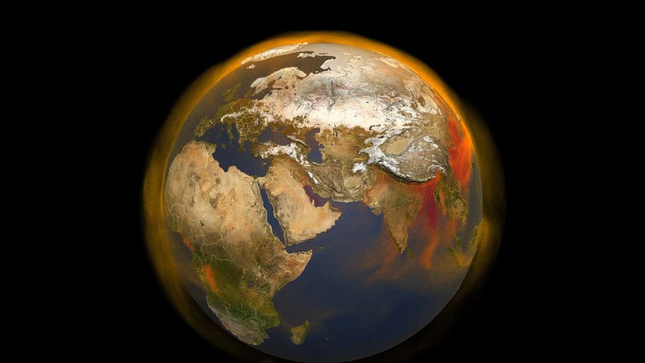
Previous research used the same satellite data to observe the speed-up and change of gear and attributed it to ice loss in Greenland and West Antarctica as well as groundwater pumping. The new study extends the record back to the 1990s and explores some of the year-to-year wobbles in more detail. The findings point to changes in groundwater use in specific regions as the source of some of those differences.

“Using the GRACE data (for the period 2002-2015) we showed that such interannual signals (as these authors pointed out: kinks at 2005 and 2012) can be explained by the terrestrial water storage,” Surendra Adhikari, a scientist at NASA Jet Propulsion Laboratory who led the 2016 research, said in an email. “The new paper reinforces the statement by also showing that another kink in the polar motion data (at 1995) is also explained by total water storage variability, especially by the on-set of accelerated Greenland ice mass loss and depletion of water storage in the Middle East and the Indian subcontinent.

“In general, the paper (along with our previous works) reveals the strong connection between the climate variability and how the Earth wobbles,” he added, noting the new study was a “nicely done paper.”

In the scheme of things, climate change triggering polar movement isn’t too worrisome, given the other clear and present dangers like intense heat waves, ocean acidification, and the sixth mass extinction. Ditto for the role of groundwater depletion, which has the potential to impact billions of lives. But it’s a powerful reminder of just how much humans have reshaped the planet and why we should probably cut it out sooner than later if we don’t want our world to turn upside down.

Correction, 4/23/21, 6:30 p.m.: This post has been updated to reflect that the rotational poles are the ones in question moving and being studied.

Climate change could trigger strong sea level rise (Science Daily)

International research team presents findings from frozen ‘climate archive’ of Antarctica

Date:
January 5, 2017
Source:
University of Bonn
Summary:
About 15,000 years ago, the ocean around Antarctica has seen an abrupt sea level rise of several meters. It could happen again.

Iceberg in the southeastern Weddell Sea region. Credit: Photo: Dr. Michael Weber

About 15,000 years ago, the ocean around Antarctica has seen an abrupt sea level rise of several meters. It could happen again. An international team of scientists with the participation of the University of Bonn is now reporting its findings in the magazine Scientific Reports.

University of Bonn’s climate researcher Michael E. Weber is a member of the study group. He says, “The changes that are currently taking place in a disturbing manner resemble those 14,700 years ago.” At that time, changes in atmospheric-oceanic circulation led to a stratification in the ocean with a cold layer at the surface and a warm layer below. Under such conditions, ice sheets melt more strongly than when the surrounding ocean is thoroughly mixed. This is exactly what is presently happening around the Antarctic.

The main author of the study, the Australian climate researcher Chris Fogwill from the Climate Change Research Center in Sydney, explains the process as follows: “The reason for the layering is that global warming in parts of Antarctica is causing land based ice to melt, adding massive amounts of freshwater to the ocean surface. At the same time as the surface is cooling, the deeper ocean is warming, which has already accelerated the decline of glaciers in the Amundsen Sea Embayment.” It appears global warming is replicating conditions that, in the past, triggered significant shifts in the stability of the Antarctic ice sheet.

To investigate the climate changes of the past, the scientists are studying drill cores from the eternal ice. Layer by layer, this frozen “climate archive” reveals its secrets to the experts. In previous studies, the scientists had found evidence of eight massive melting events in deep sea sediments around the Antarctic, which occurred at the transition from the last ice age to the present warm period. Co-author Dr. Weber from the Steinmann Institute of the University of Bonn says: “The largest melt occurred 14,700 years ago. During this time the Antarctic contributed to a sea level rise of at least three meters within a few centuries.”

The present discovery is the first direct evidence from the Antarctic continent which confirms the assumed models. The research team used isotopic analyzes of ice cores from the Weddell Sea region, which now flows into the ocean about a quarter of the Antarctic melt.

Through a combination with ice sheet and climate modeling, the isotopic data show that the waters around the Antarctic were heavily layered at the time of the melting events, so that the ice sheets melted at a faster rate. “The big question is whether the ice sheet will react to these changing ocean conditions as rapidly as it did 14,700 years ago,” says co-author Nick Golledge from the Antarctic Research Center in Wellington, New Zealand.


Journal Reference:

  1. C. J. Fogwill, C. S. M. Turney, N. R. Golledge, D. M. Etheridge, M. Rubino, D. P. Thornton, A. Baker, J. Woodward, K. Winter, T. D. van Ommen, A. D. Moy, M. A. J. Curran, S. M. Davies, M. E. Weber, M. I. Bird, N. C. Munksgaard, L. Menviel, C. M. Rootes, B. Ellis, H. Millman, J. Vohra, A. Rivera, A. Cooper. Antarctic ice sheet discharge driven by atmosphere-ocean feedbacks at the Last Glacial TerminationScientific Reports, 2017; 7: 39979 DOI: 10.1038/srep39979

West Antarctic melt rate has tripled in last decade (Science Daily)

Date: December 2, 2014

Source: University of California – Irvine

Summary: A comprehensive, 21-year analysis of the fastest-melting region of Antarctica has found that the melt rate of glaciers there has tripled during the last decade.

UCI and NASA glaciologists, including Isabella Velicogna and Tyler Sutterley, have discovered that the melt rate of glaciers in West Antarctica has tripled, with the loss of a Mt. Everest’s worth of water weight every two years. Credit: Michael Studinger / NASA

A comprehensive, 21-year analysis of the fastest-melting region of Antarctica has found that the melt rate of glaciers there has tripled during the last decade.

The glaciers in the Amundsen Sea Embayment in West Antarctica are hemorrhaging ice faster than any other part of Antarctica and are the most significant Antarctic contributors to sea level rise. This study is the first to evaluate and reconcile observations from four different measurement techniques to produce an authoritative estimate of the amount and the rate of loss over the last two decades.

“The mass loss of these glaciers is increasing at an amazing rate,” said scientist Isabella Velicogna, jointly of the UC Irvine and NASA’s Jet Propulsion Laboratory. Velicogna is a coauthor of a paper on the results, which has been accepted for Dec. 5 publication in the journal Geophysical Research Letters.

Lead author Tyler Sutterley, a UCI doctoral candidate, and his team did the analysis to verify that the melting in this part of Antarctica is shifting into high gear. “Previous studies had suggested that this region is starting to change very dramatically since the 1990s, and we wanted to see how all the different techniques compared,” Sutterley said. “The remarkable agreement among the techniques gave us confidence that we are getting this right.”

The researchers reconciled measurements of the mass balance of glaciers flowing into the Amundsen Sea Embayment. Mass balance is a measure of how much ice the glaciers gain and lose over time from accumulating or melting snow, discharges of ice as icebergs, and other causes. Measurements from all four techniques were available from 2003 to 2009. Combined, the four data sets span the years 1992 to 2013.

The glaciers in the embayment lost mass throughout the entire period. The researchers calculated two separate quantities: the total amount of loss, and the changes in the rate of loss.

The total amount of loss averaged 83 gigatons per year (91.5 billion U.S. tons). By comparison, Mt. Everest weighs about 161 gigatons, meaning the Antarctic glaciers lost a Mt.-Everest’s-worth amount of water weight every two years over the last 21 years.

The rate of loss accelerated an average of 6.1 gigatons (6.7 billion U.S. tons) per year since 1992.

From 2003 to 2009, when all four observational techniques overlapped, the melt rate increased an average of 16.3 gigatons per year — almost three times the rate of increase for the full 21-year period. The total amount of loss was close to the average at 84 gigatons.

The four sets of observations include NASA’s Gravity Recovery and Climate Experiment (GRACE) satellites, laser altimetry from NASA’s Operation IceBridge airborne campaign and earlier ICESat satellite, radar altimetry from the European Space Agency’s Envisat satellite, and mass budget analyses using radars and the University of Utrecht’s Regional Atmospheric Climate Model.

The scientists noted that glacier and ice sheet behavior worldwide is by far the greatest uncertainty in predicting future sea level. “We have an excellent observing network now. It’s critical that we maintain this network to continue monitoring the changes,” Velicogna said, “because the changes are proceeding very fast.”


Journal Reference:

  1. Tyler C. Sutterley, Isabella Velicogna, Eric Rignot, Jeremie Mouginot, Thomas Flament, Michiel R. van den Broeke, Jan M. van Wessem, Carleen H. Reijmer. Mass loss of the Amundsen Sea Embayment of West Antarctica from four independent techniquesGeophysical Research Letters, 2014; DOI: 10.1002/2014GL061940

Antarctic sea ice reaches new record maximum (Science Daily)

Date: October 8, 2014

Source: NASA/Goddard Space Flight Center

Summary: Sea ice surrounding Antarctica reached a new record high extent this year, covering more of the southern oceans than it has since scientists began a long-term satellite record to map the extent in the late 1970s.

On Sept. 19, 2014, the five-day average of Antarctic sea ice extent exceeded 20 million square kilometers for the first time since 1979, according to the National Snow and Ice Data Center. The red line shows the average maximum extent from 1979-2014. Credit: NASA’s Scientific Visualization Studio/Cindy Starr

Sea ice surrounding Antarctica reached a new record high extent this year, covering more of the southern oceans than it has since scientists began a long-term satellite record to map sea ice extent in the late 1970s. The upward trend in the Antarctic, however, is only about a third of the magnitude of the rapid loss of sea ice in the Arctic Ocean.

The new Antarctic sea ice record reflects the diversity and complexity of Earth’s environments, said NASA researchers. Claire Parkinson, a senior scientist at NASA’s Goddard Space Flight Center, has referred to changes in sea ice coverage as a microcosm of global climate change. Just as the temperatures in some regions of the planet are colder than average, even in our warming world, Antarctic sea ice has been increasing and bucking the overall trend of ice loss.

“The planet as a whole is doing what was expected in terms of warming. Sea ice as a whole is decreasing as expected, but just like with global warming, not every location with sea ice will have a downward trend in ice extent,” Parkinson said.

Since the late 1970s, the Arctic has lost an average of 20,800 square miles (53,900 square kilometers) of ice a year; the Antarctic has gained an average of 7,300 square miles (18,900 sq km). On Sept. 19 this year, for the first time ever since 1979, Antarctic sea ice extent exceeded 7.72 million square miles (20 million square kilometers), according to the National Snow and Ice Data Center. The ice extent stayed above this benchmark extent for several days. The average maximum extent between 1981 and 2010 was 7.23 million square miles (18.72 million square kilometers).

The single-day maximum extent this year was reached on Sept. 20, according to NSIDC data, when the sea ice covered 7.78 million square miles (20.14 million square kilometers). This year’s five-day average maximum was reached on Sept. 22, when sea ice covered 7.76 million square miles (20.11 million square kilometers), according to NSIDC.

A warming climate changes weather patterns, said Walt Meier, a research scientist at Goddard. Sometimes those weather patterns will bring cooler air to some areas. And in the Antarctic, where sea ice circles the continent and covers such a large area, it doesn’t take that much additional ice extent to set a new record.

“Part of it is just the geography and geometry. With no northern barrier around the whole perimeter of the ice, the ice can easily expand if conditions are favorable,” he said.

Researchers are investigating a number of other possible explanations as well. One clue, Parkinson said, could be found around the Antarctic Peninsula — a finger of land stretching up toward South America. There, the temperatures are warming, and in the Bellingshausen Sea just to the west of the peninsula the sea ice is shrinking. Beyond the Bellingshausen Sea and past the Amundsen Sea, lies the Ross Sea — where much of the sea ice growth is occurring.

That suggests that a low-pressure system centered in the Amundsen Sea could be intensifying or becoming more frequent in the area, she said — changing the wind patterns and circulating warm air over the peninsula, while sweeping cold air from the Antarctic continent over the Ross Sea. This, and other wind and lower atmospheric pattern changes, could be influenced by the ozone hole higher up in the atmosphere — a possibility that has received scientific attention in the past several years, Parkinson said.

“The winds really play a big role,” Meier said. They whip around the continent, constantly pushing the thin ice. And if they change direction or get stronger in a more northward direction, he said, they push the ice further and grow the extent. When researchers measure ice extent, they look for areas of ocean where at least 15 percent is covered by sea ice.

While scientists have observed some stronger-than-normal pressure systems — which increase winds — over the last month or so, that element alone is probably not the reason for this year’s record extent, Meier said. To better understand this year and the overall increase in Antarctic sea ice, scientists are looking at other possibilities as well.

Melting ice on the edges of the Antarctic continent could be leading to more fresh, just-above-freezing water, which makes refreezing into sea ice easier, Parkinson said. Or changes in water circulation patterns, bringing colder waters up to the surface around the landmass, could help grow more ice.

Snowfall could be a factor as well, Meier said. Snow landing on thin ice can actually push the thin ice below the water, which then allows cold ocean water to seep up through the ice and flood the snow — leading to a slushy mixture that freezes in the cold atmosphere and adds to the thickness of the ice. This new, thicker ice would be more resilient to melting.

“There hasn’t been one explanation yet that I’d say has become a consensus, where people say, ‘We’ve nailed it, this is why it’s happening,'” Parkinson said. “Our models are improving, but they’re far from perfect. One by one, scientists are figuring out that particular variables are more important than we thought years ago, and one by one those variables are getting incorporated into the models.”

For Antarctica, key variables include the atmospheric and oceanic conditions, as well as the effects of an icy land surface, changing atmospheric chemistry, the ozone hole, months of darkness and more.

“Its really not surprising to people in the climate field that not every location on the face of Earth is acting as expected — it would be amazing if everything did,” Parkinson said. “The Antarctic sea ice is one of those areas where things have not gone entirely as expected. So it’s natural for scientists to ask, ‘OK, this isn’t what we expected, now how can we explain it?'”