A single day of extreme heat in India is associated with an estimated 3,400 excess deaths, while a heatwave lasting five consecutive days could lead to around 30,000 additional deaths, according to a study covered by the Hindustan Times. The newspaper explains that University of California, Berkeley researchers adapted findings from a multi-city study of heat-related deaths in 10 Indian cities and applied them to entire districts. India Today notes that these numbers are significant because official government counts are so low – “sometimes just a few hundred in a bad season, because many heat-related deaths are not labelled as such”. The researchers tell the Wire that their estimates are likely still “conservative”. The news outlet says “such evidence‑based estimates for heat can help us argue for investment in heat‑resilient infrastructure, systems and processes”.
BBC News reports from Banda, Uttar Pradesh, a region that was the hottest place in India in May, reaching 47-48C. The outlet notes that, according to the new study, Uttar Pradesh alone could account for more than 8,000 excess deaths during a severe five-day heatwave.
MORE ON EXTREME HEAT
A Guardian article explores how “cool roofs” with reflective paint could “help millions avoid deadly heat” in Africa.
The Hong Kong Free Press reports on NGO calls for Hong Kong to strengthen its climate adaptation policies, “as the city is expected to endure an extremely hot summer this year”.
The Independent reports that invasive Asian hornet populations are “expected to soar as the UK experiences unusually hot weather”.
One day of extreme heat tied to 3,400 excess deaths in India, nearly 30,000 over five days: Study (Hindustan Times)
Temperatures have remained above 45 degrees Celsius in parts of Madhya Pradesh, Rajasthan, Uttar Pradesh and Haryana in recent days.
A day of extreme heat is associated with an estimated 3,400 excess deaths across India, while a heatwave lasting five consecutive days could lead to nearly 30,000 additional deaths, according to a new study.
Women cover themselves with scarf to beat the heat, in New Delhi on Thursday. (Jitender Gupta)
The research, conducted by Piyush Narang and Ashok Gadgil of the India Energy and Climate Center at the University of California Berkeley, sought to address the lack of accessible district-level data on heatwave-related mortality in India, according to news agency PTI.
To estimate the impact nationwide, the researchers adapted findings from a multi-city study of heat-related deaths across 10 Indian cities and applied them to districts across the country.
Excess deaths refer to the number of deaths occurring above what would normally be expected based on historical trends.
Published in the journal Frontiers in Environmental Health, the study combined district-level mortality data from the Civil Registration System with 2024 population projections to estimate deaths linked to one-day and five-day heatwave events.
“We estimate that a single day of extreme heat causes approximately 3,400 excess deaths nationally; a five-day heatwave causes nearly 30,000,” the authors wrote.
The findings come as heatwave to severe heatwave conditions continue across northern, central and eastern India.
Temperatures have remained above 45 degrees Celsius in parts of Madhya Pradesh, Rajasthan, Uttar Pradesh and Haryana in recent days.
What areas were impacted most?
The analysis found that Uttar Pradesh alone could account for around 8,100 excess deaths during a five-day heatwave. Districts including Ahmedabad, Jaipur and Surat were projected to record more than 250 excess deaths each during a single heatwave event.
Researchers also identified a significant mismatch between mortality burden and economic capacity. Uttar Pradesh, Bihar, Madhya Pradesh, Rajasthan and Gujarat together accounted for 66 per cent of the country’s projected excess deaths during a five-day heatwave, despite contributing only 29 per cent of India’s GDP.
The researchers said the findings have important implications for India’s heat adaptation and resilience planning.
“The 2.3× GDP disproportion documented here provides a quantitative basis for arguing that federal adaptation investment, including funding under the National Disaster Management Authority and the National Action Plan on Climate Change, should be weighted toward high-burden, low-GDP states rather than allocated in proportion to population or administrative capacity,” they wrote.
100 most vulnerable districts
The study also found that the 100 most vulnerable districts, home to nearly one-third of India’s population, accounted for 44 per cent of projected excess deaths during a five-day heatwave.
Further, “heatwave mortality risk is not merely proportional to population size but is structurally concentrated in states with lower economic output (which are) precisely those with the least fiscal capacity to invest in adaptation,” the authors said.
They added that the district-level estimates are consistent with a growing body of epidemiological and modelling evidence indicating that South Asia, particularly India, faces heightened vulnerability to heat-related deaths.
Hundreds of scientists gathered in London this week to discuss the role of migration as a way for communities to adapt to climate change.
The impacts of a warming world, such as sea level rise and worsening extremes, are pushing many people around the world to leave their homes.
As a form of climate adaptation, a decision to migrate involves an array of different factors, such as politics, conflict and economic opportunity.
The conference unpacked these topics, as well as the impacts of climate change on livelihoods, relocation and gender norms across Africa and Asia.
The event had a strong focus on urban areas, with one co-convenor stating that “half of the world’s population now lives in the cities…A lot of the battles of climate adaptation will be won and lost in cities.”
Another co-convenor told Carbon Brief that the conference’s “focus really is on the climate change adaptation community, showing that migration is not a failure of adaptation – it is part of adaptation”.
Carbon Brief attended the conference to report on the sessions and speak to world-leading experts on climate-driven migration.
Migration as adaptation
The two-day conference on “mobility in adaptation to climate change” was held at Wellcome’s headquarters in London. It gathered more than 100 leading experts in migration, adaptation and climate change from countries across Europe, Africa and Asia.
“Our focus really is on the climate change adaptation community, showing that migration is not a failure of adaptation – it is part of adaptation.”
In his opening address, Adger highlighted that there were still many unknowns on climate migration – such as how and when it is an appropriate way to adapt to climate change, and who benefits and loses in these situations.
Prof Neil Adger from the University of Exeter, opening the conference. Credit: Hemant Kumar from the IIHS Media Lab.
“We are all migrants. We are all part of the same history.”
She urged the scientific community to “learn the language and the political perspective” needed to support and engage with policymakers about climate-driven migration.
Conference co-convenor Dr Chandni Singh from the Indian Institute for Human Settlements (IIHS) then delivered the first in-depth talk of the conference, outlining the current state of knowledge on climate change and migration.
She explained that cross-border migration is “emotionally and economically arduous” adding “under a changing climate, people choose to move within national borders first”. (Estimates suggest that around three-quarters of total global migration is internal.)
Singh emphasised that “mobility choices are extremely complex and nuanced, based on one’s aspirations and capabilities, social norms and asset bases”. She continued:
“Some [people] are forced to move or are displaced, others are relocated preemptively to move people out of harm’s way and others choose to stay despite escalating risk – or because resilience-building measures allow people to stay.”
She stressed that people need resources to migrate, so the poorest people are often unable to move – leaving them in a state of “immobility”. However, she also noted that most people do not want to leave their homes, stressing the “visceral reality of place attachment”.
Singh explained that many families “live dual lives”, in which family members work in the city to save money for a life back in their village. This dynamic of living across two locations is often referred to as “translocality”.
For example, Singh shared the story of residents from the Indian village of Kolar, who travel more than 100km to and from Bangalore for work every day, or else live there in informal settlements.
These workers send the money they earn back home, where it is often used to dig bore wells to access water. However, Singh warned that climate change and poor water management mean these wells often fail year after year, trapping people in this cycle of travelling to Bangalore to earn more money.
Singh also stressed the prevalence of rural-to-urban migration. She cited UN estimates (that do not explicitly include climate-driven migration), which find that around 2.5 billion people are expected to migrate from rural to urban areas by 2050. It adds that 90% of the change occurring in Africa and Asia.
Singh added:
“Half of the world’s population now lives in the cities…A lot of the battles of climate adaptation will be won and lost in cities.”
She noted that although migration “helps to manage risks”, it also has “significant financial, personal and social costs”.
Singh went on to discuss the global goal on adaptation – a set of 59 indicators to measure global progress on adaptation. Singh said that “migration and mobility are completely invisible…and therefore completely overlooked” in the goals.
She concluded by discussing the importance of new narratives on climate change and migration, saying:
“It’s the narratives and stories we tell of this moment that can help us first acknowledge what is happening, help subvert misinformation and untruths, and really demand accountability.”
Cities and livelihoods
Migration from villages to cities was a central theme of the conference.
On day two of the conference, Dr Aromar Revi, founding director of the IIHS, told delegates that the “root cause of the climate emergency is maldevelopment” and emphasised the importance of pursuing adaptation, mitigation and development goals together.
Dr Aromar Revi, founding director of the IIHS, addressing conference attendees. Credit: Hemant Kumar from the IIHS Media Lab.
“Cities concentrate opportunities, but they also concentrate poverty, inequality and risk. And that’s something that we really don’t know how to understand, especially in a changing climate.”
Throughout the conference, many of the delegates presented nuanced stories of rural-to-urban migration from individual communities. These case studies highlighted the complex, interlinking factors that drive a person’s decision to move and the wide range of outcomes.
Dr Aysha Jennath from the IIHS presented the results from her research, which unpacks the experiences of migrants who have moved from rural to urban areas, for a range of reasons including the changing climate and for better livelihoods.
Jennath and her colleagues interviewed thousands of migrants living in informal settlements, or working in informal jobs, in large cities in Bangladesh, Bhutan, India and Nepal. The researchers’ questions aimed to understand the migrants’ “wellbeing, adaptive capacity and precarity”.
Overall, Jennath found that migrants in large cities are vulnerable to poor housing, unsafe working conditions and a lack of basic social services.
They conducted hundreds of surveys to identify how households are adapting to the changing climate and grouped responses into a series of “pathways” describing the impacts of rural-to-urban migration on their livelihoods.
Dr Binaya Pasakhala and Dr Sabarnee Tuladhar from the International Centre for Integrated Mountain Development and Halvard Buhaug Peace Research Institute Oslo answering questions in a panel discussion. Credit: Hemant Kumar from the IIHS Media Lab.
For example, Tuladhar noted that in Bhutan, there is a huge emphasis on education, which has “changed the aspirations of the community – especially the youth”. This drives “huge depopulation” from rural areas as young, educated people migrate to urban areas or internationally, she said.
This mass movement into the cities provides opportunities for young people. It also provides money for the families back home – a type of finance known as remittances.
However, it also “weakened resilience” in the villages through “gungtong” – a phrase which translates literally to “empty houses”.
However, they also described the case of Nepal’s Baragon mountain community, where remittances from people who moved to urban centres has allowed communities in the villages to shift livelihoods away from subsidence farming towards commercialised farming and tourism. In this case, “migration has actually strengthened the resilience of the community”, Tuladhar said.
She told the conference that when men are forced to leave for work, due to a lack of other options, a lot of their earnings go towards “survival” and less is saved. On the other hand, “mixed migration” – such as the movement of a father and son – is often “aspirational”. It typically yields higher remittances and improves adaptive capacity back home, according to Rao.
Speaking to Carbon Brief, Rao argued that in order to “make migration a case of adaptation and not just survival in the short term”, destination cities need to do more to welcome migrants.
Prof Nitya Rao addressing conference attendees. Credit: Hemant Kumar from the IIHS Media Lab.
They suggested that as a drought intensifies, there may be a threshold at which households decide to leave. The authors compared drought indices to immigration patterns across communities in Ghana, Mali, Kenya and Ethiopia, but did not find evidence of a social tipping point.
This could be because households anticipate severe droughts and leave before they hit, the speakers suggested. They also noted that there are many government-led policy responses to drought that could affect a household’s decision to stay or leave.
For example, Kenya has a livestock-insurance policy to help families who lose animals during drought. Similarly the African Union uses satellite data to assess the severity of droughts and provide compensation to affected households.
In the final session of the conference, Dr Kasia Paprocki, an associate professor of environment at the London School of Economics and Political Science, provided a counterpoint to the idea that the vast majority of villagers want to abandon farming and move to the city.
She argued that people are often displaced from rural communities and unable to live farming lifestyles, even if they want to, adding:
“I have found that agrarian dispossession is being intensified through development interventions that are today being referred to as climate change adaptation.”
She argued for the need to “reorganise economies” to enable people to stay “if they would like to”, adding:
“Climate change adaptation and climate migration without meaningful agrarian reform will not produce climate justice.”
Immobility and relocation
Movement from rural to urban areas was not the only migration pattern discussed in the conference. Experts also discussed movement patterns including planned relocation and immobility.
The graphic below – adapted from the 2021 Groundswell report and originally published in Carbon Brief’s 2024 explainer on climate-driven migration – shows different categories of mobility and immobility due to climate change.
Different categories of human mobility and immobility due to climate change. Source: Adapted from the Groundswell report (2021).
He told Carbon Brief that immobility is “basically the absence of movement”, adding:
“The are different types of immobility. We have voluntary and involuntary immobility – and sometimes these different forms are not so clearly distinguishable, but there’s more sort of a continuum. Basically, the question is whether people are able to realise their aspirations to move or to stay.”
In his talk, Hoffman noted that media narratives around migration often focus on large movements of people, while the topic of immobility “falls between the cracks”.
Immobility is often seen as a problem experienced by the poorest and most vulnerable members of society – for example, because people cannot find or afford the resources they need, such as food or transportation, because they are not healthy enough to move or because they do not have the social network they require to make such a big change.
However, Dr Joyce Soo from the Lund University Centre for Sustainability Studies, explained that there are also instances when “wealth enables immobility”.
Soo explained that in coastal regions of Sweden that are exposed to extreme events, many residents there choose to stay, as there is “strong trust in government protection”, such as coastal defences. She explained that in this instance “immobility is linked to identity and status”.
A separate session at the conference focused on planned relocation – the organised movement of a group of people away from a site that is highly vulnerable to climate extremes.
Dr Ricardo Safra de Campos, a senior lecturer in human geography at the University of Exeter, told the delegates that planned relocation is “arguably the most controversial aspect of mobility as a response to climate change” and is usually implemented when “all other forms of in-situ adaptation have failed”.
Safra de Campos and Nihal Ranjit, a senior research associate at IIHS, worked with a team of researchers to interview people who underwent planned relocation programmes in India and Bangladesh.
They told delegates that planned relocation is often implemented when people feel unsafe – for example due to climate extremes – resulting in an “erosion of habitability”.
However, Ranjit explained “safety alone doesn’t make relocation successful”. He argued that the most important aspect of planned relocation is to ensure that migrants do not lose their livelihoods.
He presented the example of Ramayapatnam – a fishing village in India where houses were slowly being lost to coastal erosion. Ranjit explained that a planned relocation programme was set up to move people away from the coast, but that many people refused to move, as doing so would mean losing their only means of earning money.
He also noted the many Indian citizens hold a deep mistrust of the government and question the authorities’ intentions.
Relocation must be “rights-based, participatory, livelihood-centred and attentive to culture, community and long-term wellbeing”, Ranjit said.
When devastating flash floods hit Queensland in January 2011, a relocation programme led by the local government was set up to move people. The first houses were built within a year, and people were moved in “extremely fast”, Pigott-McKellar said. She explained that the goal was to keep the town together and “keep some level of social continuity”.
Conference attendees asking questions to the panel. Credit: Hemant Kumar from the IIHS Media Lab.
Conversely, when northern New South Wales faced severe flooding in 2022, the response was slow, according to Pigott-McKellar. She explained that different members of the community were offered varying levels of assistance by the state. For example, some households offered buybacks for their lost properties, while others were not.
The result was a “fragmented and dispersed mobility pathway” that saw the community split up and mistrust in the government grow.
Pigott-McKellar emphasised the importance of follow-through and continuity in relocation, stating:
“Relocation isn’t a moment in time. It is a process that unfolds over months or years”.
Legal pathways
Most human migration happens within borders. However, conference delegates also discussed cases in which people move to other countries, with a focus on the possible legal pathways.
Prof Jon Barnett, professor in the school of geography, Earth and atmospheric sciences at the University of Melbourne, explained migration patterns in the south Pacific islands.
He told delegates that climate change is causing “significant social impacts” across the islands, adding:
“While we can’t say that climate change is a major factor in migration decisions…there is a “fingerprint of climate change in [all] migration decisions.”
Barnett outlined legal migration routes for Pacific islanders, such as Fiji’s climate relocation trust fund, which has already had more than 2,000 requests, or seasonal worker schemes to New Zealand, which have already issued 137,000 visas.
However, he noted that there is a “massive burden” for the women who stay on the Pacific islands when their husbands leave. He explained that not only do women substitute for the labour of the men, but climate change can also amplify their workload by making farming more difficult and illnesses more widespread.
He concluded:
“Migration cannot be the only adaptation strategy we offer to the Pacific Islands. It’s got to be one strategy in the portfolio.”
Speaking separately to Carbon Brief, he said:
“As climate change amplifies pressures on people’s livelihoods, we may end up with a whole series of transnational populations that are kind of constantly in churn – where they’re not just living on the island, but also in Australia, New Zealand, the US.
“That’s not necessarily a bad thing, I think, so long as people still have a right to return to their islands and can do so – and are making informed choices…to manage their climate risk.”
Demographer Prof Raya Muttarak, from the University of Bologna, told delegates that Italy is the only EU country with explicit legislation for climate-related protection.
This six-month residence permit was introduced in 2018, for people who are found to have faced a “contingent and exceptional calamity”. However, she noted that there are flaws in the evidence base for making these claims, which can make it difficult for people to obtain the permits.
Changing narratives
Many speakers discussed the framing of climate change and migration in their talks. There was also a workshop on how to develop and promote “new narratives” around migration as an adaptation response to a changing climate on the first day of the conference.
Workshop on “new narratives”. Credit: Hemant Kumar from the IIHS Media Lab.
Dr Reetika Subramanian, a senior research associate at UEA who helped to organise the conference, told Carbon Brief that many media narratives around migration are “alarmist” and “crisis-based”, with a focus on people from poorer countries illegally entering wealthier countries.
However, explained that the conference convenors wanted to begin work on developing a new framing for migration – both in response to climate change and more generally – focusing on its “adaptive aspects”.
However, he said that he sees migration as a “solution”, describing it as the “fastest way for intergenerational upward social mobility for people from socially and economically disadvantaged populations”.
Prof Kerilyn Schewel, assistant professor of sociology at the University of North Carolina at Chapel Hill, told Carbon Brief that the migration community has “moved beyond a ‘push factor’ narrative – that climate change is coming and uprooting communities – to a more nuanced perspective that recognises that people are already moving for all kinds of reasons”.
She said the new “research frontier” is “seeing how environmental factors intersect with these other social or developmental outcomes”, such as education.
Liby Johnson, the executive director of development organisation Gram Vikas, told the conference his reason for hope:
Attendees of the “mobility in adaptation to climate change” conference. Credit: Hemant Kumar from the IIHS Media Lab.
“Communities are figuring this out. They are not rejecting mobility – they are asking for mobility that is safer, fairer and more dignified. Communities affected by climate uncertainty are not simply enduring crises – they are actively using mobility to diversify risk, protect dignity and build better futures.”
Revi, from the IIHS, told Carbon Brief:
“The future of mobility is much more certain than the climate futures are. People have been mobile for a very long time. That’s been an important part of the transformation of societies and economies for centuries…Mobility is part of the solution. It is not the full solution, but it’s part of the solution. People are voting with their feet and with their aspirations to make a change.”
Flooding from Hurricane Helene in Asheville, North Carolina, on Saturday. Photograph: Melissa Sue Gerrits/Getty Images
Nestled in the bucolic Blue Ridge mountains of western North Carolina and far from any coast, Asheville was touted as a climate “haven” from extreme weather. Now the historic city has been devastated and cut off by Hurricane Helene’s catastrophic floodwaters, in a stunning display of the climate crisis’s unlimited reach in the United States.
Helene, which crunched into the western Florida coast as a category 4 hurricane on Thursday, brought darkly familiar carnage to a stretch of that state that has experienced three such storms in the past 13 months, flattening coastal homes and tossing boats inland.
But as the storm, with winds peaking at 140mph (225 km/h), carved a path northwards, it mangled places in multiple states that have never seen such impacts, obliterating small towns, hurling trees on to homes, unmooring houses that then floated in the floodwater, plunging millions of people into power blackouts and turning major roads into rivers.
In all, about 100 people have died across five states, with nearly a third of these deaths occurring in the county containing Asheville, a city of historic architecture where new residents have flocked amid boasts by real estate agents of a place that offers a reprieve from “crazy” extreme weather.
Now, major highways into Asheville have been severed by flooding from surging rainfall, its mud-caked and debris-strewn center turned into a place where access to cellphone reception, gasoline and food is scarce. The water supply, as well as the roads, is expected to be affected for weeks. It is, according to Roy Cooper, North Carolina’s governor, an “unprecedented tragedy”.
“Everyone thought this was a safe place, somewhere you could move with your kids for the long term, so this is just unimaginable, it’s catastrophic,” said Anna Jane Joyner, a climate campaigner who grew up in the area and whose family still lives in Black Mountain, near Asheville. Several of her friends narrowly avoided being swept away by the floodwater.
“I never, ever considered the idea that Asheville would be wiped out,” she said. “It was our backup plan to move there, so the irony is stark and scary and it’s hard for me to emotionally process. I’ve been working in the climate movement for 20 years and feel like I’m now living in a movie I imagined in my head when I started. Nowhere is safe now.”
The damage wrought by Helene is “a staggering and horrific reminder of the ways that the climate crisis can turbocharge extreme weather”, according to Al Gore, the former US vice-president. Hurricanes gain strength from heat in the ocean and atmosphere and Helene, one of the largest ever documented, sped across a record-hot Gulf, quickly turning from a category 1 to a category 4 storm within a day.
Extra heat not only helps storms spin faster, it also holds more atmospheric moisture that is then unleashed in torrents upon places such as western North Carolina, which got a month’s rain in just a couple of days. Helene was the eighth category 4 or 5 hurricane to strike the US since 2017 – the same number of such extreme storms to hit the country in the previous 57 years.
“This storm has the fingerprints of climate change all over it,” said Kathie Dello, North Carolina’s state climatologist. “The ocean was warm and it grew and grew and there was a lot of water in the atmosphere. Unfortunately, our worst fears came true. Helene was supercharged by climate change and we should expect more storms like this going forward.”
Dello said that it would take months or even years for communities, particularly in the poorer, more rural areas of the state that have been cut off completely by the storm, to recover, compounding the impacts of previous storms such as Florence, in 2018, and Fred, in 2021, that pose major questions over how, if at all, to rebuild.
“I don’t know where you run to escape climate change. Everywhere has some sort of risk,” she said. “It’s really been quite rattling to see these places which you love be devastated, knowing they have been changed forever. We can’t just rebuild like before.”
Heavy rains from Hurricane Helene caused record flooding and damage in Asheville, North Carolina. Photograph: Melissa Sue Gerrits/Getty Images
In Asheville, the historic area of Biltmore Village has been submerged underwater while, in a gloomy irony, the US’s premier climate data center has been knocked offline.
The storm has been “devastating for our folks in Asheville”, said a spokesperson for the National Oceanic and Atmospheric Administration, who said the National Centers for Environmental Information facility had lost its water supply and had shut down.
“Even those who are physically safe are generally without power, water or connectivity,” the spokesperson said of the effort to contact the center’s marooned staff.
The destruction may cast a shadow over the climate-haven reputation of Asheville, much like how Vermont’s apparent distance from the climate crisis has been rethought in the wake of recentfloods, but it probably won’t defy a broader trend where Americans are flocking to some of the places most at risk from heatwaves, storms and other climate impacts due to the ready availability of housing and jobs.
“This flood will likely accelerate development,” said Jesse Keenan, an expert in climate adaptation at Tulane University, who noted that for every one person who moves away from Asheville, three people move to the city, one of the highest such ratios in the US.
“Some people will not be inclined or unable to rebuild and their properties will be bought up by wealthy people who can afford to build private infrastructure and buildings that have the engineering resilience to withstand floods.”
“There is no truly safe place,” Keenan, who previously listed Asheville as one of the better places to move amid the climate crisis, acknowledged. But the city will “see a post-disaster boom”, he said. “This is a cycle that has happened over and over again in America.”
Drought affected livestock walk toward a river near Biyolow Kebele, in the Adadle woreda of the Somali region of Ethiopia Wednesday, Feb. 2, 2022. Drought conditions have left an estimated 13 million people facing severe hunger in the Horn of Africa, according to the United Nations World Food Program. (Michael Tewelde/WFP via AP)
United Nations (AP) — Drought in the Horn of Africa has killed more than 1.5 million livestock and drastically cut cereal production, “and we are most definitely now sitting on the brink of catastrophe,” a senior official for the U.N. Food and Agriculture Organization said Monday.
Rein Paulsen, FAO’s director of emergencies and resilience who returned from the region Friday, said a “very small window” exists for taking urgent action, and a key is whether the region’s long rains between March and May are good — and whether the agency gets the $130 million it needs until June.
The short rains in the region, which includes parts of Somalia, Ethiopia and Kenya, were supposed to come between October and December but “were extremely poor,” he said. “And this represents the third consecutive failed rainy season with lower average rans, all of which has a severe impact on vulnerable households.”
The result of the drought meant that overall cereal production for the last rainy season in southern Somalia was estimated to be 58% lower than the long-term average, Paulsen said. In agricultural areas in marginal coastal zones in southeastern parts of Kenya, “we’re looking at crop production estimated to be 70% below average,” he said.
In addition, most places for water that have usually been resilient to climate variability have dried up in Kenya, he said during a virtual news conference from Rome.
Paulsen said $130 million in funding is essential now to provide cash for people to buy food until production resumes, to keep livestock alive and to provide drought-resistant seeds for farmers to reap a harvest.
“We have a window to the middle of this year — to June, which is a very time sensitive, narrow window for urgent actions to scale up to prevent a worst-case scenario,” Paulsen said. “Agriculture needs a lot more attention. It’s central to the survival of drought affected communities.”
During his visit to the region, Paulsen said: “We saw both livestock and wildlife carcasses by the side of the road as we were driving. We saw animals dying together with their farmers, and the numbers I think are quite shocking.”
In Kenya alone, 1.4 million livestock died in the final part of last year as a result of drought, and in southern Ethiopia, about 240,000 livestock died as a result of drought, he said.
Paulsen said that “it was quite traumatic driving through communities and seeing farmers tending livestock as they were dying by the side of the roads.”
Livestock are not only crucial to people’s livelihoods, he said, but they provide milk for children, and FAO is focused on providing urgent fodder and water to keep them alive.
The U.N. World Food Program said Feb. 8 that drought has left an estimated 13 million people in the Horn of Africa facing severe hunger amid the driest conditions since 1981. It is seeking $327 million to look after the urgent needs of 4.5 million people over the next six months.
Joined by Senators Bernie Sanders and Ed Markey, Kamala Harris is pushing new legislation that would provide up to $2,000 a month for every U.S. resident. There’s another term for that: a universal basic income.
While UBIs are usually associated with the magical thinking that we’ll at some point reach a fully-automated post-work economy, the closest America came to instituting one was arguably through vast expansions of unemployment benefits during the Great Depression. We’re certainly headed for similar territory now, with a current unemployment rate of nearly 15-percent, and an estimated 20,500,000 jobs lost so far.
The proposal builds on an idea Harris has been kicking around for some years, but which was previously a more modest tax credit of up to $500. This new bill—and we can hypothesize if these unusual times, or the input of considerably more left-leaning Senators Sanders and Markey was a deciding factor—calls for direct cash payments of $2,000 per individual, $2,000 per child, and would apply retroactively to the months of March and April. This could be a life-saving infusion for many Americans who are out of work, especially as no major city has yet instituted any form of rent cancellation.
To be clear, what Harris proposes isn’t a UBI exactly, as it’s not intended to be universal. Those with an income of $100,000 would see decreased payments, while anyone making $120,000 or more would be ineligible to receive the stimulus.
Is it even worth contrasting a proposal to consistently float struggling Americans through this pandemic with an unserious, one-time, $1,200 payment approved by the Trump administration which some people still have not received? No, it most definitely is not—especially since the White House has announced it wouldn’t consider additional stimulus for the rest of the month. Unlike that ridiculous PR scheme, this bill would make funds available, even to those without social security numbers, and also stipulates that the monthly payments cannot be garnished by debt collectors.
All that said, Republicans—led by a majority leader who thought allowing states to propose bankruptcy was a smart idea—control the Senate currently, and are unlikely to vote favorably on any social welfare program. If and when this bill dies on the Senate floor, you’ll know who to blame.
A epidemia do coronavírus no mundo está evidenciando as desigualdades sociais, apesar de aparentemente o vírus contaminar todos e, neste primeiro momento, pessoas das classes média e alta que viajaram para o exterior. De fato, o que salta aos olhos neste momento da epidemia é o fato dela ter tomado uma dimensão na cobertura jornalística muito maior que outras epidemias que ainda hoje vitimam mais pessoas, como a dengue e o sarampo.
À primeira vista, isto ocorre justamente por uma questão de classe: como o epicentro atual do coronavírus é a Europa e não o continente africano ou latino-americano, a visibilidade desta epidemia é muito maior. Uma lógica que também esteve presente quando a mídia hegemônica em todo o mundo, inclusive o Brasil, mobilizou os sentimentos de consternação no ataque do grupo terrorista Exército Islâmico à Paris em 2015. O grupo Boko Haram praticou ataques terroristas até mais violentos em 2019 na Nigéria sem a mesma repercussão.
Mas o classismo e o racismo também estão neste caso do coronavírus. E é importante este alerta porque há ideias entre algumas pessoas da periferia de que se trata de “doença de gente rica” e, portanto, não deveria ser objeto de preocupação da população da quebrada. Se não ficarmos atentos, pode-se em pouco tempo haver um deslocamento do epicentro da doença para a periferia e, por conta disto, sem a visibilidade que ela tem agora.
Uma análise de algumas medidas de contenção do vírus: a ordem é sair pouco de casa, procurar trabalhar em “home-office”, transferir as atividades didáticas de escolas e universidades para a modalidade online, suspender viagens internacionais, entre outros. Note-se que os atores atingidos por estas medidas protetivas são aqueles que não estão na maior parte do trabalho precarizado e informal. Se nas universidades as aulas foram suspensas e algumas adotaram o sistema de ensino à distância, como ficam os funcionários operacionais terceirizados? Evidente que eles continuarão trabalhando.
Há o caso relatado pelo colunista Lauro Jardim, do Globo, do empresário e sua esposa que contraíram o vírus em uma viagem, se colocaram em quarentena no apartamento deles porém obrigaram a empregada doméstica a continuar indo trabalhar desconsiderando o alto risco dela se contaminar.
Com isto, em um primeiro momento, observa-se que tais medidas, ao mesmo tempo que visam proteger um determinado segmento da sociedade, deixam o outro completamente desprotegido. Estes trabalhadores operacionais e precarizados se deslocam para suas casas de transporte coletivo, um ambiente potencialmente explosivo para uma contaminação massiva.
Esta situação se agrava por dois motivos conjunturais: o primeiro é a desregulamentação do trabalho imposta pela direita em todo o mundo e aplicada no Brasil com maior intensidade no ano passado. A lógica desta proposta é: o ganho depende de quanto trabalha e não de quanto é necessário para sobreviver. Empregadas domésticas, faxineiras, trabalhadores de aplicativos, ambulantes, flanelinhas, motoboys, cicloboys, entre outros teriam que optar entre ficar sem dinheiro ou sair as ruas em busca de trabalho. Ainda que estes trabalhadores contraiam o vírus e fiquem doentes, a tendência é que eles continuem trabalhando pois no mercado informal não tem nenhum tipo de proteção. Imagine este cenário de pessoas com o COVID-19 nas ruas entregando comida, dirigindo Uber, motos, vendendo coisas nas ruas, limpando casas… Imaginem estas pessoas andando nos trens, ônibus, metros lotados. O vírus vai para a periferia, mas volta com tudo pois estas pessoas atendem justamente estes que se julgariam protegidos. O risco é intensificar comportamentos de cunho fascista, racista, xenofóbico.
O segundo motivo é o desmonte do sistema público de saúde que está enfraquecido para o enfrentamento massivo desta epidemia. Este é o momento que mais se precisa do SUS e todo o seu arcabouço de atendimento, prevenção, medicina da família, entre outros. E da estrutura dos laboratórios públicos de pesquisa das universidades e institutos como o Fiocruz, Manguinhos, FURP e das universidades públicas.
Só para lembrar: 47,3% dos trabalhadores negros estão no mercado informal, 80% dos usuários do SUS se declaram negros. Em outras palavras, estamos falando de situações que atingem a população negra na sua maioria.
Daí que é o momento ímpar para se retomar a pactuação político-social da Constituinte de 1988 e barrar as mudanças de cunho neoliberal que tem sido feitas desde o golpe de 2016. É necessário revogar a emenda constitucional do teto de gastos, fortalecer o SUS e os laboratórios públicos e centrar a política de Estado não no “equilíbrio fiscal para obter a confiança dos mercados”, mas na capacidade de atendimento social massivo para garantir o bem-estar de todos os cidadãos.
*Este artigo não reflete, necessariamente, a opinião da Fórum
Em artigo publicado na imprensa internacional, a alta-comissária da ONU para direitos humanos, Michelle Bachelet, e o alto-comissário da ONU para refugiados, Filippo Grandi, afirmam que a doença provocada pelo novo coronavírus, a Covid-19, é um teste não apenas de nossos sistemas e mecanismos de assistência médica para responder a doenças infecciosas, mas também de nossa capacidade de trabalharmos juntos como uma comunidade de nações diante de um desafio comum.
“É um teste da cobertura dos benefícios de décadas de progresso social e econômico em relação aqueles que vivem à margem de nossas sociedades, mais distantes das alavancas do poder.”
Um jovem refugiado lava as mãos em Mafraq, na Jordânia, onde um sistema de aquecimento movido a energia solar, instalado com o apoio da IKEA Foundation e da Practical Action, ajuda a fornecer água quente. Foto: ACNUR/Hannah Maule-ffinch
Por Michelle Bachelet e Filippo Grandi*
Se nós precisávamos lembrar que vivemos em um mundo interconectado, o novo coronavírus tornou isso mais claro do que nunca.
Nenhum país pode resolver esse problema sozinho, e nenhuma parcela de nossa sociedade pode ser desconsiderada se quisermos efetivamente enfrentar este desafio global.
O Covid-19 é um teste não apenas de nossos sistemas e mecanismos de assistência médica para responder a doenças infecciosas, mas também de nossa capacidade de trabalharmos juntos como uma comunidade de nações diante de um desafio comum.
É um teste da cobertura dos benefícios de décadas de progresso social e econômico em relação aqueles que vivem à margem de nossas sociedades, mais distantes das alavancas do poder.
As próximas semanas e meses desafiarão o planejamento nacional de crises e os sistemas de proteção civil — e certamente irão expor deficiências em saneamento, habitação e outros fatores que moldam os resultados de saúde.
Nossa resposta a essa epidemia deve abranger e focar, de fato, naqueles a quem a sociedade negligencia ou rebaixa a um status menor. Caso contrário, ela falhará.
A saúde de todas as pessoas está ligada à saúde dos membros mais marginalizados da comunidade. Prevenir a disseminação desse vírus requer alcance a todos e garantia de acesso equitativo ao tratamento.
Isso significa superar as barreiras existentes para cuidados de saúde acessíveis e combater o tratamento diferenciado há muito tempo baseado em renda, gênero, geografia, raça e etnia, religião ou status social.
Superar paradigmas sistêmicos que ignoram os direitos e as necessidades de mulheres e meninas ou, por exemplo, limitar o acesso e a participação de grupos minoritários será crucial para a prevenção e tratamento eficazes do COVID-19.
As pessoas que vivem em instituições — idosos ou detidos — provavelmente são mais vulneráveis à infecção e devem ser especificamente incluídas no planejamento e resposta à crise.
Migrantes e refugiados — independentemente de seu status formal — devem ser plenamente incluídos nos sistemas e planos nacionais de combate ao vírus. Muitas dessas mulheres, homens e crianças se encontram em locais onde os serviços de saúde estão sobrecarregados ou inacessíveis.
Eles podem estar confinados em abrigos, assentamentos, ou vivendo em favelas urbanas onde a superlotação e o saneamento com poucos recursos aumentam o risco de exposição.
O apoio internacional é urgentemente necessário para ajudar os países anfitriões a intensificar os serviços — tanto para refugiados e migrantes quanto para as comunidades locais — e incluí-los nos acordos nacionais de vigilância, prevenção e resposta. Não fazer isso colocará em risco a saúde de todos — e o risco de aumentar a hostilidade e o estigma.
Também é vital que qualquer restrição nos controles das fronteiras, restrições de viagem ou limitações à liberdade de movimento não impeça as pessoas que possam estar fugindo da guerra ou perseguição de acessar a segurança e proteção.
Além desses desafios muito imediatos, o coronavírus também testará, sem dúvida, nossos princípios, valores e humanidade compartilhada.
Espalhando-se rapidamente pelo mundo, com a incerteza em torno do número de infecções e com uma vacina ainda a muitos meses de distância, o vírus está provocando ansiedade e medos profundos em indivíduos e sociedades.
Sem dúvida, algumas pessoas sem escrúpulos procurarão tirar vantagem disso, manipulando medos genuínos e aumentando as preocupações.
Quando o medo e a incerteza surgem, os bodes expiatórios nunca estão longe. Já vimos raiva e hostilidade dirigidas a algumas pessoas de origem do leste asiático.
Se continuar assim, o desejo de culpar e excluir poderá em breve se estender a outros grupos — minorias, marginalizados ou qualquer pessoa rotulada como “estrangeira”.
As pessoas em deslocamento, incluindo refugiados, podem ser particularmente alvo. No entanto, o próprio coronavírus não discrimina; os infectados até o momento incluem turistas, empresários internacionais e até ministros nacionais, que estão localizados em dezenas de países, abrangendo todos os continentes.
O pânico e a discriminação nunca resolveram uma crise. Os líderes políticos devem assumir a liderança, conquistando confiança através de informações transparentes e oportunas, trabalhando juntos para o bem comum e capacitando as pessoas a participar na proteção da saúde.
Ceder espaço a boatos, medos e histeria não apenas prejudicará a resposta, mas poderá ter implicações mais amplas para os direitos humanos e para o funcionamento de instituições democráticas responsáveis.
Atualmente, nenhum país pode se isolar do impacto do coronavírus, tanto no sentido literal quanto econômico e social, como demonstram as bolsas de valores e as escolas fechadas.
Uma resposta internacional que garanta que os países em desenvolvimento estejam equipados para diagnosticar, tratar e prevenir esta doença será crucial para proteger a saúde de bilhões de pessoas.
A Organização Mundial da Saúde (OMS) está fornecendo experiência, vigilância, sistemas, investigação de casos, rastreamento de contatos, pesquisa e desenvolvimento de vacinas. É a prova de que a solidariedade internacional e os sistemas multilaterais são mais vitais do que nunca.
A longo prazo, devemos acelerar o trabalho de construção de serviços de saúde pública equitativos e acessíveis. E a maneira como reagimos a essa crise agora, sem dúvida, moldará esses esforços nas próximas décadas.
Se nossa resposta ao coronavírus estiver fundamentada nos princípios de confiança pública, transparência, respeito e empatia pelos mais vulneráveis, não apenas defenderemos os direitos intrínsecos de todo ser humano; usaremos e criaremos as ferramentas mais eficazes para garantir que possamos superar essa crise e aprender lições para o futuro.
*Michelle Bachelet é a alta-comissária da ONU para direitos humanos. Filippo Grandi é o alto-comissário da ONU para refugiados. Este artigo foi originalmente publicado no site The Telegraph.
Low-lying south Florida, at the front line of climate change in the US, will be swallowed as sea levels rise. Astonishingly, the population is growing, house prices are rising and building goes on. The problem is the city is run by climate change deniers
The Miami coastline: there are fears that even a 30cm rise in the sea level could be catastrophic. Photograph: Joe Raedle/Getty
A drive through the sticky Florida heat into Alton Road in Miami Beach can be an unexpectedly awkward business. Most of the boulevard, which runs north through the heart of the resort’s most opulent palm-fringed real estate, has been reduced to a single lane that is hemmed in by bollards, road-closed signs, diggers, trucks, workmen, stacks of giant concrete cylinders and mounds of grey, foul-smelling earth.
It is an unedifying experience but an illuminating one – for this once glamorous thoroughfare, a few blocks from Miami Beach’s art deco waterfront and its white beaches, has taken on an unexpected role. It now lies on the front line of America’s battle against climate change and the rise in sea levels that it has triggered.
“Climate change is no longer viewed as a future threat round here,” says atmosphere expert Professor Ben Kirtman, of the University of Miami. “It is something that we are having to deal with today.”
Every year, with the coming of high spring and autumn tides, the sea surges up the Florida coast and hits the west side of Miami Beach, which lies on a long, thin island that runs north and south across the water from the city of Miami. The problem is particularly severe in autumn when winds often reach hurricane levels. Tidal surges are turned into walls of seawater that batter Miami Beach’s west coast and sweep into the resort’s storm drains, reversing the flow of water that normally comes down from the streets above. Instead seawater floods up into the gutters of Alton Road, the first main thoroughfare on the western side of Miami Beach, and pours into the street. Then the water surges across the rest of the island.
The effect is calamitous. Shops and houses are inundated; city life is paralysed; cars are ruined by the corrosive seawater that immerses them. During one recent high spring tide, laundromat owner Eliseo Toussaint watched as slimy green saltwater bubbled up from the gutters. It rapidly filled the street and then blocked his front door. “This never used to happen,” Toussaint told reporters. “I’ve owned this place eight years and now it’s all the time.”
Today, shop owners keep plastic bags and rubber bands handy to wrap around their feet when they have to get to their cars through rising waters, while householders have found that ground-floor spaces in garages are no longer safe to keep their cars. Only those on higher floors can hope to protect their cars from surging sea waters that corrode and rot the innards of their vehicles.
Hence the construction work at Alton Road, where $400m is now being spent in an attempt to halt these devastating floods – by improving Miami Beach’s stricken system of drains and sewers. In total, around $1.5bn is to be invested in projects aimed at holding back the rising waters. Few scientists believe the works will have a long-term effect.
Low-lying houses in Miami Beach are especially vulnerable. Photograph: Joe Raedle/Getty Images
“There has been a rise of about 10 inches in sea levels since the 19th century – brought about by humanity’s heating of the planet through its industrial practices – and that is now bringing chaos to Miami Beach by regularly flooding places like Alton Road,” says Harold Wanless, a geology professor at the University of Miami. “And it is going to get worse. By the end of this century we could easily have a rise of six feet, possibly 10 feet. Nothing much will survive that. Most of the land here is less than 10 feet above sea level.”
What makes Miami exceptionally vulnerable to climate change is its unique geology. The city – and its satellite towns and resorts – is built on a dome of porous limestone which is soaking up the rising seawater, slowly filling up the city’s foundations and then bubbling up through drains and pipes. Sewage is being forced upwards and fresh water polluted. Miami’s low topography only adds to these problems. There is little land out here that rises more than six feet above sea level. Many condos and apartment blocks open straight on the edge of the sea. Of the total of 4.2 million US citizens who live at an elevation of four feet or less, 2.4 million of them live in south Florida.
At Florida International University, geologist Peter Harlem has created a series of maps that chart what will happen as the sea continues to rise. These show that by the time oceans have risen by four feet – a fairly conservative forecast – most of Miami Beach, Key Biscayne, Virginia Key and all the area’s other pieces of prime real estate, will be bathtubs. At six feet, Miami city’s waterfront and the Florida Keys will have disappeared. The world’s busiest cruise ship port, which handles four million passengers, will disappear beneath the waves. “This is the fact of life about the ocean: it is very, very powerful,” says Harlem.
Miami and its surroundings are facing a calamity worthy of the Old Testament. It is an astonishing story. Despite its vast wealth, the city might soon be consumed by the waves, for even if all emissions of carbon dioxide were halted tomorrow – a very unlikely event given their consistent rise over the decades – there is probably enough of the gas in the atmosphere to continue to warm our planet, heat and expand our seas, and melt polar ice. In short, there seems there is nothing that can stop the waters washing over Miami completely.
It a devastating scenario. But what really surprises visitors and observers is the city’s response, or to be more accurate, its almost total lack of reaction. The local population is steadily increasing; land prices continue to surge; and building is progressing at a generous pace. During my visit last month, signs of construction – new shopping malls, cranes towering over new condominiums and scaffolding enclosing freshly built apartment blocks – could be seen across the city, its backers apparently oblivious of scientists’ warnings that the foundations of their buildings may be awash very soon.
Protesters gather near the office of Senator Marco Rubio to ask him to take action to address climate change. Photograph: Joe Raedle/Getty Images
Not that they are alone. Most of Florida’s senior politicians – in particular, Senator Marco Rubio, former governor Jeb Bush and current governor Rick Scott, all Republican climate-change deniers – have refused to act or respond to warnings of people like Wanless or Harlem or to give media interviews to explain their stance, though Rubio, a Republican party star and a possible 2016 presidential contender, has made his views clear in speeches. “I do not believe that human activity is causing these dramatic changes to our climate the way these scientists are portraying it. I do not believe that the laws that they propose we pass will do anything about it, except it will destroy our economy,” he said recently. Miami is in denial in every sense, it would seem. Or as Wanless puts it: “People are simply sticking their heads in the sand. It is mind-boggling.”
Not surprisingly, Rubio’s insistence that his state is no danger from climate change has brought him into conflict with local people. Philip Stoddard, the mayor of South Miami, has a particularly succinct view of the man and his stance. “Rubio is an idiot,” says Stoddard. “He says he is not a scientist so he doesn’t have a view about climate change and sea-level rise and so won’t do anything about it. Yet Florida’s other senator, Democrat Bill Nelson, is holding field hearings where scientists can tell people what the data means. Unfortunately, not enough people follow his example. And all the time, the waters are rising.”
Philip Stoddard is particularly well-placed to judge what is happening to Miami. Tall, thin, with a dry sense of humour, he is a politician, having won two successive elections to be mayor of South Miami, and a scientist, a biology professor at Florida International University. The backyard of the home that he shares with his architect wife, Grey Reid, reflects his passion for the living world. While most other South Miami residences sport bright blue swimming pools and barbecues, Stoddard has created a small lake, fringed with palms and ferns, that would do justice to the swampy Everglades near his home. Bass, koi and mosquito fish swim here, while bright dragonflies and zebra lapwing butterflies flit overhead. It is a naturalists’ haven but Stoddard is under no illusions about the risks facing his home. Although several miles inland, the house is certainly not immune to the changes that threaten to engulf south Florida.
“The thing about Miami is that when it goes, it will all be gone,” says Stoddard. “I used to work at Cornell University and every morning, when I went to work, I climbed more elevation than exists in the entire state of Florida. Our living-room floor here in south Miami is at an elevation of 10 feet above sea level at present. There are significant parts of south Florida that are less than six feet above sea level and which are now under serious threat of inundation.”
Nor will south Florida have to wait that long for the devastation to come. Long before the seas have risen a further three or four feet, there will be irreversible breakdowns in society, he says. “Another foot of sea-level rise will be enough to bring salt water into our fresh water supplies and our sewage system. Those services will be lost when that happens,” says Stoddard.
“You won’t be able to flush away your sewage and taps will no longer provide homes with fresh water. Then you will find you will no longer be able to get flood insurance for your home. Land and property values will plummet and people will start to leave. Places like South Miami will no longer be able to raise enough taxes to run our neighbourhoods. Where will we find the money to fund police to protect us or fire services to tackle house fires? Will there even be enough water pressure for their fire hoses? It takes us into all sorts of post-apocalyptic scenarios. And that is only with a one-foot sea-level rise. It makes one thing clear though: mayhem is coming.”
In November 2013, a full moon and high tides led to flooding in parts of the city, including here at Alton Road and 10th Street. Photograph: Corbis
And then there is the issue of Turkey Point nuclear plant, which lies 24 miles south of Miami. Its operators insist it can survive sea surges and hurricanes and point out that its reactor vessel has been built 20 feet above sea level. But critics who include Stoddard, Harlem and others argue that anciliary equipment – including emergency diesel generators that are crucial to keeping cooling waters circulating in the event of power failure – are not so well protected. In the event of sea rise and a major storm surge, a power supply disruption could cause a repeat of the Fukushima accident of 2011, they claim. In addition, inundation maps like those prepared by Harlem show that with a three-foot sea-level rise, Turkey Point will be cut off from the mainland and will become accessible only by boat or aircraft. And the higher the seas go, the deeper it will be submerged.
Turkey Point was built in the 1970s when sea level rises were not an issue, of course. But for scientists like Ben Kirtman, they are now a fact of life. The problem is that many planners and managers still do not take the threat into account when planning for the future, he argues. A classic example is provided by the state’s water management. South Florida, because it is so low-lying, is criss-crossed with canals that take away water when there is heavy rainfall and let it pour into the sea.
“But if you have sea level rises of much more than a foot in the near future, when you raise the canal gates to let the rain water out, you will find sea water rushing in instead,” Kirtman said. “The answer is to install massive pumps as they have done in New Orleans. Admittedly, these are expensive. They each cost millions of dollars. But we are going to need them and if we don’t act now we are going to get caught out. The trouble is that no one is thinking about climate change or sea-level rises at a senior management level.”
The problem stems from the top, Kirtman said, from the absolute insistence of influential climate change deniers that global warming is not happening. “When statesmen like Rubio say things like that, they make it very, very hard for anything to get done on a local level – for instance for Miami to raise the millions it needs to build new sewers and canals. If local people have been told by their leaders that global warming is not happening, they will simply assume you are wasting their money by building defences against it.
“But global warming is occurring. That is absolutely unequivocal. Since the 1950s, the climate system has warmed. That is an absolute fact. And we are now 95% sure that that warming is due to human activities. If I was 95% sure that my house was on fire, would I get out? Obviously I would. It is straightforward.”
This point is backed by Harold Wanless. “Every day we continue to pump uncontrolled amounts of greenhouse gas into the atmosphere, we strengthen the monster that is going to consume us. We are heating up the atmosphere and then we are heating up the oceans so that they expand and rise. There doesn’t look as if anything is going to stop that. People are starting to plan in Miami but really they just don’t see where it is all going.”
Thus one of the great cities of the world faces obliteration in the coming decades. “It is over for south Florida. It is as simple as that. Nor is it on its own,” Wanless admits.
“The next two or three feet of sea-level rise that we get will do away with just about every barrier island we have across the planet. Then, when rises get to four-to-six feet, all the world’s great river deltas will disappear and with them the great stretches of agricultural land that surrounds them. People still have their heads in the sand about this but it is coming. Miami is just the start. It is worth watching just for that reason alone. It is a major US city and it is going to let itself drown.”
Other areas at risk
London
With eight power stations, 35 tube stations and all of Whitehall in the tidal Thames floodplain, the threat of floods has long loomed large, posing a risk to the economy, infrastructure and national heritage. With sea level rises and increased rainfall on the cards thanks to climate change, measures are being put in place to revamp and boost the ageing flood defences. Meanwhile, the south-east of England is sinking by around 1.5mm a year.
Amsterdam/Netherlands
The Dutch are often looked to as the masters of flood defence engineering with their impressive array of dams, dikes and barriers. It’s a skill they have had to acquire as almost half the population lives less than 3ft above sea level and many livelihoods depend on the country’s strong flood defences. They have adopted a “live with water, rather than fight it” attitude in recent years, with innovations including “floating homes” being built in Amsterdam.
New Orleans
Bearing in mind that roughly half of New Orleans is below sea level, its future in terms of coastal flooding does not look too bright. Indeed, according to the World Bank it is the fourth-most vulnerable city to future sea level rise in economic costs, with predicted average annual losses of $1.8bn in 2050. It is predicted that rising waters and subsiding land could result in relative sea level rises of up to 4.6ft by 2100, one of the highest rates in the US.
Maldives
The Maldives is generally thought of as an island paradise but is critically endangered by the rising ocean that both supports and surrounds it. Of its 1,192 islands, 80% are less than 3ft above sea level, with global warming putting the Maldives at risk of becoming the Atlantis of our time. So perhaps it is unsurprising that the Maldivian president is looking at the options of buying land should the country’s 200 densely inhabited islands need to be evacuated.There’s even a pot of money especially allocated for buying land overseas and moving the islands’s residents to safer ground.
Bangladesh
Bangladesh is a nation in which three majestic Himalayan rivers converge, before meandering their way to the sea via the Ganges delta: beautiful on a map, but not ideal in terms of river flooding, or tidal flooding for that matter. The country is basically a massive floodplain, with more than 20% of its land awash with water every year and around 70% experiencing severe flooding in extreme cases. As one of the world’s least developed countries, it cannot afford the technology others use to mitigate the effects of flooding and has to turn to more imaginative means, such as creating houses built on stilts in coastal areas.
Barreira de proteção para proteger a praia da força das ondas. Estudo realizado por pesquisadores de São Paulo e de Pernambuco detalhou a vulnerabilidade da costa nos dois estados (foto: Eduardo Siegle)
04/07/2014
Por Fabio Reynol
Agência FAPESP – As zonas costeiras costumam sofrer alterações provocadas por elementos naturais, como elevação do nível do mar e o regime de ondas a que são submetidas. Com as mudanças climáticas, os elementos naturais que influenciam nas alterações das praias, chamados de condições forçantes, devem se intensificar e modificar o desenho das terras costeiras.
Pesquisa conduzida em São Paulo e Pernambuco, que investigou os impactos sofridos por quatro praias nos dois estados, concluiu, no entanto, que os efeitos da ação humana podem ser ainda mais fortes do que os da natureza.
Executado com apoio da FAPESP e da Fundação de Amparo à Ciência e Tecnologia do Estado de Pernambuco (Facepe), o trabalho é resultado de uma chamada de propostas lançada no âmbito de um acordo de cooperação entre as instituições.
“Escolhemos praias com características diferentes para fazer as comparações. Massaguaçu, no litoral norte paulista, e Jaboatão, na região metropolitana do Recife, são praias urbanas, enquanto Ilha Comprida e Paiva ficam em regiões menos habitadas”, disse o coordenador do projeto, Eduardo Siegle, professor do Instituto Oceanográfico da Universidade de São Paulo (IO/USP), que dividiu a liderança dos trabalhos com a professora Tereza Araújo, da Universidade Federal de Pernambuco (UFPE).
A pesquisa analisou como as mudanças climáticas globais provocam alterações na costa. Uma das condições forçantes é o clima de ondas. Segundo Siegle, as mudanças climáticas provocam alterações nos regimes de ventos, principais influenciadores na formação das ondas. Com direção e força alteradas, as ondas podem redesenhar o contorno das praias, refazendo sua morfologia.
“As ondas redefinem os depósitos de sedimentos e as praias atingem um equilíbrio dinâmico mediante as condições a que estão sujeitas; pode ocorrer erosão em alguns pontos e deposição de material em outros”, disse Siegle, acrescentando que uma praia pode encolher, mudar de formato e até aumentar de tamanho.
Outro fator decorrente das mudanças climáticas é a elevação do nível do mar, que leva as ondas a ter maior alcance e atingir novos pontos da costa. Essa condição costuma aumentar erosões e provocar inundações de áreas próximas à costa.
Um ponto confirmado pelos resultados obtidos foi o fato de que, em algumas regiões, as ações antrópicas no litoral exerceram mais influência nessas alterações que as forças da natureza. “Acompanhamos imagens de décadas. Nesse período, os impactos de uma ocupação mal feita do litoral podem ser muito maiores do que aqueles provocados por mudanças climáticas”, disse.
Processos de urbanização que impermeabilizam áreas praianas necessárias ao movimento de sedimentos, por exemplo, costumam provocar erosões de forma mais acentuada. No estudo, a ação humana figurou entre os principais influenciadores da vulnerabilidade costeira.
Observação dos processos costeiros
O trabalho também se debruçou sobre as mudanças históricas nas condições forçantes naturais. Para isso, a equipe lançou mão de modelos computacionais que simularam essas forças e seus efeitos ao longo das últimas décadas. Outro método de investigação foi a coleta de dados em campo. Os pesquisadores fizeram levantamentos morfológicos, que analisam o formato das praias e mediram parâmetros de suas ondas.
A medição de variáveis físicas na região costeira exigiu a aplicação de métodos inovadores para colocar instrumentos nas zonas de arrebentação, relatou Siegle. A equipe acoplou um perfilador acústico de correntes marinhas Doppler (ADCP) em uma moto aquática com um trenó.
O equipamento fornece parâmetros como velocidade das correntes na coluna d’água, altura, direção e período das ondas. A moto aquática foi usada para levantamentos batimétricos e hidrodinâmicos em áreas rasas sujeitas à arrebentação de ondas, nas quais embarcações convencionais não conseguem navegar.
Uma série de imagens aéreas registradas ao longo de aproximadamente 40 anos foi outra importante fonte de dados para a pesquisa. Foram acessados arquivos do Instituto Nacional de Pesquisas Espaciais (Inpe) e do próprio Instituto Oceanográfico da USP. Por meio de pontos georreferenciados marcados sobre as imagens, foi possível acompanhar as alterações na faixa costeira ao longo do tempo.
Com os dados coletados pelos diferentes métodos, o grupo estabeleceu nove indicadores de vulnerabilidade: posição da linha de costa, largura da praia, elevação do terreno, obras de engenharia costeira, permeabilidade do solo, vegetação, presença de rios ou desembocaduras, taxa de ocupação e configurações ao largo. Este último diz respeito à área de mar aberto adjacente à região costeira em estudo.
Sistemas praiais mais largos tendem a ser mais estáveis que faixas estreitas, portanto menos vulneráveis. A presença de vegetação bem desenvolvida na zona pós-praia sugere um cenário de baixa erosão e rara intrusão de água salina.
A vulnerabilidade à inundação pode ser estimada, entre outros fatores, pela permeabilidade do solo. Quanto menos permeável for o solo, mais sujeita à inundação será a área. E por alterar simultaneamente vários desses fatores, a taxa de ocupação da costa é um dos mais preponderantes indicadores de vulnerabilidade de uma área costeira.
Os indicadores foram depois tabulados e classificados de acordo com três graus de vulnerabilidade: alta, média ou baixa, para cada ano analisado. Registrou-se a evolução da vulnerabilidade de cada praia estudada e os pesquisadores chegaram a várias conclusões.
“Entre elas eu destacaria a importância da ocupação humana no litoral na elevação da vulnerabilidade da praia”, disse Siegle. As praias urbanas nos dois estados apresentaram situação de vulnerabilidade maior que aquelas com taxa de ocupação menor.
A aplicação desse método foi detalhada na tese de doutorado de Paulo Henrique Gomes de Oliveira Sousa, intitulada “Vulnerabilidade à erosão costeira no litoral de São Paulo: interação entre processos costeiros e atividades antrópicas”, defendida em 2013 no Programa de Pós-Graduação em Oceanografia do IOUSP.
Além dos resultados científicos, o projeto apresentou como fruto a aproximação entre instituições de pesquisa paulistas e pernambucanas. “A interação foi muito grande e pesquisadores pernambucanos participaram das pesquisas em campo em São Paulo e vice-versa”, contou Siegle.
A execução do projeto coordenado por Siegle e Tereza Araújo ainda levou à formação do Grupo de Trabalho “Respostas da Linha de Costa” que incorpora o Instituto Nacional de Ciência e Tecnologia Ambientes Tropicais Marinhos (AmbTropic) , sediado no Instituto de Geociências da Universidade Federal da Bahia e apoiado pelo Conselho Nacional de Desenvolvimento Científico e Tecnológico (CNPq) e pela Fundação de Amparo à Pesquisa do Estado da Bahia (Fapesb).
Segundo pesquisadores, elevada incidência de transtornos é consequência da alta urbanização associada com privações sociais
Da Redação
São Paulo representou o Brasil no estudo (Foto: Andre Deak / Flickr)
O relatório São Paulo Megacity Mental Health Surve mostrou que a região metropolitana de São Paulo possui a maior incidência de perturbações mentais no mundo. O estudo feito pela OMS (Organização Mundial de Saúde) revela que 29,6% dos paulistanos, e moradores da região metropolitana, sofrem de algum tipo de perturbação mental. O levantamento pesquisou 24 grandes cidades em diferentes países.
Entre os problemas mais comuns apontados no estudo estão a ansiedade, mudanças comportamentais e abuso de substâncias químicas. Dentre eles, a ansiedade é o mais comum, afetando 19,9% das 5.037 pessoas pesquisadas.
Depois de São Paulo, cidade que representa o Brasil no estudo, os EUA aparece em segundo lugar, com aproximadamente 25% de incidência de perturbações mentais. A cidade norte-americana utilizada no levantamento da OMS não foi revelada.
Além de ser a cidade com maior incidência de perturbações mentais, São Paulo também aparece na liderança do ranking de casos graves, com 10% da população afetada. Neste ponto, a capital paulista também é seguida pelos EUA, que possui uma incidência de casos graves de 5,7%
De acordo com os pesquisadores responsáveis pelo estudo, a alta incidência de perturbações mentais é causada pela alta urbanização associada com privações sociais. Segundo eles, os grupos mais vulneráveis são homens migrantes e mulheres que residem em regiões de alta vulnerabilidade social.
Em São Paulo, a pesquisa da OMS foi financiada pela Fapesp (Fundação de Amparo à Pesquisa do Estado de São Paulo), sob a coordenação da Profa. Laura Helena Andrade, professora do Departamento e Instituto de Psiquiatria da Faculdade de Medicina da USP, e da Profa. Maria Carmen Viana, professora do Departamento de Medicina Social da Universidade Federal do Espírito Santo.
ScienceDaily (Sep. 5, 2012) — The stress of drought is acutely felt by aquatic animals such as salamanders. The extreme drought in the southeastern United States in 2007-2008 provided an opportunity to study how salamanders react and survive during such dry conditions. It also gave us clues as to how salamanders and other aquatic organisms may react to global warming.
The journal Herpetologica reports on a 5-year study of the Northern Dusky Salamander, common to eastern North America. From 2005 to 2009, including two severe drought years, the presence of salamanders was recorded at 17 first-order streams in the Piedmont region of North Carolina. Data on the amphibians’ presence were established by capturing, marking, and recapturing salamanders over the course of the study.
Researchers found that the adult salamanders had a high rate of survival over the course of the study, even during the drought years. The abundance of larval salamanders, however, decreased by an average of 30 percent during the drought. This differential mortality suggests a between-generation survival strategy, with the high survival rate of adults mitigating the effect of drought on the numbers of larvae.
During the extreme drought, water levels reached a 110-year low. Many streams were dry for periods of 2 to 3 months at a time, reduced to pools rather than flowing water. These conditions brought about another survival strategy, temporary migration of adult salamanders — at twice the rate of non-drought years. They moved from stream beds to underground or high-humidity refuges. Crayfish burrows and rocks provided shelter from the hot and dry conditions.
Because climate change is expected to bring warming trends and more drought, this study offers implications for the survival of stream-dwelling salamanders. An increase in the mortality of larvae, or early metamorphosis, could mean declines in salamander fitness and size.
Journal Reference:
Steven J. Price, Robert A. Browne, and Michael E. Dorcas.Resistance and Resilience of A Stream Salamander To Supraseasonal Drought. Herpetologica:, September 2012; 68 (3): 312-323 DOI: 10.1655/HERPETOLOGICA-D-11-00084.1
Fatores socioeconômicos e culturais potencializam as vulnerabilidades do sexo feminino aos desastres provocados pelos eventos climáticos extremos, avalia pesquisadora mexicana que integra o IPCC (foto:Eduardo Cesar/FAPESP)
06/09/2012
Por Elton Alisson
Agência FAPESP – As mulheres e meninas representam atualmente 72% do total de pessoas que vivem em condições de extrema pobreza no mundo. Em função disso e da combinação de uma série de outros fatores socioeconômicos e culturais, elas representam hoje as maiores vítimas de desastres provocados por eventos climáticos extremos, como inundações e furacões.
Os dados foram apresentados pela médica e antropóloga mexicana Úrsula Oswald Spring durante o workshop “Gestão dos riscos dos extremos climáticos e desastres na América do Sul – O que podemos aprender com o Relatório Especial do IPCC sobre os extremos?”, realizado em agosto pela FAPESP, em São Paulo.
Professora da Universidade Nacional Autônoma do México, a pesquisadora mexicana, que é membro do IPCC, explica em entrevista concedida à Agência FAPESP as razões e quais ações são necessárias para diminuir a vulnerabilidade das mulheres e meninas aos impactos das mudanças climáticas.
Agência FAPESP – Quais são os grupos humanos mais vulneráveis aos impactos das mudanças climáticas globais? Úrsula Oswald Spring – Primeiro, as mulheres e meninas. Em segundo lugar, os grupos indígenas refugiados em comunidades com línguas e culturas diferentes das suas. E em terceiro todas as pessoas que vivem em cidades em pobreza extrema, em zonas de alto risco e de violência, sem apoio governamental, ilegais, sem emprego e expostas às intempéries climáticas. Coincidentemente, esses três grupos humanos também são os mais discriminados. Há um problema de discriminação estrutural e uma combinação catastrófica de fatores socioeconômicos, ambientais e culturais que potencializam as vulnerabilidades desses três grupos humanos aos impactos das mudanças climáticas.
Agência FAPESP – O que torna as mulheres e meninas mais vulneráveis aos impactos das mudanças climáticas? Úrsula Oswald Spring – Mundialmente, elas representam 72% dos pobres extremos e, sem recursos financeiros, é muito difícil enfrentar os impactos dos eventos climáticos extremos. Além disso, as mulheres foram educadas a cuidar dos outros e, por isso, assumimos o papel de “mãe de todos”. Esse processo, que chamo de teoria das representações sociais, também nos torna mais vulneráveis, porque temos o papel de proteger primeiramente os outros, para depois nos preocuparmos conosco. Por trás de tudo isso também persiste há milhares de anos um sistema político excludente, reforçado por todas as crenças religiosas, denominado sistema patriarcal, que preceitua a autoridade de um ser – o homem –, resultando em muita violência, exclusão e discriminação contra as mulheres. O capitalismo, por sua vez, se aproveitou do sistema patriarcal e construiu um sistema vertical, excludente, autoritário e violento, que permitiu que hoje 1,2 mil homens comandem a metade de todo o planeta e que as mulheres tivessem pouco poder de decisão e de veto em questões que lhes afetam diretamente.
Agência FAPESP – Diante desta realidade, o que é preciso fazer para diminuir a vulnerabilidade das mulheres e meninas aos impactos dos eventos climáticos extremos? Úrsula Oswald Spring – Não vale a pena destruir, por exemplo, essa capacidade das mulheres em querer ser a mãe de todos. Mas é necessário treiná-las para que esse processo de cuidar dos outros seja mais eficiente e que não seja realizado ao custo de sua própria vida, mas que possa beneficiar todo um conjunto de pessoas, incluindo ela e suas filhas. E isto implica em mais condições para que possam ter maior poder de decisão.
Agência FAPESP – Como seria possível realizar esse processo? Úrsula Oswald Spring – Sobretudo, possibilitando o maior acesso das mulheres à educação. De acordo com o Banco Mundial, todo país islâmico que investe na educação de suas mulheres aumenta imediatamente 1% de seu PIB. Outra ação é dar mais visibilidade ao trabalho das mulheres, que muitas vezes não é valorizado. Nos Estados Unidos o trabalho feminino representa 38% do PIB. É preciso dar visibilidade a essa participação econômica das mulheres. Alem disso, são necessárias leis que garantam maior equidade e participação das mulheres em todos os processos decisórios. Teríamos que usar sistemas de cotas para mulheres para reverter a discriminação, que seria um passo para garantir maior equidade. Desgraçadamente, as catástrofes e os desastres provocados pelos eventos climáticos extremos irão ajudar no processo de dar maior poder às mulheres.
Agência FAPESP – De que maneira? Úrsula Oswald Spring – No México, por exemplo, a produção campesina está nas mãos dos homens. Mas está passando para as mãos das mulheres, porque os homens migraram para os Estados Unidos em busca de emprego. Na nova condição de chefes de família, elas estão tendo que tomar decisões sobre as mais variadas questões. Nós precisamos ajudá-las nesse processo de “empoderamento”, possibilitando que elas tenham acesso a tecnologias sustentáveis, que lhes permitam, por exemplo, se proteger dos riscos de desastres causados pelos eventos climáticos extremos.
Agência FAPESP – Além da questão do “empoderamento”, que é um processo que demanda longo prazo, que ações mais urgentes devem ser tomadas para preparar as mulheres para enfrentar os eventos climáticos extremos? Úrsula Oswald Spring – É preciso possibilitar e treinar as mulheres para que em um momento de perigo iminente, por exemplo, elas tenham o direito de sair de casa. Muitas comunidades proíbem que uma mulher saia de casa se não está acompanhada por um homem. Isso é uma discriminação e uma forma de controle que é preciso superar com leis de equidade de gênero. Além disso, é preciso treinar mulheres para aprender a nadar, a correr, a trepar em uma árvore, e permitir que possam usar uma roupa mais adequada para realizar essas atividades. Eu assisti os Jogos Olímpicos de Londres e me chamou a atenção a vestimenta das atletas da natação e de corrida da Arábia Saudita. Apesar de estarem vestidas de forma diferente das atletas de outros países, ao menos elas vestiam uma calça que lhes permitia correr, sem infringir os códigos religiosos. Esse é um tipo de ação que poderíamos socializar. Poderíamos aproveitar os Jogos Olímpicos para promover em todos os países islâmicos esse tipo de ação, e dar cursos de natação e de corrida para as mulheres.
Agência FAPESP – Dentre os três grupos humanos que a senhora aponta como os mais vulneráveis aos impactos das mudanças climáticas, qual apresenta maior resiliência? Úrsula Oswald Spring – Só os indígenas têm a capacidade adquirida ao longo de milhares de anos de administrar situações muito difíceis sem contar com ajuda internacional, nacional ou estatal, mas sim sozinhos. Eles se adaptaram às mudanças climáticas e cultivaram durante milhares de anos e da mesma maneira vegetais, como batatas, resistentes à seca, ao frio e ao calor, e desenvolveram sistemas muito eficientes e baratos de irrigação e fertilização da terra. É preciso aproveitar esses conhecimentos tradicionais e vinculá-los às tecnologias modernas para nos adaptarmos às mudanças climáticas. Mas estamos perdendo esses conhecimentos tradicionais porque a última geração de indígenas que ainda detêm esses conhecimentos, que são jovens, já passou pela escola, fala outras línguas que não a materna e está perdendo sua cultura indígena. Se não fizermos nada, vamos perder mundialmente esses conhecimentos tradicionais que permitiriam desenvolver soluções locais para enfrentar as mudanças climáticas.
Agência FAPESP – Que iniciativas existem hoje para promover essa aproximação de conhecimentos tradicionais com os científicos? Úrsula Oswald Spring – No México, por exemplo, foi criada a Universidade Campesina do Sul. Lá são integrados grupos locais, que são constituídos hoje basicamente por mulheres – há 20 anos eram formados, em sua maioria, por homens –, e com base nas necessidades desses grupos nós disseminamos um processo de educação baseado no método de Paulo Freire, em que eles aprendem a partir de sua própria realidade.
Agência FAPESP – O que é ensinado na Universidade Campesina do Sul? Úrsula Oswald Spring – Um dos temas com os quais trabalhamos é agricultura orgânica, ensinando as mulheres a trabalhar com hortas familiares, para garantir seus próprios alimentos e de sua família. Outro tema é o manejo de água. Há muita água não potável, como a utilizada para lavar as mãos, por exemplo, que é muito fácil de tratar e que pode ser utilizada junto com dejetos orgânicos de sanitários secos como melhoradores de solo para ajudar a recuperar a fertilidade natural do solo. Outro tema ao qual temos nos dedicado é o da medicina alternativa. A medicina moderna é muito cara e a maior parte das pessoas não tem recursos para utilizar o sistema de saúde. Em função disso, estamos criando modos de integrar a medicina tradicional mexicana, que utiliza ervas e métodos tradicionais de cura, como vapores, com a medicina moderna. É um conjunto de ações voltadas para potencializar o uso dos conhecimentos científico e tradicional e tentar buscar soluções para enfrentar coletivamente problemas das mais variadas ordens, como o das mudanças climáticas. Porque não são grandes obras que protegem as pessoas de uma catástrofe provocada por um evento climático extremo, como uma inundação, mas sim pequenas obras, contanto que sejam muito eficientes.
Agência FAPESP – Na opinião da senhora, como será possível enfrentar os riscos das mudanças climáticas em escala mundial, em um momento em que diversos países passam por graves crises econômicas e têm problemas mais urgentes para resolver? Úrsula Oswald Spring – Há condições de grande incerteza em relação às mudanças climáticas porque, além das crises econômicas, grande parte das pessoas no mundo nunca presenciou uma situação de desastre causado por um evento climático extremo. Mas se algumas pessoas ainda não passaram por uma situação dessas, é preciso justamente pensar em maneiras de se preparar para enfrentar os eventos climáticos extremos, que ocorrerão com maior frequência nos próximos anos. E uma das formas de se fazer isso é descentralizando a gestão dos riscos das mudanças climáticas, levando em contas as condições próprias de cada região. O problema climático na Amazônia, por exemplo, não é o mesmo que ocorre na parte alta dos Andes. Os tipos de manejos nessas regiões são muito diferentes. Por isso, os países precisam descentralizar as ações. A gestão dos riscos de mudanças climáticas pelos países irá depender de uma boa gestão local. Os primeiros 10 minutos de uma situação de risco, como uma inundação ou deslizamento, são cruciais e não há ajuda internacional que possa socorrer. Por isso, é preciso investir fortemente em prevenção e treinamento em nível local para enfrentar os riscos de um evento climático extremo.
Relatório do IPCC aponta que eventos extremos aliados à alta exposição humana a situações de risco podem aumentar tragédias.
Nos últimos 30 anos, o aumento da ocorrência de desastres naturais no mundo foi responsável por perdas que saltaram de poucos bilhões de dólares em 1980 para mais de 200 bilhões em 2010. No Brasil, em somente seis anos (2004-2010), os gastos das três esferas governamentais com a reconstrução de estruturas afetadas nesses eventos evoluíram de US$ 65 milhões para mais de US$ 1 bilhão – um aumento de mais de 15 vezes.
Os dados foram citados ontem durante evento de divulgação do Relatório Especial sobre Gestão de Riscos de Extremos Climáticos e Desastres (SREX), do Painel Intergovernamental de Mudanças Climáticas (IPCC). A elaboração do documento foi motivada justamente por conta dessa elevação já observada de desastres e perdas. O alerta, porém, é para o futuro – a expectativa é de que essas situações ocorram com frequência cada vez maior em consequência do aquecimento global.
Alguns dos autores do relatório estiverem presentes ontem em São Paulo, em evento promovido pela Fapesp e pelo Instituto Nacional de Pesquisas Espaciais (Inpe), para divulgar para a comunidade científica e tomadores de decisão os resultados específicos de América Latina e Caribe. A principal conclusão é que para evitar os desastres naturais, os cuidados vão muito além de lidar com o clima.
Vulnerabilidade – “O desastre natural não tem nada de natural. É a conjunção do evento natural com a vulnerabilidade e a exposição das populações a situações críticas”, afirma Vicente Barros, da Universidade de Buenos Aires e um dos coordenadores do relatório.
Segundo ele, desde 1950 vem ocorrendo um aumento do número de dias extremamente quentes e com chuvas extremas. Apesar disso, afirma o climatologista Carlos Nobre, co-autor do trabalho, o que foi considerado como fator determinante para os desastres foi a maior exposição dos seres humanos por conta do aumento do adensamento urbano. No final das contas, acaba sendo um problema de planejamento urbano.
Com base nas pesquisas existentes, ainda não dá para dizer com elevado grau de confiança que esse aumento de eventos extremos já seja resultado das mudanças climáticas. Mas para o futuro a indicação é de que o aquecimento possivelmente irá impulsioná-los. Situações consideradas hoje extremas poderão se tornar mais comuns – chuvas ou secas que acontecem a cada 20 anos, poderão aparecer a cada cinco, dois ou até anualmente. Outra tendência também é que elas possam se inverter, chuva forte num ano, seca em outro.
Independentemente do clima, porém, o relatório alerta que o risco de desastres continuará subindo uma vez que mais pessoas estarão em situação vulnerável. “É daí que virão os problemas. É um alerta para pensarmos em formas de adaptação. O Nordeste teve uma grande seca neste ano e o que o governo fez? Mandou cesta básica. A população, assim, não se adapta”, afirma o pesquisador José Marengo, do Inpe.
Além de alertar para ações dos governos, os pesquisadores chamaram a atenção também para a necessidade de mais estudos regionais. A confiança sobre o que é mais provável de acontecer, principalmente na Amazônia, ainda não é alta. Uma das ferramentas para isso é o desenvolvimento de modelos climáticos regionais. O projeto de um está sendo coordenado pelo Inpe e pela Fapesp, que pode estar pronto em até um ano, adaptado para a realidade brasileira.
ScienceDaily (Aug. 2, 2012) — Our planet’s changing climate is devastating communities in Africa through droughts, floods and myriad other disasters.
Children in the foothills of Drakensberg mountains in South Africa who still live in traditional rondavels on family homesteads. (Credit: Todd G. Smith, CCAPS Program)
Using detailed regional climate models and geographic information systems, researchers with the Climate Change and African Political Stability (CCAPS) program developed an online mapping tool that analyzes how climate and other forces interact to threaten the security of African communities.
The program was piloted by the Robert S. Strauss Center for International Security and Law at The University of Texas at Austin in 2009 after receiving a $7.6 million five-year grant from the Minerva Initiative with the Department of Defense, according to Francis J. Gavin, professor of international affairs and director of the Strauss Center.
“The first goal was to look at whether we could more effectively identify what were the causes and locations of vulnerability in Africa, not just climate, but other kinds of vulnerability,” Gavin said.
CCAPS comprises nine research teams focusing on various aspects of climate change, their relationship to different types of conflict, the government structures that exist to mitigate them, and the effectiveness of international aid in intervening. Although most CCAPS researchers are based at The University of Texas at Austin, the Strauss Center also works closely with Trinity College Dublin, the College of William and Mary, and the University of North Texas.
“In the beginning these all began as related, but not intimately connected, topics” Gavin said, “and one of the really impressive things about the project is how all these different streams have come together.”
Africa is particularly vulnerable to the effects of climate change due to its reliance on rain-fed agriculture and the inability of many of its governments to help communities in times of need.
The region is of increasing importance for U.S. national security, according to Gavin, because of the growth of its population, economic strength and resource importance, and also due to concerns about non-state actors, weakening governments and humanitarian disasters.
Although these issues are too complex to yield a direct causal link between climate change and security concerns, he said, understanding the levels of vulnerability that exist is crucial in comprehending the full effect of this changing paradigm.
The vulnerability mapping program within CCAPS is led by Joshua Busby, assistant professor at the Lyndon B. Johnson School of Public Affairs.
To determine the vulnerability of a given location based on changing climate conditions, Busby and his team looked at four different sources: 1) the degree of physical exposure to climate hazards, 2) population size, 3) household or community resilience, and 4) the quality of governance or presence of political violence.
The first source records the different types of climate hazards which could occur in the area, including droughts, floods, wildfires, storms and coastal inundation. However, their presence alone is not enough to qualify a region as vulnerable.
The second source — population size — determines the number of people who will be impacted by these climate hazards. More people create more demand for resources, potentially making the entire population more vulnerable.
The third source looks at how resilient a community is to adverse effects, analyzing the quality of their education and health, as well as whether they have easy access to food, water and health care.
“If exposure is really bad, it may exceed the capacity of local communities to protect themselves,” Busby said, “and then it comes down to whether or not the governments are going to be willing or able to help them.”
The final source accounts for the effectiveness of a given government, the amount of accountability present, how integrated it is with the international community, how politically stable it is, and whether there is any political violence present.
Busby and his team combined the four sources of vulnerability and gave them each equal weight, adding them together to form a composite map. Their scores were then divided into a ranking of five equal parts, or quintiles, going from the 20 percent of regions with the lowest vulnerability to the 20 percent with the highest.
The researchers gathered information for the tool from a variety of sources, including historic models of physical exposure from the United Nations Environment Programme (UNEP), population estimates from LandScan, as well as household surveys and governance assessments from the World Bank’s World Development and Worldwide Governance Indicators.
This data reflects past and present vulnerability, but to understand which places in Africa would be most vulnerable to future climate change, Busby and his team relied on the regional climate model simulations designed by Edward Vizy and Kerry Cook, both members of the CCAPS team from the Jackson School of Geosciences.
Vizy and Cook ran three, 20-year nested simulations of the African continent’s climate at the regional scales of 90 and 30 kilometers, using a derivation of the Weather Research and Forecasting Model of the National Center for Atmospheric Research. One was a control simulation representative of the years 1989-2008, and the others represented the climate as it may exist in 2041-2060 and 2081-2100.
“We’re adjusting the control simulation’s CO2 concentration, model boundary conditions, and sea surface temperatures to increased greenhouse gas forcing scenario conditions derived from atmosphere-ocean global climate models. We re-run the simulation to understand how the climate will operate under a different, warmer state at spatial resolutions needed for regional impact analyses,” Vizy said.
Each simulation took two months to complete on the Rangersupercomputer at the Texas Advanced Computing Center (TACC).
“We couldn’t run these simulations without the high-performance computing resources at TACC, it would just take too long. If it takes two months running with 200 processors, I can’t fathom doing it with one processor,” Vizy said.
Researchers input data from these vulnerability maps into an online mapping tool developed by the CCAPS program to integrate its various lines of climate, conflict and aid research. CCAPS’s current mapping tool is based on a prototype developed by the team to assess conflict patterns in Africa with the help of researchers at the TACC/ACES Visualization Laboratory (Vislab), according to Ashley Moran, program manager of CCAPS.
“The mapping tool is a key part of our effort to produce new research that could support policy making and the work of practitioners and governments in Africa,” Moran said. “We want to communicate this research in ways that are of maximum use to policymakers and researchers.”
The initial prototype of the mapping tool used the ArcGIS platform to project data onto maps. Working with its partner Development Gateway, CCAPS expanded the system to incorporate conflict, vulnerability, governance and aid research data.
After completing the first version of their model, Busby and his team carried out the process of ground truthing their maps by visiting local officials and experts in several African countries, such as Kenya and South Africa.
“The experience of talking with local experts was tremendously gratifying,” Busby said. “They gave us confidence that the things we’re doing in a computer lab setting in Austin do pick up on some of the ground-level expert opinions.”
Busby and his team complemented their maps with local perspectives on the kind of impact climate was already having, leading to new insights that could help perfect the model. For example, local experts felt the model did not address areas with chronic water scarcity, an issue the researchers then corrected upon returning home.
According to Busby, the vulnerability maps serve as focal points which can give way to further analysis about the issues they illustrate.
Some of the countries most vulnerable to climate change include Somalia, Sierra Leone, Guinea, Sudan and parts of the Democratic Republic of Congo. Knowing this allows local policymakers to develop security strategies for the future, including early warning systems against floods, investments in drought-resistant agriculture, and alternative livelihoods that might facilitate resource sharing and help prevent future conflicts. The next iteration of the online mapping tool to be released later this year will also incorporate the future projections of climate exposure from the models developed by Vizy and Cook.
The CCAPS team publishes their research in journals likeClimate Dynamics and The International Studies Review, carries out regular consultations with the U.S. government and governments in Africa, and participates in conferences sponsored by concerned organizations, such as the United Nations and the United States Africa Command.
“What this project has showed us is that many of the real challenges of the 21st century aren’t always in traditional state-to-state interactions, but are transnational in nature and require new ways of dealing with,” Gavin said.
")
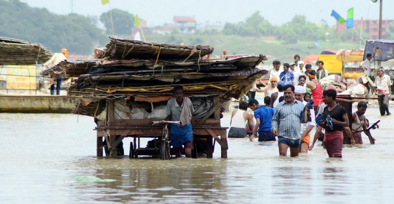
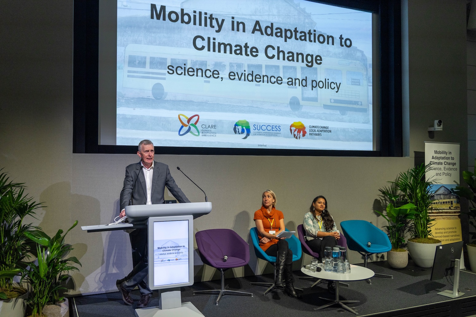
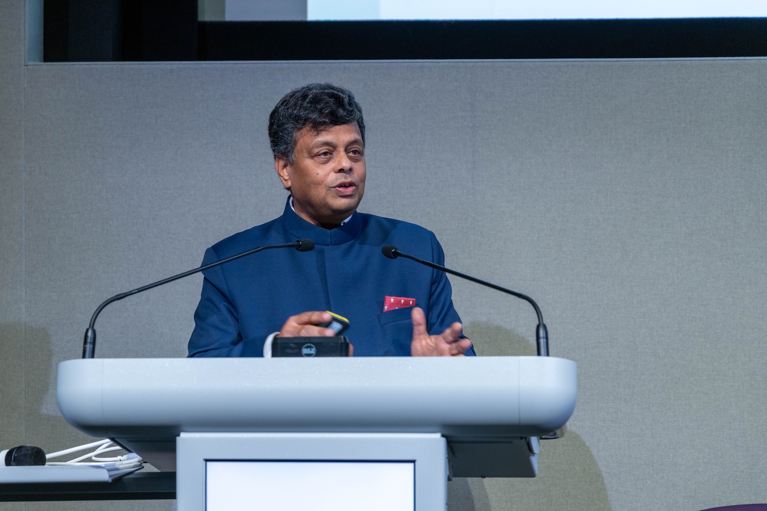
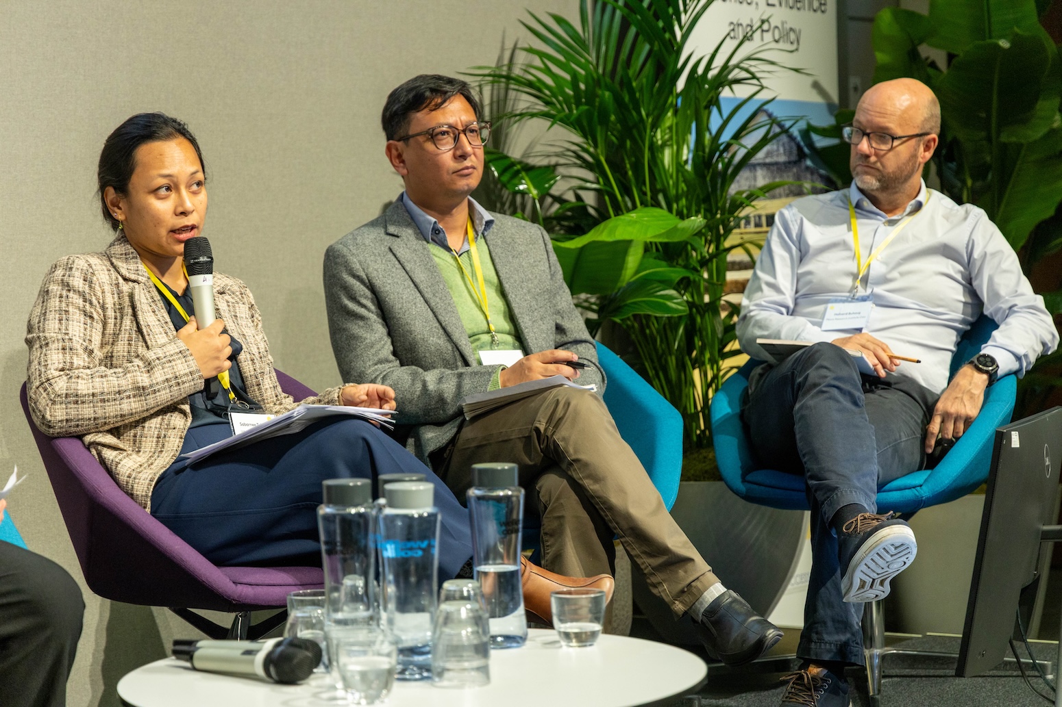
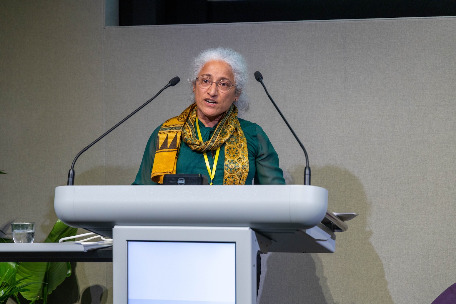
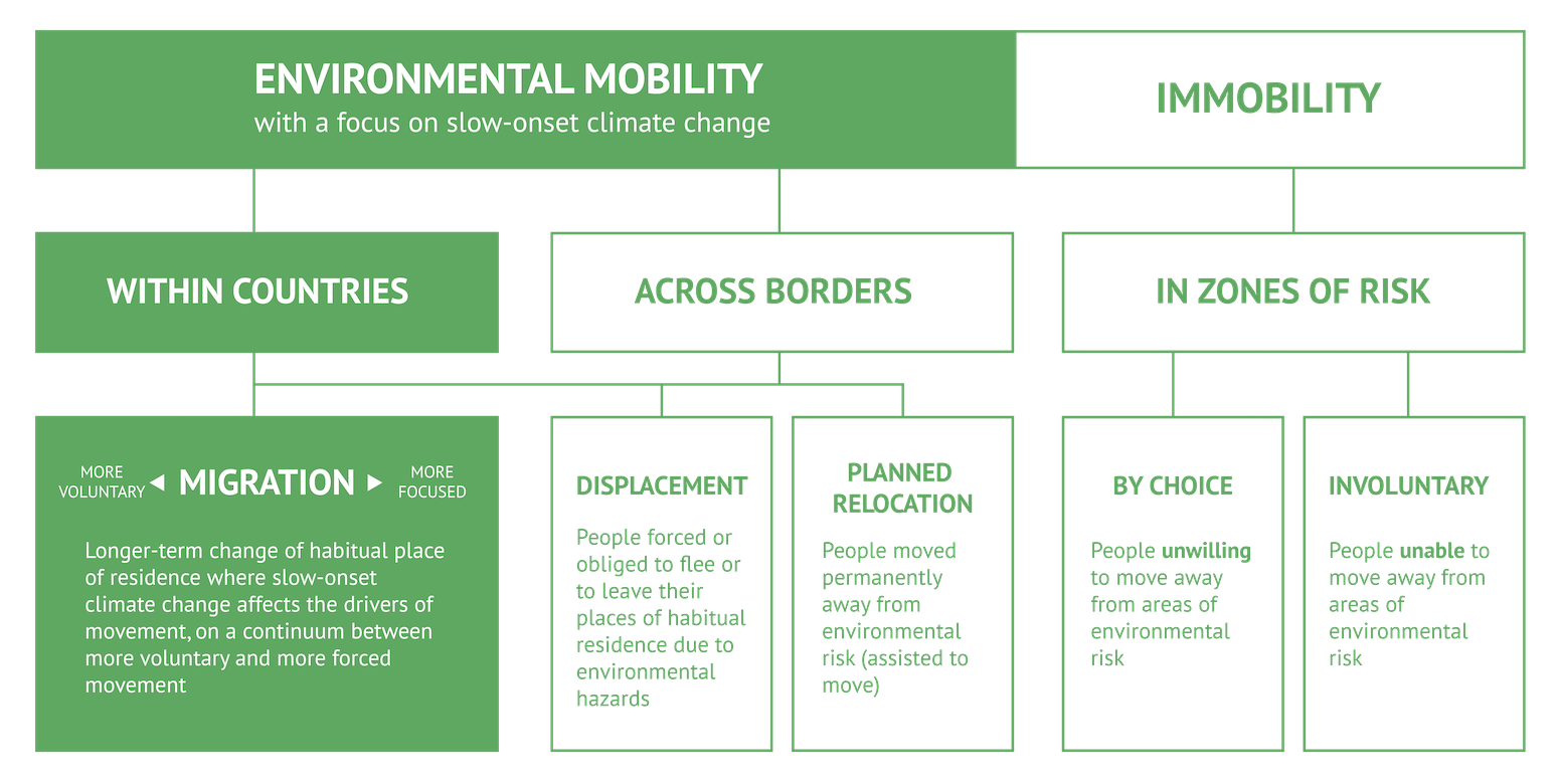
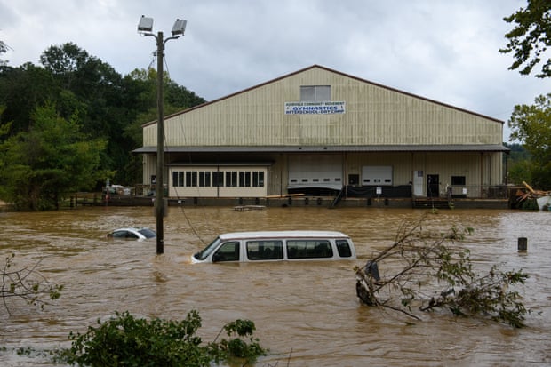
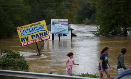
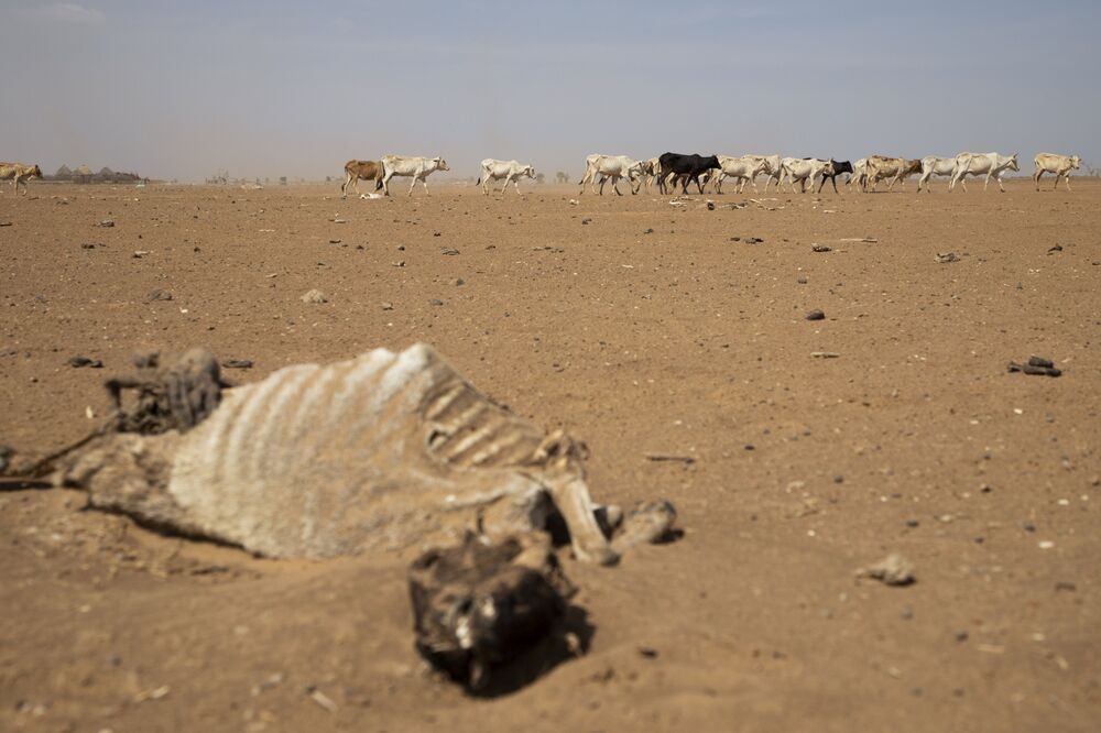

 Foto: Marcelo Casal Jr/Agência Brasil


 Barreira de proteção para proteger a praia da força das ondas. Estudo realizado por pesquisadores de São Paulo e de Pernambuco detalhou a vulnerabilidade da costa nos dois estados (foto: Eduardo Siegle)
 Fatores socioeconômicos e culturais potencializam as vulnerabilidades do sexo feminino aos desastres provocados pelos eventos climáticos extremos, avalia pesquisadora mexicana que integra o IPCC (foto:Eduardo Cesar/FAPESP)


Você precisa fazer login para comentar.