Placing our faith in forecasting and science could save lives and money
Oliver Uberti
October 14, 2021
2021 is shaping up to be a historically busy hurricane season. And while damage and destruction have been serious, there has been one saving grace — that the National Weather Service has been mostly correct in its predictions.
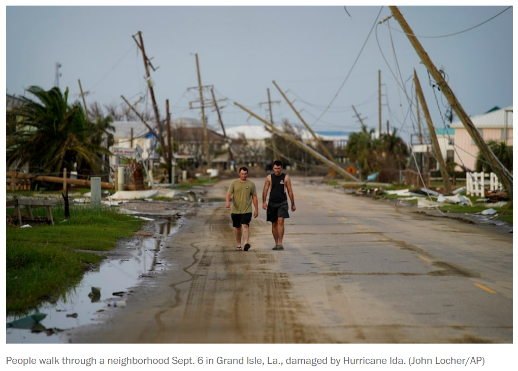
Thanks to remote sensing, Gulf Coast residents knew to prepare for the “life-threatening inundation,” “urban flooding” and “potentially catastrophic wind damage” that the Weather Service predicted for Hurricane Ida. Meteorologists nailed Ida’s strength, surge and location of landfall while anticipating that a warm eddy would make her intensify too quickly to evacuate New Orleans safely. Then, as her remnants swirled northeast, reports warned of tornadoes and torrential rain. Millions took heed, and lives were saved. While many people died, their deaths resulted from failures of infrastructure and policy, not forecasting.
The long history of weather forecasting and weather mapping shows that having access to good data can help us make better choices in our own lives. Trust in meteorology has made our communities, commutes and commerce safer — and the same is possible for climate science.
Two hundred years ago, the few who studied weather deemed any atmospheric phenomenon a “meteor.” The term, referencing Aristotle’s “Meteorologica,” essentially meant “strange thing in the sky.” There were wet things (hail), windy things (tornadoes), luminous things (auroras) and fiery things (comets). In fact, the naturalist Elias Loomis, who was among the first to spot Halley’s comet upon its return in 1835, thought storms behaved as cyclically as comets. So to understand “the laws of storms,” Loomis and the era’s other leading weatherheads began gathering observations. Master the elements, they reasoned, and you could safely sail the seas, settle the American West, plant crops with confidence and ward off disease.
In 1856, Joseph Henry, the Smithsonian Institution’s first director, hung a map of the United States in the lobby of its Washington headquarters. Every morning, he would affix small colored discs to show the nation’s weather: white for places with clear skies, blue for snow, black for rain and brown for cloud cover. An arrow on each disc allowed him to note wind direction, too. For the first time, visitors could see weather across the expanding country.
Although simple by today’s standards, the map belied the effort and expense needed to select the correct colors each day. Henry persuaded telegraph companies to transmit weather reports every morning at 10. Then he equipped each station with thermometers, barometers, weathervanes and rain gauges — no small task by horse and rail, as instruments often broke in transit.
For longer-term studies of the North American climate, Henry enlisted academics, farmers and volunteers from Maine to the Caribbean. Eager to contribute, “Smithsonian observers” took readings three times a day and posted them to Washington each month. At its peak in 1860, the Smithsonian Meteorological Project had more than 500 observers. Then the Civil War broke out.
Henry’s ranks thinned by 40 percent as men traded barometers for bayonets. Severed telegraph lines and the priority of war messages crippled his network. Then in January 1865, a fire in Henry’s office landed the fatal blow to the project. All of his efforts turned to salvaging what survived. With a vacuum of leadership in Washington, citizen scientists picked up the slack.
Although the Chicago Tribune lampooned Lapham, wondering “what practical value” a warning service would provide “if it takes 10 years to calculate the progress of a storm,” Rep. Halbert E. Paine (Wis.), who had studied storms under Loomis, rushed a bill into Congress before the winter recess. In early 1870, a joint resolution establishing a storm-warning service under the U.S. Army Signal Office passed without debate. President Ulysses S. Grant signed it into law the following week.
Despite the mandate for an early-warning system, an aversion to predictions remained. Fiscal hawks could not justify an investment in erroneous forecasts, religious zealots could not stomach the hubris, and politicians wary of a skeptical public could not bear the fallout. In 1893, Agriculture Secretary J. Sterling Morton cut the salary of one of the country’s top weather scientists, Cleveland Abbe, by 25 percent, making an example out of him.
While Moore didn’t face consequences for his dereliction of duty, the Weather Bureau’s hurricane-forecasting methods gradually improved as the network expanded and technologies like radio emerged. The advent of aviation increased insight into the upper atmosphere; military research led to civilian weather radar, first deployed at Washington National Airport in 1947. By the 1950s, computers were ushering in the future of numerical forecasting. Meanwhile, public skepticism thawed as more people and businesses saw it in their best interests to trust experts.
In September 1961, a local news team decided to broadcast live from the Weather Bureau office in Galveston, Tex., as Hurricane Carla angled across the Gulf of Mexico. Leading the coverage was a young reporter named Dan Rather. “There is the eye of the hurricane right there,” he told his audience as the radar sweep brought the invisible into view. At the time, no one had seen a radar weather map televised before.
Rather realized that for viewers to comprehend the storm’s size, location and imminent danger, people needed a sense of scale. So he had a meteorologist draw the Texas coast on a transparent sheet of plastic, which Rather laid over the radarscope. Years later, he recalled that when he said “one inch equals 50 miles,” you could hear people in the studio gasp. The sight of the approaching buzz saw persuaded 350,000 Texans to evacuate their homes in what was then the largest weather-related evacuation in U.S. history. Ultimately, Carla inflicted twice as much damage as the Galveston hurricane 60 years earlier. But with the aid of Rather’s impromptu visualization, fewer than 50 lives were lost.
In other words, weather forecasting wasn’t only about good science, but about good communication and visuals.
Data visualization helped the public better understand the weather shaping their lives, and this enabled them to take action. It also gives us the power to see deadly storms not as freak occurrences, but as part of something else: a pattern.

Two hundred years ago, a 10-day forecast would have seemed preposterous. Now we can predict if we’ll need an umbrella tomorrow or a snowplow next week. Imagine if we planned careers, bought homes, built infrastructure and passed policy based on 50-year forecasts as routinely as we plan our weeks by five-day ones.
Unlike our predecessors of the 19th or even 20th centuries, we have access to ample climate data and data visualization that give us the knowledge to take bold actions. What we do with that knowledge is a matter of political will. It may be too late to stop the coming storm, but we still have time to board our windows.
